


This new Manual is a guide for evaluating peoples' ability to access services and activities, and therefore the performance of transportation and land use configurations.
Transportation planning is shifting from evaluating mobility (physical movement) to accessibility (people's ability to reach desired services and activities), which expands the range of solutions that can be applied to transportation problems. For example, mobility-based planning assumes that the preferred solution to traffic congestion is to expand roadways so motorists can travel faster and farther. Accessibility-based planning considers roadway expansions, improvements to non-auto modes (such as bicycle improvements and grade-separated transit), development reforms to reduce the distances that people must travel, pricing reforms and commute trip reduction programs that encourage use of more space-efficient modes, plus mobility substitutes such as telework and delivery services. Access-based analysis is more complicated, but better reflects what want want overall: the ability to reach desired services and activities. It leads to more multimodal transportation systems and more compact and connected communities.

This new book, Transport Access Manual: A Guide for Measuring Connection between People and Places, provides practical information on how to measure these impacts. It is a guide for quantifying and evaluating access for anybody interested in truly understanding how to measure the performance of transport and land use configurations. It contains enough information to help transport and planning professionals achieve a more comprehensive look at their city or region than traditional transport analysis allows. It provides a point of entry for interested members of the public as well as practitioners by being organized in a logical and straightforward way. It is now available as a free PDF document, or as a hard-copy book.
Thanks to Professors David Levinson and David King for their great leadership on this project.
FULL STORY: Transport Access Manual: A Guide for Measuring Connection between People and Places


An International Comparison of Transportation Modes
Access (the ease of reaching desired destinations) is a key factor in transport, sustainability, and urban planning. This new study applies multimodal accessibility analysis to 4 modes in 117 cities in 6 countries, illustrated graphically.

New Orleans Makes Push for Accessibility Improvements Ahead of Super Bowl
Major sporting events like the Olympics and the Super Bowl can serve as catalysts for major changes in transportation infrastructure and accessibility.

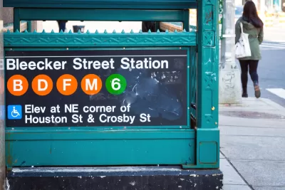
Planning for Accessibility: Proximity is More Important than Mobility
Accessibility-based planning minimizes the distance that people must travel to reach desired services and activities. Measured this way, increased density can provide more total benefits than increased speeds.

Planetizen Federal Action Tracker
A weekly monitor of how Trump’s orders and actions are impacting planners and planning in America.

Maui's Vacation Rental Debate Turns Ugly
Verbal attacks, misinformation campaigns and fistfights plague a high-stakes debate to convert thousands of vacation rentals into long-term housing.

San Francisco Suspends Traffic Calming Amidst Record Deaths
Citing “a challenging fiscal landscape,” the city will cease the program on the heels of 42 traffic deaths, including 24 pedestrians.

Amtrak Rolls Out New Orleans to Alabama “Mardi Gras” Train
The new service will operate morning and evening departures between Mobile and New Orleans.

The Subversive Car-Free Guide to Trump's Great American Road Trip
Car-free ways to access Chicagoland’s best tourist attractions.

San Antonio and Austin are Fusing Into one Massive Megaregion
The region spanning the two central Texas cities is growing fast, posing challenges for local infrastructure and water supplies.
Urban Design for Planners 1: Software Tools
This six-course series explores essential urban design concepts using open source software and equips planners with the tools they need to participate fully in the urban design process.
Planning for Universal Design
Learn the tools for implementing Universal Design in planning regulations.
Heyer Gruel & Associates PA
JM Goldson LLC
Custer County Colorado
City of Camden Redevelopment Agency
City of Astoria
Transportation Research & Education Center (TREC) at Portland State University
Jefferson Parish Government
Camden Redevelopment Agency
City of Claremont