


The Pew Research Center digs into a question of definitions, fraught with exceptions and subjectivity.
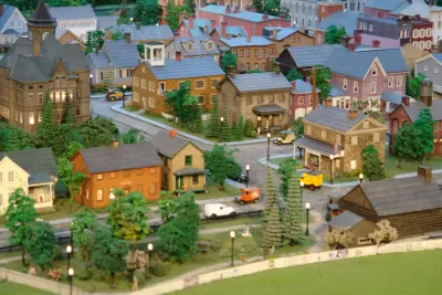
Ruth Igielnik Wieder shares the results of a survey and analysis intended to determine more about the defining characteristics of urban, suburban, and rural communities in the United States.
As a new approach to the question of how to tell these types of communities apart, the team at the Pew Research Center took the additional step of surveying residents to compare public perception to outside sources of classification, two from the government and one based on ZIP codes. The government sources included 1) the National Center for Health Studies Urban-Rural Classification Scheme and 2) the U.S. Department of Agriculture Economic Research Service’s Rural-Urban Continuum County Classification. The ZIP Code measure included two factors: "the distance from the ZIP code to the center of the largest principal city in the nearest metro area (as measured by distance to the city hall) and the household density in the ZIP code."
According to Wilder, the comparisons between those three measures and the findings of the survey reveal a few patterns: "All three methods most accurately classified rural Americans and did less well with Americans in urban and suburban areas. And while all the measures performed relatively well overall, the decision tree most closely matched self-reports across all three community types."
As for which metric turned out to be the most useful, in the opinion of researchers: the self-reported assessment.
FULL STORY: Evaluating what makes a U.S. community urban, suburban or rural


Is the Urban-Suburban Divide Destined to Disappear?
In a new book, Hans Westlund and Tigran Haas argue that the global knowledge economy is radically reshaping urban development. Eventually, they say, it'll render meaningless our present notions of "urban," "suburban," and "rural."
Housing Price Increases in Urban Areas Outpace Suburbs
As we've heard recently, home prices are on the rise throughout the United States. New research from Jed Kolko shows that increases are particularly acute in areas with high rises, multi-family housing, and a diversity of residents.
You Weigh Where You Live
A new study to be published in the fall issue of the Journal of Rural Health finds evidence that rural Americans are more likely to be overweight than their urban cohorts, reports Mary MacVean.

Planetizen Federal Action Tracker
A weekly monitor of how Trump’s orders and actions are impacting planners and planning in America.

Chicago’s Ghost Rails
Just beneath the surface of the modern city lie the remnants of its expansive early 20th-century streetcar system.

San Antonio and Austin are Fusing Into one Massive Megaregion
The region spanning the two central Texas cities is growing fast, posing challenges for local infrastructure and water supplies.

Since Zion's Shuttles Went Electric “The Smog is Gone”
Visitors to Zion National Park can enjoy the canyon via the nation’s first fully electric park shuttle system.

Trump Distributing DOT Safety Funds at 1/10 Rate of Biden
Funds for Safe Streets and other transportation safety and equity programs are being held up by administrative reviews and conflicts with the Trump administration’s priorities.

German Cities Subsidize Taxis for Women Amid Wave of Violence
Free or low-cost taxi rides can help women navigate cities more safely, but critics say the programs don't address the root causes of violence against women.
Urban Design for Planners 1: Software Tools
This six-course series explores essential urban design concepts using open source software and equips planners with the tools they need to participate fully in the urban design process.
Planning for Universal Design
Learn the tools for implementing Universal Design in planning regulations.
planning NEXT
Appalachian Highlands Housing Partners
Mpact (founded as Rail~Volution)
City of Camden Redevelopment Agency
City of Astoria
City of Portland
City of Laramie