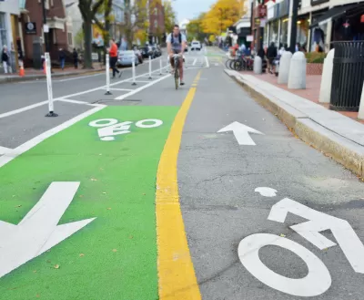
A review of The Sustainable Urban Design Handbook, by architects Nico Larco and Kaarin Knudson.

More than one book has sought to create lists of pro-walkability and pro-smart growth policies. But in The Sustainable Urban Design Handbook, Nico Larco and Kaarin Knudson seek to combine this idea with sustainability (or, in plain English, environmental protection) by listing dozens of urban planning policies that both improve the physical environment and make cities more walkable and/or transit-friendly. For example the book has chapters not only on issues traditionally associated with the smart growth movement (such as zoning, transit and street design), but also on traditional environmental issues such as stormwater runoff and wildlife preservation.
This book has a few other unique features:
- Rather than merely listing policies, the authors describe the cost and difficulty of each option. For example, in a section on “Multimodal Street Design” the authors describe pedestrian-oriented design as “[l]ow-medium cost and low difficulty” in undeveloped areas, but “[h]igh cost and high difficulty” in already built-out areas. They explain that in the latter type of place, retrofitting wider streets might require “traffic engineering and changes in intersection design.”
- In each chapter, the authors describe a “typical approach” and then critique that approach. For example, in the “multimodal street” section they point out that American streets are typically “designed almost exclusively to the needs of automobiles.” They add that this policy is inequitable because of its negative impact upon nondrivers, and propose that streets “should be narrow to control traffic speeds."
- The authors are willing to discuss tradeoffs. For example, in a chapter on public transit, they write that transit agencies have a choice between ridership and coverage goals. Some cities might choose to “provide everyone with some level of transit service, which is critically important for those with no other options.” On the other hand, a transit agency seeking to maximize ridership will place “frequent service along dense, high-population corridors.” A city that follows this policy can afford to “serve more people with more frequent service and lower operating costs per rider.” Similarly, if government protects habitat by limiting development in urbanized areas, it risks “push[ing] development to the periphery of urban areas… This can increase travel distances, promote car use, and increase stormwater runoff.” The authors recommend that zoning should keep vulnerable populations away from polluting land uses such as transportation corridors and heavy industry, but add that such polluting land uses “can contribute significantly to local economies and employment.”
- The authors are sensitive to regional differences. Rather than consistently endorsing or attacking tall buildings, they suggest that taller buildings are especially beneficial in hot areas. They explain that cities often suffer from an “urban heat island effect” as buildings trap heat, but that taller buildings mitigate this effect in hot climates, because “taller, narrower streets shade the public realm and minimize the reflected heat trapped within urban areas.” On the other hand, cold climates might require “bulkier buildings that minimize the amount of exposed building envelope” which in turn might “limit the amount of daylight that reaches building interiors… [which] increases the need for energy to power electric lighting.”
- The authors explain the relationship between status quo policies and their negative environmental impacts. For example, municipal laws requiring landowners to create large parking lots for shops and offices create large amounts of impervious surface that in turn increase stormwater runoff.
One part of this book may be outdated. The authors argue that development should be pushed away from flood-prone areas into “areas with low flood frequency.” But flooding is no longer limited to coastal areas. For example, in 2021 rainfall created flooding in Forest Hills, a neighborhood in Queens that is so far inland that it was almost unaffected by Superstorm Sandy (a 2012 storm that primarily affected coastal areas). . If floods happen even in places like Forest Hills, is there any reason for government to pick and choose between risky places and supposedly non-risky areas?

Maui's Vacation Rental Debate Turns Ugly
Verbal attacks, misinformation campaigns and fistfights plague a high-stakes debate to convert thousands of vacation rentals into long-term housing.

Planetizen Federal Action Tracker
A weekly monitor of how Trump’s orders and actions are impacting planners and planning in America.

Chicago’s Ghost Rails
Just beneath the surface of the modern city lie the remnants of its expansive early 20th-century streetcar system.

Bend, Oregon Zoning Reforms Prioritize Small-Scale Housing
The city altered its zoning code to allow multi-family housing and eliminated parking mandates citywide.

Amtrak Cutting Jobs, Funding to High-Speed Rail
The agency plans to cut 10 percent of its workforce and has confirmed it will not fund new high-speed rail projects.

LA Denies Basic Services to Unhoused Residents
The city has repeatedly failed to respond to requests for trash pickup at encampment sites, and eliminated a program that provided mobile showers and toilets.
Urban Design for Planners 1: Software Tools
This six-course series explores essential urban design concepts using open source software and equips planners with the tools they need to participate fully in the urban design process.
Planning for Universal Design
Learn the tools for implementing Universal Design in planning regulations.
planning NEXT
Appalachian Highlands Housing Partners
Mpact (founded as Rail~Volution)
City of Camden Redevelopment Agency
City of Astoria
City of Portland
City of Laramie


