


Chia-Yuan Yu and Minjie Xu guest blog about a recent article in the Journal of Planning Education and Research.


Guest Bloggers: Chia-Yuan Yu of the University of Central Florida and Minjie Xu of Texas A&M University
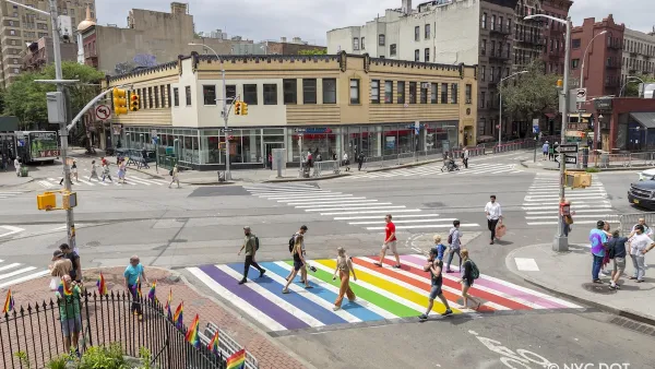
Transportation planning increasingly promotes non-motorized travel in order to reduce automobile dependence. However if planners don’t provide safe environments for new pedestrians and cyclists, they expose them to dangerous situations. Promoting safety is therefore a critical issue. In particular, the built environments that planners create are an important determinant of traffic safety. Since crashes are often unevenly spatially distributed within a region, the relationship between built environments and crashes may vary by each area’s particular characteristics. Understanding this relationship is crucial to providing direction for improving traffic safety in different built environments, especially for governments with limited financial and other resources.
In our recent paper in the Journal of Planning Education and Research we use Austin, Texas to explore how the built environment correlates with collisions that result in three different injury severities: fatal, injury, and no–injury. Our local models (geographically weighted negative binomial regressions) considered the influence of various dimensions of built environments—density, diversity, design, and regional accessibility—and explored the potential interaction effects among land uses and road types on traffic safety. While controlling for volume, we found that areas with high traffic volumes consistently had a higher number of total, fatal, injury, and no-injury crashes. High-speed and high-volume facilities (e.g., highways/freeways and arterial roads) were associated with more total and fatal crashes and the influence was stronger in downtown areas than in peripheral areas. Areas with a higher percentage of commercial areas experienced more total and injury crashes, especially in downtown areas.
Based on the result, three strategies should be considered for planners and policymakers to improve traffic safety.
- Mode shift, especially in downtown locations: Because downtown areas, with their higher traffic volume, were associated with an increased number of crashes, it is necessary to find ways of strategically shift automobile travel demand to other travel modes to downtown locations. Programs such as Commute Trip Reduction (CTR) programs, Travel Demand Management (TDM), and Commuter financial incentives would be feasible approaches.
- Retrofit high-speed and high-volume roads: Retrofitting high-speed and high-volume roads to encourage lower traffic speeds may provide safety benefits. Complete Streets programs that retrofit downtown thoroughfares for diverse users and activities would be a possible option. It is important to design trip-attracting land uses into the other way to lower vehicle trip generations.
- Design land areas that generate fewer lower vehicle trips: Car–free planning involves designing particular areas to accommodate minimal automobile use. Commercial centers and districts that feature a concentration of businesses and convenient accessibility are an alternative to automobile-oriented suburban strip designs. People in these districts travel shorter distances and use alternative transportation modes, thus reducing the total number of automobile trips.
Such efforts aimed at reducing automobile travel through programs and retrofitting require partnerships among multi–level agencies and stakeholders, such as transportation planners and engineers, neighborhood and business associations, real estate developers, and local governments.
Open Access Until September 8th, 2017


Let’s End Traffic Stops
The technology to make traffic enforcement obsolete is becoming available. But in the U.S. willing to use it?

A New Traffic Safety Paradigm
Despite numerous traffic safety programs, traffic death rates have not declined in a decade and recently started to increase. We can do better! A new paradigm identifies additional safety strategies that reduce both crash rates and risk exposure.
USDOT Launches Unfunded 'SAFE ROADS' Program
The program targets “distractions” and “political messages or artwork,” and paves the way for autonomous vehicles.

Planetizen Federal Action Tracker
A weekly monitor of how Trump’s orders and actions are impacting planners and planning in America.

Chicago’s Ghost Rails
Just beneath the surface of the modern city lie the remnants of its expansive early 20th-century streetcar system.

Amtrak Cutting Jobs, Funding to High-Speed Rail
The agency plans to cut 10 percent of its workforce and has confirmed it will not fund new high-speed rail projects.

Ohio Forces Data Centers to Prepay for Power
Utilities are calling on states to hold data center operators responsible for new energy demands to prevent leaving consumers on the hook for their bills.

MARTA CEO Steps Down Amid Citizenship Concerns
MARTA’s board announced Thursday that its chief, who is from Canada, is resigning due to questions about his immigration status.

Silicon Valley ‘Bike Superhighway’ Awarded $14M State Grant
A Caltrans grant brings the 10-mile Central Bikeway project connecting Santa Clara and East San Jose closer to fruition.
Urban Design for Planners 1: Software Tools
This six-course series explores essential urban design concepts using open source software and equips planners with the tools they need to participate fully in the urban design process.
Planning for Universal Design
Learn the tools for implementing Universal Design in planning regulations.
Caltrans
City of Fort Worth
Mpact (founded as Rail~Volution)
City of Camden Redevelopment Agency
City of Astoria
City of Portland
City of Laramie