


In a new brief, Penn IUR Faculty Fellow Richard Weller writes about mapping that recognizes the interdependence of people and conservation.
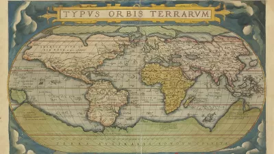
On May 20, 1570, Abraham Ortelius—book collector and engraver from Antwerp—published the world’s first Atlas: the Theatrum Orbis Terrarum (Theater of the World). With his maps Ortelius laid bare a world of healthy ecoregions ripe for exploitation. Some 450 years later, at the opposite end of modernity to Ortelius, researchers at Penn Design are building the Atlas for the End of the World— an atlas about the end of Ortelius’ world, the end of the world as a God-given and unlimited resource for human exploitation and its concomitant myths of progress.
The Atlas shows the difference between the United Nations Convention on Biological Diversity targets for achieving 17 percent global terrestrial area as protected habitat by 2020 and what is actually now protected. A new Penn IUR brief, Atlas For the End of the World: Mapping that Recognizes the Interdependence of People and Conservation, describes the measurement efforts to meet these targets by 1) mapping protected areas in the ecoregions within world’s biodiversity hotspots and calculating how much remains to meet targets, and 2) demonstrating the coming conflicts between projected city growth and biologically diverse habitat.
FULL STORY: Atlas for the End of the World


How the ‘Big Beautiful Bill’ Impacts Transportation
Five ways the bill negatively impacts U.S. transportation policy.

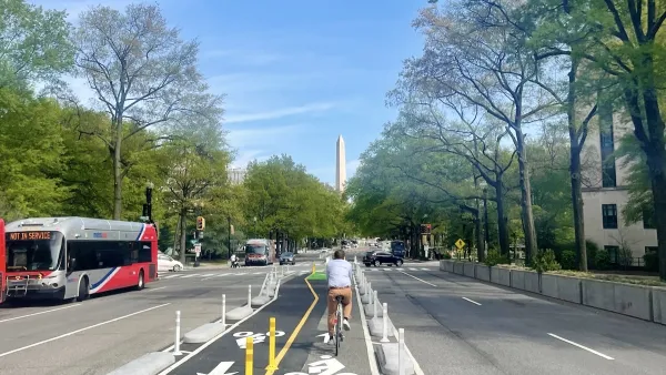
DC to Launch E-Bike Delivery Pilot
The District will fund low-cost e-bikes and provide charging and battery swap stations for delivery workers to encourage e-bikes as an alternative to driving for food deliveries.
Trump Prompts Restructuring of Transportation Research Board in “Unprecedented Overreach”
The TRB has eliminated more than half of its committees including those focused on climate, equity, and cities.

Maui's Vacation Rental Debate Turns Ugly
Verbal attacks, misinformation campaigns and fistfights plague a high-stakes debate to convert thousands of vacation rentals into long-term housing.

Planetizen Federal Action Tracker
A weekly monitor of how Trump’s orders and actions are impacting planners and planning in America.

Chicago’s Ghost Rails
Just beneath the surface of the modern city lie the remnants of its expansive early 20th-century streetcar system.

Bend, Oregon Zoning Reforms Prioritize Small-Scale Housing
The city altered its zoning code to allow multi-family housing and eliminated parking mandates citywide.

Amtrak Cutting Jobs, Funding to High-Speed Rail
The agency plans to cut 10 percent of its workforce and has confirmed it will not fund new high-speed rail projects.

LA Denies Basic Services to Unhoused Residents
The city has repeatedly failed to respond to requests for trash pickup at encampment sites, and eliminated a program that provided mobile showers and toilets.
Urban Design for Planners 1: Software Tools
This six-course series explores essential urban design concepts using open source software and equips planners with the tools they need to participate fully in the urban design process.
Planning for Universal Design
Learn the tools for implementing Universal Design in planning regulations.
planning NEXT
Appalachian Highlands Housing Partners
Mpact (founded as Rail~Volution)
City of Camden Redevelopment Agency
City of Astoria
City of Portland
City of Laramie