


As cities and states across the U.S. strive to find solutions to the sprawling pattern of land development, promising control measures have been met head-on by one recurring and controversial issue -- land owner equity.
 As the state, indeed the country, strives to find solutions to the sprawling pattern of land development that is leapfrogging across the landscape, promising control measures, among them ecologically based land use planning, have been met head-on by one recurring and controversial issue -- land owner equity.
From the Farmer's Perspective
Farmers, in particular have been especially outspoken, perhaps with some justification. But, there is a difference in equities. For example, farmland that was, in a sense, carved out of what may have originally been forest or wetlands, by a farmer and his family, and been maintained as farmland by their successors and heirs, would certainly have earned "sweat equity". This in turn would equate to some real fiscal equity. They have in fact, created something of value, a commodity, that did not exist prior -- namely productive farmland. Is this a compensable value? Absolutely.
With the advent of zoning, this simple equation of sweat equity = fiscal equity, changed dramatically, and artificial values, produced, not by the sweat equity of the farmer or his family, but by the mere stroke of a pen, were superimposed on the same land, inflating its potential equity or value -- but not necessarily with regard to its utility as productive farmland. Rather, the farmer's land had acquired "societal equity" or equity of the civil/social community infrastructure. Societal equity has a decidedly different set of values than sweat equity, conferring new rights for sure, but requiring significant obligations as well, including the obligation to contribute to transgenerational equity or value of the commons for residents yet to be born. Transgenerational equity, importantly includes, among others, the value assigned to those portions of the community's ecological or "green infrastructure" (e.g. streams, aquifers, soils, forests), whose degradation or destruction would result in a concurrent deterioration in the quality of community life or at the worst, the complete extinction on the community in the long term.
Despite what appears to be an obvious moral obligation to share responsibility for the welfare of the commons, farmers argue that any community regulation, for example, an ordinance that requires a 150 ft. wide buffer along all waterways to protect long term water quality and stream organisms, including fish, is a taking and therefore requires compensation. They further argue that as the largest landowners generally in the community, their contribution to community welfare, under such a buffer regulation is disproportional, when compared to others in the community with much smaller lots or parcels of property. At face value, this latter argument appears to have merit. Others, however, counter that farmland has been subsidized heavily for decades by the community, not only through numerous federal program grants and subsidized low interest loans, but here in New Jersey in particular by the Farmland Assessment Act of 1964. This latter legislation provides substantial real estate tax reduction for the farmer, even while his property is banking and collecting substantial interest from the artificial equity bestowed by the community's zoning ordinances. That preferential tax treatment alone, argue some, balances out any disproportionality, despite the fact that three years of rollback taxes are due when the land is sold for uses other than farming.
From the Land Developer's Perspective
The nation's farmers have found some strong allies supporting their argument on takings and compensation -- namely the nation's cadre of large land developers, land speculators and other large landowners. Unlike the farmer, however, their equity, most often labeled as "tenure equity" rarely comes about as the result of sweat equity. In fact, that tenure equity is often tenuous itself, with title to the land not fully vested with the developer or speculator until some threshold level of subdivision or site improvement has been approved by the community planners.
While these absentee landlords may not live in the communities within which they own the land, is their obligation to the welfare of the commons, any less than that of the farmers'? It would be hard to argue no, especially since their ultimate "products" will dramatically reshape and impact the commons in the form of more impervious pavement, more traffic, more air pollutants, more water pollutants, more storm sewers, more roads and bridges and ultimately the complete loss of very productive farmland soils.
As in the case example of the farmer above, requiring the developer/speculator to absorb a 150 foot wide buffer along all waterways on his property is certain to produce similar claims of an unjust taking. However, such an argument seems more specious for the developer/speculator, given the impact his "products" have on the land. It can also be argued that requiring a 150 foot streamside buffer, in order to protect what is essentially the natural "plumbing system" of the community's green infrastructure, is no more onerous or egregious than the offsite impact fees already commonly assessed to the developer to help fund the newly created gray infrastructure (e.g. roads, schools, storm sewers etc.) resulting from the conversion of farmland to other uses.
Is There A Solution?
While the equity issue will likely remain contentious in the short term, there are pre-emptive solutions that could be applied immediately.
First, communities could redirect part of their open space acquisition funds toward some compensation to the farmer/land owner for any linear buffer strips required to protect stream corridors. However, any such payments would need to be part of a planned community-wide greenway, greenbelt, or streamside buffer protection program that has been clearly enumerated in the municipality's ecologically based Master Plan. Such planned acquisitions would be more beneficial than the current practice of fragmented acquisitions of opportunity.
Second, and perhaps most pre-emptive and fair to all, would be to invite the farmer/land owner /speculator, among others, to actively participate in the development of the community's Master Plan, wherein those portions of the community's ecological infrastructure or community commons deemed sacrosanct to community longevity and quality of life are clearly enumerated. This exposure to the "larger picture" will help to reduce polarization of views and at the same time foster a greater proclivity by all participants to compromise.
The greatest advantage to this early-on participation, however, is the ability, through such tools as GIS, for the farmer/land owner to actually see where any proposed protected resources (areas of highest ground water recharge, for example), might occur on his particular parcel of property. Identifying such potential encumbrances on the development potential of his parcel early on allows room to negotiate an acceptable compromise, such as an option in any subsequent zoning ordinance to cluster development at an allowable density, away from the protected high recharge areas.
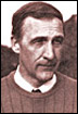
William Honachefsky, an environmental scientist, is also licensed as a professional land planner, a professional land surveyor, and a health officer in New Jersey. He is also certified as a Qualified Environmental Professional, (QUP), a Certified Hazard Control Manager, Master Level (CHCM), and a Certified Professional in Erosion and Sediment Control (CPESC). He is the author of three books on land use and environmental planning.


Maui's Vacation Rental Debate Turns Ugly
Verbal attacks, misinformation campaigns and fistfights plague a high-stakes debate to convert thousands of vacation rentals into long-term housing.

Planetizen Federal Action Tracker
A weekly monitor of how Trump’s orders and actions are impacting planners and planning in America.

San Francisco Suspends Traffic Calming Amidst Record Deaths
Citing “a challenging fiscal landscape,” the city will cease the program on the heels of 42 traffic deaths, including 24 pedestrians.

Defunct Pittsburgh Power Plant to Become Residential Tower
A decommissioned steam heat plant will be redeveloped into almost 100 affordable housing units.

Trump Prompts Restructuring of Transportation Research Board in “Unprecedented Overreach”
The TRB has eliminated more than half of its committees including those focused on climate, equity, and cities.

Amtrak Rolls Out New Orleans to Alabama “Mardi Gras” Train
The new service will operate morning and evening departures between Mobile and New Orleans.
Urban Design for Planners 1: Software Tools
This six-course series explores essential urban design concepts using open source software and equips planners with the tools they need to participate fully in the urban design process.
Planning for Universal Design
Learn the tools for implementing Universal Design in planning regulations.
Heyer Gruel & Associates PA
JM Goldson LLC
Custer County Colorado
City of Camden Redevelopment Agency
City of Astoria
Transportation Research & Education Center (TREC) at Portland State University
Jefferson Parish Government
Camden Redevelopment Agency
City of Claremont