


One of Detroit’s most defining modern characteristics—and most pressing dilemmas—is its huge amount of neglected and vacant land.
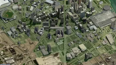
One of Detroit’s most defining modern characteristics—and most pressing dilemmas—is its huge amount of neglected and vacant land. New from editors June Manning Thomas and Henco Bekkering, Mapping Detroit: Land, Community, and Shaping a City uses a variety of maps to shed light on how Detroit moved from frontier fort to thriving industrial metropolis to today's high-vacancy city. With contributors ranging from a map archivist and a historian to architects, urban designers, and urban planners, Mapping Detroit brings a unique perspective to the historical causes, contemporary effects, and potential future of Detroit's transformed landscape.
To show how Detroit arrived in its present condition, contributors begin by tracing the city’s beginnings as an agricultural, military, and trade outpost and map both its depopulation and attempts at redevelopment. They move on to discuss particular land-related systems and neighborhood characteristics that encouraged modern social and economic changes and offer case studies of two city neighborhoods—the Brightmoor area and Southwest Detroit. Contributors also consider both the city's ecological assets and its sociological fragmentation to add dimension to the current understanding of its emptiness. The volume's epilogue offers a synopsis of the major points of the 2012 Detroit Future City report, the city's own strategic blueprint for future land use. Containing some of the leading voices on Detroit’s history and future, Mapping Detroit will be informative reading for anyone interested in urban studies, geography, and recent American history.
- María Arquero de Alarcón, Taubman College assistant professor of architecture and urban planning and design
- Henco Bekkering (co-editor), Delft University of Technology professor emeritus of urban design at the School of Architecture
- Robert Fishman, Taubman College professor in architecture and urban planning
- Lars Graebner, Taubman College assistant professor of practice in architecture
- Joe Grengs, Taubman College associate professor of urban planning
- June Thomas (co-editor), Ph.D., FAICP, Taubman College centennial professor of urban planning
FULL STORY: Wayne State University Press

Detroit Says Problems With Property Tax Assessments are Fixed. Advocates Disagree.
With higher-valued properties under assessed and lower-valued properties over assessed, advocates say there's still a problem with Detroit's property tax system.

Detroit Launches Community Land Trust
A newly created CLT aims to support the building of affordable housing.

Detroit Transit Agency Requests $20M Budget Increase
The Detroit Department of Transportation wants to boost ridership by hiring more drivers, buying new buses, and enhancing station infrastructure.

Maui's Vacation Rental Debate Turns Ugly
Verbal attacks, misinformation campaigns and fistfights plague a high-stakes debate to convert thousands of vacation rentals into long-term housing.

Planetizen Federal Action Tracker
A weekly monitor of how Trump’s orders and actions are impacting planners and planning in America.

In Urban Planning, AI Prompting Could be the New Design Thinking
Creativity has long been key to great urban design. What if we see AI as our new creative partner?

King County Supportive Housing Program Offers Hope for Unhoused Residents
The county is taking a ‘Housing First’ approach that prioritizes getting people into housing, then offering wraparound supportive services.

Researchers Use AI to Get Clearer Picture of US Housing
Analysts are using artificial intelligence to supercharge their research by allowing them to comb through data faster. Though these AI tools can be error prone, they save time and housing researchers are optimistic about the future.

Making Shared Micromobility More Inclusive
Cities and shared mobility system operators can do more to include people with disabilities in planning and operations, per a new report.
Urban Design for Planners 1: Software Tools
This six-course series explores essential urban design concepts using open source software and equips planners with the tools they need to participate fully in the urban design process.
Planning for Universal Design
Learn the tools for implementing Universal Design in planning regulations.
planning NEXT
Appalachian Highlands Housing Partners
Mpact (founded as Rail~Volution)
City of Camden Redevelopment Agency
City of Astoria
City of Portland
City of Laramie