


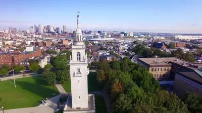
An ambitious new transportation plan is yet another step in the transformation of South Boston from a gritty, blue-collar waterfront to one of the nation's most promising zones of innovation.
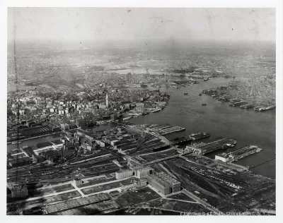
Five decades ago, the waterfront of South Boston reeked, and its economy was decidedly old-fashioned. Those longshoreman would hardly recognize the place now. "Southie" is now home to the gleaming Boston Convention Center, the Institute of Contemporary Art, and thousands of units of premium residential property. An estimated 17 million square feet of development is on the way.
The next set of jewels in South Boston's unlikely crown is outlined in a report that calls for the city to develop a new transportation plan for the area. Infrastructure that was designed to handle cargo ships cannot quite handle the influx of upscale residents and tech workers.
"The report advocates transportation suitable for an area forced to shoot up, not out. Some suggested transformations should be relatively easy to accomplish — Silver Line expansions, upgrades to pedestrian infrastructure and new bike facilities. Others sound far more ambitious: urban rail connections, ferry services across the water and even an internal transit route to serve only the district."
Though the report does not include specific proposals—and is not funded by a longshot—it attempts to think progressively about the city's growth and about what it will mean to build a 21st century neighborhood in the country's oldest major city.
FULL STORY: South Boston’s New Boomtown Gets an Ambitious Transportation Plan

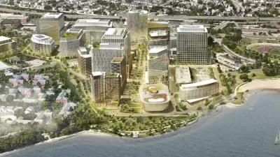
Mega-Project Aims to Transform South Boston
Developers with a ground lease for land owned by the University of Massachusetts Boston want to build a new mixed-use development to rival Kendall Square in nearby Cambridge.
New Zoning Code for South Boston Increases Parking Requirements
Recently approved changes to the zoning code in South Boston are designed to reduce the number variances granted by the Boston Zoning Board of Appeals. They also increase the number of parking sports required for new developments.
Would Soccer Stadium Conflict with Olympic Stadium Plans in South Boston?
The New England Revolution Major League Soccer team would like to leave the cavernous and distant Gillette Stadium, also home to the New England Patriots. Is a location in South Boston, also central to a potential Olympic bid, the best fit?

Maui's Vacation Rental Debate Turns Ugly
Verbal attacks, misinformation campaigns and fistfights plague a high-stakes debate to convert thousands of vacation rentals into long-term housing.

Planetizen Federal Action Tracker
A weekly monitor of how Trump’s orders and actions are impacting planners and planning in America.

In Urban Planning, AI Prompting Could be the New Design Thinking
Creativity has long been key to great urban design. What if we see AI as our new creative partner?

Cal Fire Chatbot Fails to Answer Basic Questions
An AI chatbot designed to provide information about wildfires can’t answer questions about evacuation orders, among other problems.

What Happens if Trump Kills Section 8?
The Trump admin aims to slash federal rental aid by nearly half and shift distribution to states. Experts warn this could spike homelessness and destabilize communities nationwide.

Sean Duffy Targets Rainbow Crosswalks in Road Safety Efforts
Despite evidence that colorful crosswalks actually improve intersection safety — and the lack of almost any crosswalks at all on the nation’s most dangerous arterial roads — U.S. Transportation Secretary Duffy is calling on states to remove them.
Urban Design for Planners 1: Software Tools
This six-course series explores essential urban design concepts using open source software and equips planners with the tools they need to participate fully in the urban design process.
Planning for Universal Design
Learn the tools for implementing Universal Design in planning regulations.
Appalachian Highlands Housing Partners
Gallatin County Department of Planning & Community Development
Heyer Gruel & Associates PA
Mpact (founded as Rail~Volution)
City of Camden Redevelopment Agency
City of Astoria
City of Portland
City of Laramie