


Technology is a great benefit for urban design and urban planning. Not only does it help boost productivity for design and urban planning teams, but it also increases team collaboration, citizen engagement, attention to detail, and accuracy.
Technology is a great gain for those working in urban design and urban planning. Not only does it help boost productivity for design and urban planning teams, but it also increases team collaboration, citizen engagement, attention to detail, accuracy when laying out a city, and data-driven processes. With rapid growth, climate change, expanding urban lines, and gentrification, it is important that design teams look at the whole picture.
The right tools make life easier for the urban planner’s team. They facilitate workflow and collaboration. In today’s fast-moving business world, communication and collaboration is key.
How Technology Improves Urban Design

Sustainability
Using the right tools can help planners establish the best way to improve a community’s sustainability. For example, through the use of apps like Environmental Impact Calculator that provides information on time by mode and number of calories that will be burned to get from one destination to another, developers can determine how to create an urban space that is less reliant on fossil fuel vehicles and more accessible to pedestrians and bicyclists. Reducing reliance on cars decreases pollution and energy consumption. It also inspires a feeling of community and makes life convenient for city dwellers.
Connectivity
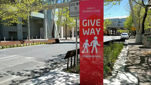
By incorporating technology into urban design, a greater level of connectivity can be achieved for residential and commercial settings. It enables one to work from home and other locations, reducing commute times and improving traffic conditions. Furthermore, the development of co-working spaces, Internet-based clubs, etc., can bring people together like never before. With an eye on how people use technology within an urban setting, designers and planners can facilitate connections.
Planning
Back when we didn’t have technology and data, urban centres were often poorly planned and haphazardly built. Through the use of modern technology and open data in urban design, planners can better determine how best to string together the different elements of urban planning to create inclusive communities. Tools such as the National Equity Atlas and Metro Pulse help planners and designers make sense of demographic data, racial equity, and economic benefits. By using services like these ones planners, urban designers, and architects can spend more time on planning tasks and confidently create a space that will be inclusive, vibrant and in demand – both for residents and for businesses. Better data helps create better community.
Collaboration & Sharing Economy
Cities as platforms for sharing and collaborating is emerging as powerful concept and is gaining traction in part through open data, open governments and in part through the increase in remote work. No longer is work based in just one location. New technologies and applications are providing participatory and collaborative platforms for planners to tap into resources from around the globe. We can learn from those in Hong Kong about how to best use the space we’re given to meet the needs of our population, those in San Francisco about how to cultivate a local culture, and those in New York about how to offer citizens a city that is more easily navigated by foot. Data is the launching pad for the sharing economy and the web is the vessel for carrying the data to planners.
Urban Design Needs Technology
When you’re planning a city, you will find it hard do so successfully without technology. It helps in the successful design and layout of urban centres, and incorporating it effectively can boost creativity, connections and trust with a given community.
What sort of impact has technology had on your urban design projects? I would love to hear your thoughts. Let me know in the comments section below or Tweet to @simolapointe.
PS. If you liked this post, you might enjoy our 3Pikas/Civicly newsletter. Receive each new post delivered right to your inbox! Sign up here.
FULL STORY: 5 Ways Technology Can Improve Urban Design


In Urban Planning, AI Prompting Could be the New Design Thinking
Creativity has long been key to great urban design. What if we see AI as our new creative partner?
May Must-Reads: Top 10 Articles From Last Month
Mall redevelopment, saving California’s high-speed rail, and a provocative rethinking of the concept of redlining.

Four Reasons Urban Planners Can’t Ignore AI
It’s no longer a question of whether AI will shape planning, but how. That how is up to us.

Maui's Vacation Rental Debate Turns Ugly
Verbal attacks, misinformation campaigns and fistfights plague a high-stakes debate to convert thousands of vacation rentals into long-term housing.

Planetizen Federal Action Tracker
A weekly monitor of how Trump’s orders and actions are impacting planners and planning in America.

Chicago’s Ghost Rails
Just beneath the surface of the modern city lie the remnants of its expansive early 20th-century streetcar system.

Bend, Oregon Zoning Reforms Prioritize Small-Scale Housing
The city altered its zoning code to allow multi-family housing and eliminated parking mandates citywide.

Amtrak Cutting Jobs, Funding to High-Speed Rail
The agency plans to cut 10 percent of its workforce and has confirmed it will not fund new high-speed rail projects.

LA Denies Basic Services to Unhoused Residents
The city has repeatedly failed to respond to requests for trash pickup at encampment sites, and eliminated a program that provided mobile showers and toilets.
Urban Design for Planners 1: Software Tools
This six-course series explores essential urban design concepts using open source software and equips planners with the tools they need to participate fully in the urban design process.
Planning for Universal Design
Learn the tools for implementing Universal Design in planning regulations.
planning NEXT
Appalachian Highlands Housing Partners
Mpact (founded as Rail~Volution)
City of Camden Redevelopment Agency
City of Astoria
City of Portland
City of Laramie