A region dominated by automobile-friendly infrastructure has released a Draft EIR for a bus rapid transit project connecting central San Jose to Palo Alto via El Camino Real.

El Camino Real was the road originally used by Spanish missionaries as they founded missions throughout California. Now, that road is the focus of the latest BRT project in the Silicon Valley, destined to connect central San Jose and Palo Alto. El Camino Real runs through or nearby many downtowns on the peninsula, including San Jose, Santa Clara, Sunnyvale, Mountain View, and Palo Alto.
According to Jarrett Walker of the Human Transit blog, "[in] land use terms, the project corridor is ideal territory for transit—lots of employment and commercial destinations, with strong anchoring institutions at each end... the modern street was designed with a singular focus on auto travel time, as a six-lane divided boulevard. Auto and transit travel times continue to increase substantially as more people come to live and work in the corridor, and even more population and employment growth is forecast for the coming decades."
Santa Clara Valley Transportation Authority and the Federal Transit Administration released the Draft Environmental Impact Report, evaluating a number of alternatives varying in dedicated lane extent and various street configurations.
FULL STORY: silicon valley: bus rapid transit that's faster than driving?

Planetizen Federal Action Tracker
A weekly monitor of how Trump’s orders and actions are impacting planners and planning in America.

Chicago’s Ghost Rails
Just beneath the surface of the modern city lie the remnants of its expansive early 20th-century streetcar system.

Amtrak Cutting Jobs, Funding to High-Speed Rail
The agency plans to cut 10 percent of its workforce and has confirmed it will not fund new high-speed rail projects.

Ohio Forces Data Centers to Prepay for Power
Utilities are calling on states to hold data center operators responsible for new energy demands to prevent leaving consumers on the hook for their bills.

MARTA CEO Steps Down Amid Citizenship Concerns
MARTA’s board announced Thursday that its chief, who is from Canada, is resigning due to questions about his immigration status.

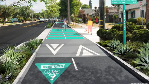
Silicon Valley ‘Bike Superhighway’ Awarded $14M State Grant
A Caltrans grant brings the 10-mile Central Bikeway project connecting Santa Clara and East San Jose closer to fruition.
Urban Design for Planners 1: Software Tools
This six-course series explores essential urban design concepts using open source software and equips planners with the tools they need to participate fully in the urban design process.
Planning for Universal Design
Learn the tools for implementing Universal Design in planning regulations.
Caltrans
City of Fort Worth
Mpact (founded as Rail~Volution)
City of Camden Redevelopment Agency
City of Astoria
City of Portland
City of Laramie


