


Researchers at the University of Wisconsin-Madison and Aarhus University in Denmark understand for the first time the combined potential impacts of both climate and land-use change on plants, animals, and ecosystems throughout the United States.
As shared on Science Daily, a new study used the Intergovernmental Panel on Climate Change 5th Assessment Report, coupled with socioeconomic parameters from the U.S. Natural Resources Inventory, to model the rate of change in both climate and land use. The study produced findings on how "climate change alters habitats for birds and bees and everything in between," as well as the implications these changes have for the way humans decide to use land.
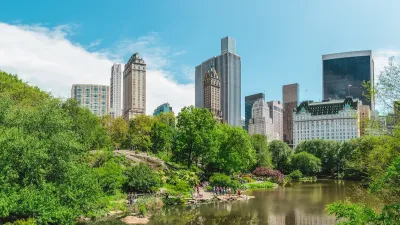
The study found, for example, that "flat areas of the Midwest are more vulnerable to climate change than mountainous regions of the country. Conversely, areas in the northeastern U.S. may experience more intensive rates of land use. High demand for cropland in New England would lead to greater destruction of forest, while, in the upper Midwest, it would lead to slower growth of cities."
Relevant for the first 50 years of the 21st century, the study "provide[s] a basis for national, regional and local policy discussions about how to conserve biodiversity and ecosystems in a rapidly changing world. Combining climate and land-use change, the researchers say, may lead to different actions than consideration of either alone."
The work was supported by the Bryson Climate, People and Environment Program; the HISTFUNC project; the National Science Foundation; and NASA’s Land Cover and Land Use Change Program.
FULL STORY: No one-size-fits-all approach in a changing climate, changing land

Public Parks as Climate Resilience Tools
Designed with green infrastructure, parks can mitigate flooding, reduce urban heat, and enhance climate resilience, offering cost-effective solutions to environmental challenges while benefiting communities.

How Cities Are Adopting Green Solutions to Combat Flooding
Cities are increasingly adopting nature-based solutions like floodable parks and green roofs to combat flooding, offering cost-effective, multifunctional benefits while requiring careful planning and integration with traditional infrastructure.
Nature-Based Solutions for Sustainable Climate Action
These solutions offer cost-effective, sustainable methods to combat climate change, but require government action to reallocate subsidies, integrate natural assets into financial systems, and develop biodiversity credit markets.

Maui's Vacation Rental Debate Turns Ugly
Verbal attacks, misinformation campaigns and fistfights plague a high-stakes debate to convert thousands of vacation rentals into long-term housing.

Planetizen Federal Action Tracker
A weekly monitor of how Trump’s orders and actions are impacting planners and planning in America.

In Urban Planning, AI Prompting Could be the New Design Thinking
Creativity has long been key to great urban design. What if we see AI as our new creative partner?

King County Supportive Housing Program Offers Hope for Unhoused Residents
The county is taking a ‘Housing First’ approach that prioritizes getting people into housing, then offering wraparound supportive services.

Researchers Use AI to Get Clearer Picture of US Housing
Analysts are using artificial intelligence to supercharge their research by allowing them to comb through data faster. Though these AI tools can be error prone, they save time and housing researchers are optimistic about the future.

Making Shared Micromobility More Inclusive
Cities and shared mobility system operators can do more to include people with disabilities in planning and operations, per a new report.
Urban Design for Planners 1: Software Tools
This six-course series explores essential urban design concepts using open source software and equips planners with the tools they need to participate fully in the urban design process.
Planning for Universal Design
Learn the tools for implementing Universal Design in planning regulations.
planning NEXT
Appalachian Highlands Housing Partners
Mpact (founded as Rail~Volution)
City of Camden Redevelopment Agency
City of Astoria
City of Portland
City of Laramie