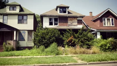
With thousands of abandoned homes located in neighborhoods of varying shape and character, Chicago has a massive challenge in returning its vacant properties to active use. Can algorithms help leaders decide on the right solutions?
"Last month, fellows with the University of Chicago’s Data Science for Social Good began working with the Chicago area’s newly born Cook County Land Bank Authority (CCLBA)," reports Brady Dale. "The aim is to create a tool that will make it easier to process data on foreclosures, real estate trends and the like to determine which properties are the best candidates for redevelopment. Think of it as a data-backed triage unit for vacant land."
“'I don’t think we’ll be able to create a model that makes those choices easy,' Thomas Plagge, a post-doc in astrophysics and mentor for the land use fellows said. 'What I think that we’ll be able to prototype out is a selection of algorithms that the land bank staff can apply to different neighborhoods in different situations.'”
“A lot of times when the government intervenes in the real estate market, they have this kind of one-size-fits-all solution,” Plagge continued. “We want to be more flexible, and we also want to be able to evaluate our interventions on the fly and bake that into the cake.”
FULL STORY: Applying Big Data to Vacants, and Other Steps Taken By Chicago’s Land Bank

Planetizen Federal Action Tracker
A weekly monitor of how Trump’s orders and actions are impacting planners and planning in America.

Maui's Vacation Rental Debate Turns Ugly
Verbal attacks, misinformation campaigns and fistfights plague a high-stakes debate to convert thousands of vacation rentals into long-term housing.

San Francisco Suspends Traffic Calming Amidst Record Deaths
Citing “a challenging fiscal landscape,” the city will cease the program on the heels of 42 traffic deaths, including 24 pedestrians.

Amtrak Rolls Out New Orleans to Alabama “Mardi Gras” Train
The new service will operate morning and evening departures between Mobile and New Orleans.

The Subversive Car-Free Guide to Trump's Great American Road Trip
Car-free ways to access Chicagoland’s best tourist attractions.

San Antonio and Austin are Fusing Into one Massive Megaregion
The region spanning the two central Texas cities is growing fast, posing challenges for local infrastructure and water supplies.
Urban Design for Planners 1: Software Tools
This six-course series explores essential urban design concepts using open source software and equips planners with the tools they need to participate fully in the urban design process.
Planning for Universal Design
Learn the tools for implementing Universal Design in planning regulations.
Heyer Gruel & Associates PA
JM Goldson LLC
Custer County Colorado
City of Camden Redevelopment Agency
City of Astoria
Transportation Research & Education Center (TREC) at Portland State University
Jefferson Parish Government
Camden Redevelopment Agency
City of Claremont


