


A new study by the Chicago-based Center for Neighborhood Technology (CNT) compares that city's flood insurance claims with its floodplains, and finds a 'completely counter-intuitive' relationship between the two.
Common sense would lead one to imagine the bulk of Chicago's flood insurance claims would occur in those areas most prone to flooding. But what may seem logical to the average person, or "even the average expert in flooding," is incorrect, says a new report [PDF] authored by Harriet Festing, CNT's water program director. And as Emily Badger explains, impervious surfaces are to blame.
"Chicago – and plenty of other cities just like it – has artificially created flood-prone places simply by paving over the region's natural ability to manage excess water. And, as Festing points out, most people are entirely unaware that the city has done this. In urban areas anywhere, when we focus instead on the risks posed by flood plains, we may be ignoring the even greater threat created by how we've designed cities to crowd out their essential green space," says Badger.
FULL STORY: The Way We Build Cities Is Making Them Flood


Chicago’s Ghost Rails
Just beneath the surface of the modern city lie the remnants of its expansive early 20th-century streetcar system.

The Subversive Car-Free Guide to Trump's Great American Road Trip
Car-free ways to access Chicagoland’s best tourist attractions.
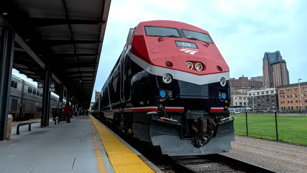
Amtrak’s Borealis Exceeds First Year Ridership Expectations
205,800 passengers have boarded the St. Paul to Chicago line, well above initial MDOT projections.

Maui's Vacation Rental Debate Turns Ugly
Verbal attacks, misinformation campaigns and fistfights plague a high-stakes debate to convert thousands of vacation rentals into long-term housing.

Planetizen Federal Action Tracker
A weekly monitor of how Trump’s orders and actions are impacting planners and planning in America.
Chicago’s Ghost Rails
Just beneath the surface of the modern city lie the remnants of its expansive early 20th-century streetcar system.

Bend, Oregon Zoning Reforms Prioritize Small-Scale Housing
The city altered its zoning code to allow multi-family housing and eliminated parking mandates citywide.

Amtrak Cutting Jobs, Funding to High-Speed Rail
The agency plans to cut 10 percent of its workforce and has confirmed it will not fund new high-speed rail projects.

LA Denies Basic Services to Unhoused Residents
The city has repeatedly failed to respond to requests for trash pickup at encampment sites, and eliminated a program that provided mobile showers and toilets.
Urban Design for Planners 1: Software Tools
This six-course series explores essential urban design concepts using open source software and equips planners with the tools they need to participate fully in the urban design process.
Planning for Universal Design
Learn the tools for implementing Universal Design in planning regulations.
planning NEXT
Appalachian Highlands Housing Partners
Mpact (founded as Rail~Volution)
City of Camden Redevelopment Agency
City of Astoria
City of Portland
City of Laramie