


Parking regulations are generally formulated as uniform standards that apply to hundreds or thousands of parcels equally, often resulting in overbuilt supply. But what if planners could anticipate the parking demand down to the parcel?

As Emily Badger reports, Seattle's King County Metro Transit agency, with the help of the Center for Neighborhood Technology and the Urban Land Institute Northwest, have been working on solving the parking supply vs. demand conundrum and may have achieved a significant breakthrough.
"They've spent the past year trying to measure exactly which factors dictate residential parking demand around the region, in downtown Seattle, in urban neighborhoods, in the suburbs and even farther out. The result of their efforts is this Right Size Parking Calculator web application that can estimate parking demand down to a single parcel of land (and that should be replicated in other cities)," she writes.
"The idea is that developers might use the tool when planning a project," she adds, "but also that local governments might consider this data in updating their parking regulations. King Country is agnostic about what they come up with."
"The name 'Right Size' is very conscious because we don’t want to just say 'in all cases there should be less parking,'" says Ron Posthuma, the assistant director of the King County Department of Transportation. "In some cases, maybe there should be more."
FULL STORY: Mapping the Subtle Science of Parking Demand

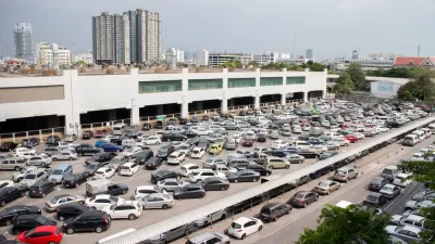
Parking Inventories for Five Cities
A new report providing credible estimates of five cities of differing size and geographic location reveals one truth about the United States: parking is the dominant land use in cities.
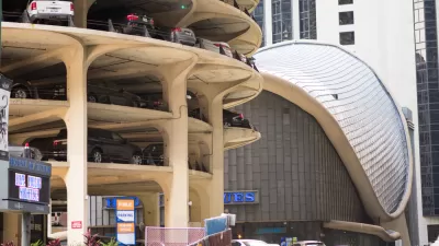
Fun Parking Facts
Parking requirements are the dark matter of the urban universe: they affect transport and land use in mysterious ways. These fun facts illustrate the costs and impacts of economically excessive parking supply.
Study: There's Too Much Parking in Chicago
With underground parking spaces costing $37,000 and more to build in Chicago, it might come as a shock that a recent study found much more parking supply than demand around the city's apartment buildings.

Maui's Vacation Rental Debate Turns Ugly
Verbal attacks, misinformation campaigns and fistfights plague a high-stakes debate to convert thousands of vacation rentals into long-term housing.

Planetizen Federal Action Tracker
A weekly monitor of how Trump’s orders and actions are impacting planners and planning in America.

San Francisco Suspends Traffic Calming Amidst Record Deaths
Citing “a challenging fiscal landscape,” the city will cease the program on the heels of 42 traffic deaths, including 24 pedestrians.

Defunct Pittsburgh Power Plant to Become Residential Tower
A decommissioned steam heat plant will be redeveloped into almost 100 affordable housing units.

Trump Prompts Restructuring of Transportation Research Board in “Unprecedented Overreach”
The TRB has eliminated more than half of its committees including those focused on climate, equity, and cities.

Amtrak Rolls Out New Orleans to Alabama “Mardi Gras” Train
The new service will operate morning and evening departures between Mobile and New Orleans.
Urban Design for Planners 1: Software Tools
This six-course series explores essential urban design concepts using open source software and equips planners with the tools they need to participate fully in the urban design process.
Planning for Universal Design
Learn the tools for implementing Universal Design in planning regulations.
Heyer Gruel & Associates PA
JM Goldson LLC
Custer County Colorado
City of Camden Redevelopment Agency
City of Astoria
Transportation Research & Education Center (TREC) at Portland State University
Jefferson Parish Government
Camden Redevelopment Agency
City of Claremont