San Francisco's Municipal Transportation Agency is adding GPS units to all lines within five years.


"Digital signs mounted inside the Fillmore Street bus shelters, which are connected to a bus-tracking satellite system, answer for Detwiler the one question that vexes all public transit riders: When is the next bus coming?.. Using global positioning satellites, the system displays arrival times in stations and at bus stops. NextBus also allows people with most wireless phones, some handheld computers, Palm Pilots and two-way pagers with Internet access to track their rides through the Web site www.nextbus.com."
Thanks to Transport-Policy List
Read the full story: Tracking system will go on all Muni lines

Desperate measures: Advocates weigh draining Lake Powell to fill Colorado River
Draining the reservoir could reduce evaporation losses by a couple hundred thousand acre-feet.

Eastern Nebraska is running out of electricity
Data centers and electrification are straining eastern Nebraska’s grid, throttling economic development.
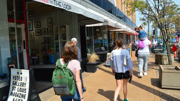
Move over, LA: St. Louis gears up for Olympics, invests millions in downtown redevelopment
The Missouri city will host the 2028 Olympic soccer group stage and knockout matches.

MTA sends Dem leaders a wish list to mend Trump’s damages
Requests include exempting new train and bus components from tariffs and increasing transit security funding.

Mass. votes against statewide minimum lot size for single-family homes
Over 2 million residents voted on Question 7; it was decided by just over 30,000 votes.

Maryland’s $15 billion bridge project gains key approval
The Maryland Transit Authority said the project will create over 60,000 jobs and add $23 billion to the local economy.

FREE Course: Walkable City 1: Why Walkability?
After describing his path towards focusing on walkability as the essence of good planning, Jeff Speck marches through his five principal reasons for making more walkable places.
Reinventing Malls: Planning Alchemy—Turning Gray Fields Into Gold
The course focuses on the opportunities and imperatives that shape reinvention of mall sites.

City of Rosemead
Rutgers University, Edward J. Bloustein School of Planning and Public Policy
One Hundred Miles
University of Michigan School for Environment and Sustainability (SEAS)
Hunter College, City University of New York (CUNY)
The Architects Foundation
City of Cambridge
The Pocatello Development Authority
The Urban Renewal Agency of the City of Pocatello