John King writes about an ambitious new regional plan for the Bay Area that looks to accommodate the 1.1 million new jobs and 2.1 million new residents expected by 2040, with relatively little suburban sprawl.


Plan Bay Area, which was presented last week to a joint meeting of the Metropolitan Transportation Commission and the Association of Bay Area Governments, has been a year in the making. Part of a state-mandated plan to cut greenhouse gas emissions, the plan "is the latest attempt to encourage local governments to accept higher-density growth as part of an effort to create communities where jobs, housing, shopping and recreational space all are within convenient reach," notes King.
Based on expected demographic trends and changes in tastes that will drive a market for urban living, the plan would focus development in the cities of San Francisco, Oakland and San Jose, and along such corridors as El Camino Real on the Peninsula and San Pablo Avenue from Oakland to Richmond.
The plan, however, is not without its detractors. "'Everything here is cookie-cutter,' said Richard Willis of Corte Madera, referring to the plan's enthusiasm for putting apartments and condominiums near transit. 'If you want to deny that this (Agenda 21) is the basis of your plan, you're in la-la land.'"
Read the full story: Plan Bay Area envisions growth without sprawl

Bay Area Planners Acknowledge the Need for Regional Housing Solutions
While most Bay Area communities are pursuing housing solutions "individually," local planners acknowledge the need for strategies that address the regional as a unified whole.
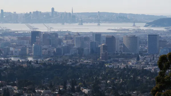
The Many Ongoing Public Transportation Projects of the Bay Area
The San Francisco Chronicle offers a round-up of 11 big transit projects, by Caltrans, BART, SFMTA, and others, making progress around the bay.

Is CEQA the Main Impediment to Housing Construction in California?
According to a new study by UC Berkeley and Columbia University, local land use processes, specifically the approval process, rather than the California Environmental Quality Act, is the main impediment to housing production in California.

Planetizen Federal Action Tracker
A weekly monitor of how Trump’s orders and actions are impacting planners and planning in America.

Eastern Nebraska is running out of electricity
Data centers and electrification are straining eastern Nebraska’s grid, throttling economic development.

Study reveals best places in the U.S. for cycling, walking
New research from Streetlight Data examines bicycle and pedestrian miles per capita in the 100 largest U.S. cities by population.

DSA members accuse Mamdani of 'abandoning values' over housing redevelopment
New York City's mayor plans to replace about 2,000 units of public housing with private, mixed-income housing.

All sides of BRT debate unhappy with CDOT’s most recent move
The Colorado Department of Transportation is no longer considering center-running bus lanes for Colorado Boulevard.

Massachusetts bogs generate both power, and cranberries
Putting solar panels above farmland is one way Massachusetts is advancing toward its goal of net-zero carbon emissions by 2050.

FREE Course: Walkable City 1: Why Walkability?
After describing his path towards focusing on walkability as the essence of good planning, Jeff Speck marches through his five principal reasons for making more walkable places.
Reinventing Malls: Planning Alchemy—Turning Gray Fields Into Gold
The course focuses on the opportunities and imperatives that shape reinvention of mall sites.

City of Rosemead
Rutgers University, Edward J. Bloustein School of Planning and Public Policy
One Hundred Miles
University of Michigan School for Environment and Sustainability (SEAS)
Hunter College, City University of New York (CUNY)
The Architects Foundation
City of Cambridge
The Pocatello Development Authority
The Urban Renewal Agency of the City of Pocatello