Last year I had the opportunity to teach a graduate course on "Web 2.0 for Policy and Planning" at the University of Southern California's School of Policy, Planning & Development. Although I am co-teaching a different class this year, I have updated my course website with a revised course syllabus and extensive reading list on Web 2.0 and planning, based on what I learned from teaching the course in Spring, 2009.
Last year I had the opportunity to teach a graduate course on "Web 2.0 for Policy and Planning" at the University of Southern California's School of Policy, Planning & Development.
Although I am co-teaching a different class this year, I have updated my
course website with a revised course syllabus and extensive reading list on Web 2.0 and planning, based on what I learned
from teaching the course in Spring, 2009.
Each student selected a particular Web 2.0 technology and examined the technology through a planning or urban policy lense. I selected the best six student white papers from the
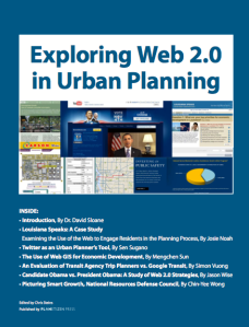
course, and have now assembled them in a short book, Exploring Web 2.0
in Urban Planning.
 Exploring Web 2.0 in Urban Planning
A collection of six white papers,
Edited by Chris Steins | Published by Planetizen Press
Abstract: Emerging technologies are fundamentally changing how we
plan, develop and manage our urban areas. Likewise, planning
professionals are increasingly being called on to adopt new
technologies to plan, communicate planning concepts and engage citizens
in the planning process. This collection of articles introduces a range
of Web 2.0 technologies that can be applied to the field of planning,
including Web surveys, Twitter, Web-based geographic information
systems, Google transit, citizen engagement strategies, and image
visualizations. The six white papers in this document were researched
and written by authors at the School of Policy, Planning, and
Development University of Southern California as part of a Spring, 2009
graduate- level course on Internet Technologies and Urban Planning.
Contents
- Introduction, By Dr. David Slaone
- Louisiana Speaks: A Case Study: Examining the Use of the Web to Engage Residents in the Planning Process, By Josie Noah
- Twitter as an Urban Planner's Tool, By Sen Sugano
- The Use of Web GIS for Economic Development, By Mengchen Sun
- An Evaluation of Transit Agency Trip Planners vs. Google Transit, By Simon Vuong
- Candidate Obama vs. President Obama: A Study of Web 2.0 Strategies, By Jason Wise
- Picturing Smart Growth, National Resources Defense Council, By Chin-Yee Wong
The book is available for free to download (PDF), or
available in printed form for a modest printing fee (Ordering information is at the bottom of the linked page.)

Maui's Vacation Rental Debate Turns Ugly
Verbal attacks, misinformation campaigns and fistfights plague a high-stakes debate to convert thousands of vacation rentals into long-term housing.

Planetizen Federal Action Tracker
A weekly monitor of how Trump’s orders and actions are impacting planners and planning in America.

In Urban Planning, AI Prompting Could be the New Design Thinking
Creativity has long been key to great urban design. What if we see AI as our new creative partner?

King County Supportive Housing Program Offers Hope for Unhoused Residents
The county is taking a ‘Housing First’ approach that prioritizes getting people into housing, then offering wraparound supportive services.

Researchers Use AI to Get Clearer Picture of US Housing
Analysts are using artificial intelligence to supercharge their research by allowing them to comb through data faster. Though these AI tools can be error prone, they save time and housing researchers are optimistic about the future.

Making Shared Micromobility More Inclusive
Cities and shared mobility system operators can do more to include people with disabilities in planning and operations, per a new report.
Urban Design for Planners 1: Software Tools
This six-course series explores essential urban design concepts using open source software and equips planners with the tools they need to participate fully in the urban design process.
Planning for Universal Design
Learn the tools for implementing Universal Design in planning regulations.
planning NEXT
Appalachian Highlands Housing Partners
Mpact (founded as Rail~Volution)
City of Camden Redevelopment Agency
City of Astoria
City of Portland
City of Laramie


