


One important planning approach for sustainable living is how to locate and integrate the natural and man-made attributes of the land to configure a low-carbon site for large scale development.
One important planning approach for sustainable living is how to locate and integrate the natural and man-made attributes of the land to configure a low-carbon site for large scale development. Steven Kellenberg's, Urban Land Green article, "Ten Keys to a Low-Carbon Community", http://www.uli.org/ResearchAndPublications/Magazines/UrbanLandGreen.aspx offers an excellent primer on the symbiotic relationship between a variety of planning and design principles that provide measurable solutions for sustainable growth.
Land planners continue to deepened the analytical process of qualifying low-carbon sites through an integrated strategy for sustainable site development called Potential Energy & Renewable Resource Mapping, or PERRM.
PERRM assists property owners identify and document the inherent surface and subsurface resources available on their land to create synergy and an energy efficient infrastructure between the natural and man-made environment to provide an affordable strategy for low carbon development. The goal is to save energy costs for the property owner, the inhabitants and the planet by lowering greenhouse gas emissions and promoting a carbon neutral environment. The objectives are to leverage financial incentives, create steady, ancillary revenue sources and foster entrepreneurial cooperation based on a framework of low carbon development and energy efficiency.
In the past developers often ignored potential energy & renewable resources or left them independent. The data collected by civil and geotechnical engineers was primarily used to identify build /no build areas or close gaps in the traditional infrastructure owned by public utilities. Today, property owners have found PERRM to be valuable for establishing energy usage and efficiency criteria required to for new community development, renewable energy tax credits, revenue negotiations, formation of municipal utility districts, lease strategies, partnering with emerging technology companies, energy legislation and jurisdictional approvals and new federal and state incentive programs,. Also, PERRM is useful to communicate the ‘uniqueness of the land' as a branding opportunity, since the process and results are inherently interesting to the public.
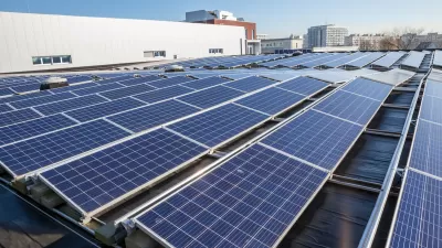
PERRM identifies and explores the potential for integrated strategies between crude oil, natural gas, landfill, wastewater treatment, hydro, solar, wind, geothermal, water wells, rain harvesting, conventional power grids CH&P, desalinization, biomass agriculture, bioremediation and potential for loop optimization to fulfill a variety of outcomes. For instance, a slope analysis study, often used only to identify buildable areas are being reexamined using PERRM as locations for thermal radiation collection based on solar and surface geothermal (GHPs) potential.
PERRM may not make sense everywhere. Scale is important and large properties benefit. Some of the overlapping tasks that need to be performed in a PERRM study include:
- Preparation of a 1:1000 base map and aerial photo by civil & geotechnical experts.
- Agree on the purpose and goals for the PERRM.
- Complete the PERRM Energy Questionnaire
- Compile a first-level PERRM based on local knowledge of existing conditions.
- Locate available public and private data such as specific plan documents and internal technical reports. Plot all relevant information on the first-level map (wastewater and soils, etc).
- Overlay initial PERRM results to determine opportunity and constraints.
- Evaluate overall energy requirements for the property.Develop second and third-level PERRM criteria for collecting data on solar, thermal heat, wind studies, etc.
- Begin informational meetings with companies that have products and services that rely on renewable resources. Build consensus on overall community energy infrastructure planning, micro grids, SMART Home technology, timing and costs.
- Begin jurisdictional meetings with state and federal agencies regarding tax credit, application requirements, expediting, costs and public relations.
- Prepare a cost benefit analysis and infrastructure savings report for negotiations during land sales.
PERRM has resulted in a several low carbon development criteria that property owners once thought were unattainable. First, striving for 80% of peak energy demand with renewable resources is realistic. Second, developers should keep the carbon reduction credits in anticipation of a future cap and trade strategy being initiated by the US government. Finally, while mineral rights are important - so are air rights. Developers should keep the air gap rights above the roof lines on all new structures for future renewable potential which they can use or sell.
PERRM studies ultimately leads to a myriad of new questions and scenarios that need to be solved on a case by case basis. The methodology also involves engaging new disciplines and energy experts to cooperate on this breakthrough process. PERRM creates a new value proposition from how land planning and development has been approached before in order to create a low carbon environment to help us all.

Retrofitting Old Cities for Sustainability
Explore strategies for retrofitting old cities to enhance sustainability while preserving historical integrity and managing logistical challenges.

Michigan Proposal to Attract Data Centers Garners Criticism
The state legislature is poised to pass a law that would bring more data centers to the state, but critics say the move would threaten the state’s climate goals.
US Building Emissions are Growing
Green building standards and efficiency retrofits are not keeping up with energy demand, resulting in a net increase in greenhouse gas emissions from buildings.

Maui's Vacation Rental Debate Turns Ugly
Verbal attacks, misinformation campaigns and fistfights plague a high-stakes debate to convert thousands of vacation rentals into long-term housing.

Planetizen Federal Action Tracker
A weekly monitor of how Trump’s orders and actions are impacting planners and planning in America.

San Francisco Suspends Traffic Calming Amidst Record Deaths
Citing “a challenging fiscal landscape,” the city will cease the program on the heels of 42 traffic deaths, including 24 pedestrians.

Defunct Pittsburgh Power Plant to Become Residential Tower
A decommissioned steam heat plant will be redeveloped into almost 100 affordable housing units.

Trump Prompts Restructuring of Transportation Research Board in “Unprecedented Overreach”
The TRB has eliminated more than half of its committees including those focused on climate, equity, and cities.

Amtrak Rolls Out New Orleans to Alabama “Mardi Gras” Train
The new service will operate morning and evening departures between Mobile and New Orleans.
Urban Design for Planners 1: Software Tools
This six-course series explores essential urban design concepts using open source software and equips planners with the tools they need to participate fully in the urban design process.
Planning for Universal Design
Learn the tools for implementing Universal Design in planning regulations.
Heyer Gruel & Associates PA
JM Goldson LLC
Custer County Colorado
City of Camden Redevelopment Agency
City of Astoria
Transportation Research & Education Center (TREC) at Portland State University
Jefferson Parish Government
Camden Redevelopment Agency
City of Claremont