


A few weeks ago, I read a newspaper article commenting on a pedestrian who was killed in a car crash; the article suggested “educating pedestrians to cross at intersections.” But sometimes, some pedestrians are actually safer crossing mid-block. Here’s why: when I cross at the intersection nearest my suburban apartment, I have to look for traffic coming from a variety of directions: not just oncoming drivers in both directions who might run red lights, but also drivers turning from the corners of the intersection.

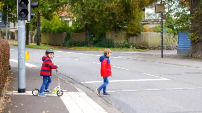
A few weeks ago, I read a newspaper article commenting on a pedestrian who was killed in a car crash; the article suggested "educating pedestrians to cross at intersections." But sometimes, some pedestrians are actually safer crossing mid-block.
Here's why: when I cross at the intersection nearest my suburban apartment, I have to look for traffic coming from a variety of directions: not just oncoming drivers in both directions who might run red lights, but also drivers turning from the corners of the intersection.
By contrast, if I cross in midblock, I only have to look at traffic coming in one direction at a time: in the northbound lane I look for traffic heading north, in the southbound lane for traffic heading south. So if there's not any traffic, I run for it.
On the other hand, midblock crossings are not for everyone. In the suburban area where I live, traffic goes very fast when it goes- but at times congestion is low enough that there are no cars nearby. So crossing anywhere near a car is dangerous because any crash is likely to be fatal - while on the other hand when there is no nearby traffic, crossing is safe regardless of the location.
On the other hand, in a more urban and/or congested environment where traffic flows more evenly, there will always be a few cars near you in the oncoming lane- so in that situation, midblock crossings are less safe. (And the slower traffic means that even if you are in the intersection, your risk of being seriously injured by a crash is lower).
And if you are too young or too visually impaired to see whether there are cars nearby, there is, alas, no good alternative to relying on traffic signals.

Friday Funny: Pity the Fool Who Doesn't Yield to a Law-Abiding Pedestrian
A satirical article published by The Onion tells a familiar tale.
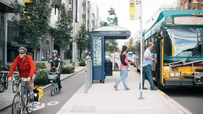
Transit Shelter Modernization Plan on the Shelf in Seattle
Transit advocates thought a public-private partnership to modernize transit shelters and enhance the public realm was a done deal.
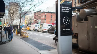
Watch the Olympics on Digital Kiosks
Three cities around the country have the hardware to provide coverage of the Olympics in public.

Planetizen Federal Action Tracker
A weekly monitor of how Trump’s orders and actions are impacting planners and planning in America.

Maui's Vacation Rental Debate Turns Ugly
Verbal attacks, misinformation campaigns and fistfights plague a high-stakes debate to convert thousands of vacation rentals into long-term housing.

San Francisco Suspends Traffic Calming Amidst Record Deaths
Citing “a challenging fiscal landscape,” the city will cease the program on the heels of 42 traffic deaths, including 24 pedestrians.

Amtrak Rolls Out New Orleans to Alabama “Mardi Gras” Train
The new service will operate morning and evening departures between Mobile and New Orleans.

The Subversive Car-Free Guide to Trump's Great American Road Trip
Car-free ways to access Chicagoland’s best tourist attractions.

San Antonio and Austin are Fusing Into one Massive Megaregion
The region spanning the two central Texas cities is growing fast, posing challenges for local infrastructure and water supplies.
Urban Design for Planners 1: Software Tools
This six-course series explores essential urban design concepts using open source software and equips planners with the tools they need to participate fully in the urban design process.
Planning for Universal Design
Learn the tools for implementing Universal Design in planning regulations.
Heyer Gruel & Associates PA
JM Goldson LLC
Custer County Colorado
City of Camden Redevelopment Agency
City of Astoria
Transportation Research & Education Center (TREC) at Portland State University
Jefferson Parish Government
Camden Redevelopment Agency
City of Claremont