


In this column, Richard Florida argues the decline in the popularity of suburbs is not just a product of rising oil prices, but a result of a new "spatial fix" that is reorganizing how and where people live their lives.
"One of the few things increasing as fast as the price of oil lately has been the amount of commentary linking higher energy costs to the death of suburbia. Clearly, higher gas prices have affected where people want – or can afford – to live. Just as the demand for SUVs plummets and consumers have finally begun to see the point of hybrids, people are turning away from sprawling exurbs toward urban neighbourhoods and inner suburbs."
"But what's happening here goes a lot deeper than the end of cheap oil. We are now passing through the early development of a wholly new geographic order – what geographers call "the spatial fix" – of which the move back toward the city is just one part."
"Suburbanization was the spatial fix for the industrial age – the geographic expression of mass production. Low-cost mortgages, massive highway systems and suburban infrastructure projects fueled the industrial engine of postwar capitalism, propelling demand for cars, appliances and all sorts of industrial goods."
"The creative economy is giving rise to a new spatial fix and a very different geography – the contours of which are only now emerging."
FULL STORY: The days of urban sprawl are over ...

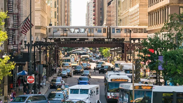
Planning for Congestion Relief
The third and final installment of Planetizen's examination of the role of the planning profession in both perpetuating and solving traffic congestion.

How Planning Fails to Solve Congestion
Solutions for congestion are never as simple and easy as armchair planners and engineers would like you to believe—especially those who suggest that congestion can be solved by forever building more roadway capacity.

Planning and the Complicated Causes and Effects of Congestion
What do planners know about congestion, and what can they do about it? Explanations and solutions are less obvious than they seem (part one of a three-part series).

Planetizen Federal Action Tracker
A weekly monitor of how Trump’s orders and actions are impacting planners and planning in America.

Chicago’s Ghost Rails
Just beneath the surface of the modern city lie the remnants of its expansive early 20th-century streetcar system.

Amtrak Cutting Jobs, Funding to High-Speed Rail
The agency plans to cut 10 percent of its workforce and has confirmed it will not fund new high-speed rail projects.

Ohio Forces Data Centers to Prepay for Power
Utilities are calling on states to hold data center operators responsible for new energy demands to prevent leaving consumers on the hook for their bills.

MARTA CEO Steps Down Amid Citizenship Concerns
MARTA’s board announced Thursday that its chief, who is from Canada, is resigning due to questions about his immigration status.

Silicon Valley ‘Bike Superhighway’ Awarded $14M State Grant
A Caltrans grant brings the 10-mile Central Bikeway project connecting Santa Clara and East San Jose closer to fruition.
Urban Design for Planners 1: Software Tools
This six-course series explores essential urban design concepts using open source software and equips planners with the tools they need to participate fully in the urban design process.
Planning for Universal Design
Learn the tools for implementing Universal Design in planning regulations.
Caltrans
City of Fort Worth
Mpact (founded as Rail~Volution)
City of Camden Redevelopment Agency
City of Astoria
City of Portland
City of Laramie