


It's not so easy to measure urban density -- either by sight or calculation -- but thoughtful analysis of development intensity can illustrate useful insights into our cities and regions.
This article includes excerpts from white paper by Terry Holzheimer, PhD, Director, Arlington (Virginia) Economic Development, which is available online at www.arlingtonvirginiausa.com. All supporting attribution for facts and figures included in this excerpt are footnoted in the white paper.
 Often what we perceive or observe to be true is not necessarily true at all -- as is the case when trying to determine the density of an urban neighborhood. Most people, urban planners included, have a difficult time determining a community's density simply by observation. Perceptions can be deceiving, especially when trying to compare areas with varying building heights, population sizes and geographical size.
Density is a complex concept that includes measured density, perceived density and crowding of a given area. While the term is often described as objective, it is also relative. What do measures of jobs per acre, or population per acre, feel like to employees or residents of a neighborhood? How do the places in which we live and work measure up and compare? Can objective, numeric measures really reflect the "urban-ness" of a place? If so, which is a better presentation of that "urban-ness"? Numeric measures of density or relative perceptions of low, medium and high densities?
In an attempt to help answer these questions and quantify urban density and intensity, I have analyzed specific formulas of measurement for the density of regional activity centers, along with growth projection data, to better understand current and future trends about urban development. While I have used date from my own area -- Greater Washington, D.C. and Northern Virginia -- as an example, these approaches can be applied to any major metro region.
Regional Activity Center Data
The Metropolitan Washington (D.C.) Council of Governments (COG) has developed a typology of regional activity centers; essentially, clusters of employment. Starting with the D.C. core and moving outward through Northern Virginia and suburban Maryland, they include mixed-use centers, employment centers and suburban employment centers. Each classification represents a different type and scale of development (one should also recognize that there are significant differences within the classifications themselves).
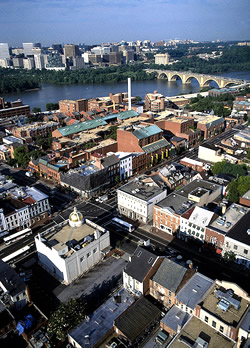
The Washington, D.C. core, the region's business center, includes both Georgetown and Alexandria, Virginia, the region's two 18th century cities that pre-date the formation of Washington itself. The mixed-use centers in Northern Virginia include the Metrorail-served markets of the Rosslyn-Ballston corridor, Crystal City and Pentagon City. Employment centers or "edge cities" include Tysons Corner, Reston and Fairfax Center as well as the purely government based work compounds around and near the Pentagon. Suburban employment centers are the emerging areas of job growth in this region, displaying clearly dispersed suburban patterns.
The Formula of Measurement
The simplest measures used in this analysis are jobs and population per acre -- two very common methods of describing density. Separately they do not provide an adequate vision of a place in terms of its form or function, due to the fact that most urban development is built for either employment or residential purposes. However the combined measure of development intensity -- derived by adding the two measures together - can provide a clearer sense of the use of land.
At 167.5 jobs and residents per acre, Downtown Washington, D.C. is by far the most intensely developed area in the region. Most of this is attributable to jobs, although residential densities are still roughly equivalent to the "higher density" transit-oriented mixed-use centers. Using this measure, Downtown is developed at an intensity rate nearly four times that of Tysons Corner, and well above other areas with much "taller" development such as Rosslyn.
The next intensity tier includes transit-oriented mixed-use centers. These areas have densities generally above 80 jobs per acre and above 30 persons per acre -- the highest residential densities in the region. And while the edge city areas of Fairfax County have high employment densities (and the buildings to match), they do not approach the development intensity of mixed-use centers due to population densities below 10 persons per acre.
One perhaps surprising conclusion that can be reached from the COG data is that the 18th century cities of Georgetown and Alexandria, with development intensities above 50 jobs and residents per acre, have higher development intensities than those of Tysons Corner and comparable edge cities. While both of these older cities have marginally increased their development intensity over the past 200 years, it has generally been within the traditional street grid, height and scale of the original buildings. Furthermore, their street grids have impressively accommodated traffic levels associated with 21st century America.

Aerial view of Tysons Corner. Photo credit: Fairfax County Economic Development Authority.
Finally, with job densities below 10 per acre and overall development intensities below 15, the data reinforces the notion that suburban employment centers such as the Dulles corridor are far from being urban places by any measure.
Projected Regional Growth
How will development proceed over the next 25 years? Arthur "Chris" Nelson, professor and director of Urban Affairs and Planning at Virginia Tech's Washington-Alexandria Center suggests that by 2030, the entire built environment in the Greater Washington, D.C. region will need to be nearly replicated by a like amount of new construction. Based on COG projections, every regional activity center is expected to increase significantly in densities and intensities. The transit-oriented, mixed-use centers will achieve true urban-level development intensities, approaching or eclipsing 200 persons per acre with growth rates above 40 percent while maintaining the highest residential densities. The edge city communities will grow at about the same rate. The suburban employment centers will show the greatest percentage growth, especially those along the Dulles corridor, an area planned to receive a Metrorail extension -- though their development densities will fall short of today's edge cities. Overall, despite the continued intensification of the Washington, D.C. core, mixed-use centers and employment centers, 73 percent of the region's projected job growth over the next 25 years will be outside of these activity areas, resulting in increased suburban employment areas.
Conclusions
So what conclusions can be reached from this analysis? First, development intensities of those 18th Century cities drastically surpass those found today. Georgetown and Alexandria demonstrate that even with constrained building heights and street grids, traditional neighborhoods can achieve, surprisingly, relatively high intensity. Second, transit-oriented mixed use centers will continue to accommodate growth and increase their urban intensity -- achieving a development intensity three or more times greater than the 18th century model. Third, even with the growth of core areas and mixed-use urban centers, suburban edge cities and employment centers such as the Dulles corridor will continue to develop dramatically to meet the demands of projected growth.
Through further study and analysis of these factors, we can increase our understanding of density's role in urban areas -- and developers can begin making strategic growth plans for the future.
Terry Holzheimer has served Arlington Economic Development since 1996, and is the former director of Loudoun County's economic development department. He is currently a member of the adjunct faculty in Urban Affairs and Planning at Virginia Tech
.


Planetizen Federal Action Tracker
A weekly monitor of how Trump’s orders and actions are impacting planners and planning in America.

Maui's Vacation Rental Debate Turns Ugly
Verbal attacks, misinformation campaigns and fistfights plague a high-stakes debate to convert thousands of vacation rentals into long-term housing.

San Francisco Suspends Traffic Calming Amidst Record Deaths
Citing “a challenging fiscal landscape,” the city will cease the program on the heels of 42 traffic deaths, including 24 pedestrians.

Defunct Pittsburgh Power Plant to Become Residential Tower
A decommissioned steam heat plant will be redeveloped into almost 100 affordable housing units.

Trump Prompts Restructuring of Transportation Research Board in “Unprecedented Overreach”
The TRB has eliminated more than half of its committees including those focused on climate, equity, and cities.

Amtrak Rolls Out New Orleans to Alabama “Mardi Gras” Train
The new service will operate morning and evening departures between Mobile and New Orleans.
Urban Design for Planners 1: Software Tools
This six-course series explores essential urban design concepts using open source software and equips planners with the tools they need to participate fully in the urban design process.
Planning for Universal Design
Learn the tools for implementing Universal Design in planning regulations.
Heyer Gruel & Associates PA
JM Goldson LLC
Custer County Colorado
City of Camden Redevelopment Agency
City of Astoria
Transportation Research & Education Center (TREC) at Portland State University
Jefferson Parish Government
Camden Redevelopment Agency
City of Claremont