Angkor was a low-density metropolis. It lasted six centuries, until it could no longer maintain its infrastructure in a changing climate. Today, it offers planners a sobering warning about the risks of dispersed urban living.


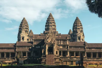
I have visited Angkor several times. Standing among the banyan trees that now engulf several of the temples, it is tempting to see its fall as another case of architectural hubris — a civilization that invested too much in monuments. But if we look beyond the stone temples, across the vast plain now overtaken by forest, a different story emerges. What seems like untouched jungle was once a vast metropolis of dispersed dwellings. Angkor's true achievement — and fatal vulnerability — lay in its sprawling infrastructure.
Rome, a five-mile city
To understand why Angkor fell, it helps to contrast Angkor with an ancient metropolis built on the opposite principle. Ancient Rome, similar to Angkor, at its peak had a population close to one million. It was a colossus of a city, relying on water sourced from locations as far as forty-four miles away through massive aqueducts. Yet unlike Angkor, Rome itself occupied only about five square miles, achieving extraordinary density. Many Romans lived in insulae, multi-story apartment buildings. Rather than spreading outward, Rome compacted its life inward, packing more people and activities into its limited footprint.
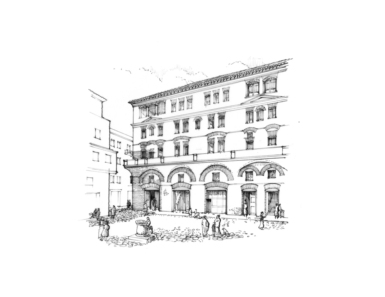
However, due to a series of shocks, from the Late Antique Little Ice Age to the Plague of Justinian, Rome’s population rapidly declined. And as its population fell, maintaining the infrastructure that supported Rome — roads, aqueducts and defense walls — became increasingly difficult. By 1084 AD, Norman forces set the city ablaze and Rome’s population had dwindled to around 20,000 people, becoming a mere shadow of its former glory. The once-prized aqueducts, engineering marvels that had carried water for centuries, fell into disrepair. Most of their waters ceased to flow. Yet remarkably, the city endured. However, other ancient cities would not survive similar catastrophes. The fate of a metropolis, it seems, was intimately tied to how its people chose to dwell.
Other ancient cities relied on, died by decentralized urbanism
Unlike Rome’s concentrated design, other large ancient cities relied on a different urban model. Maya communities, for instance, created a landscape of scattered household compounds integrated with garden plots and agricultural fields — what archaeologists call “agrarian urbanism.” Cities such as Tikal and Copán were low-density urban centers that blurred the line between city and countryside. This scattered dwelling pattern likely emerged from environmental adaptation. In a tropical forest environment, where there are dry periods and soils are more quickly depleted, decentralized settlements could better exploit local resources.
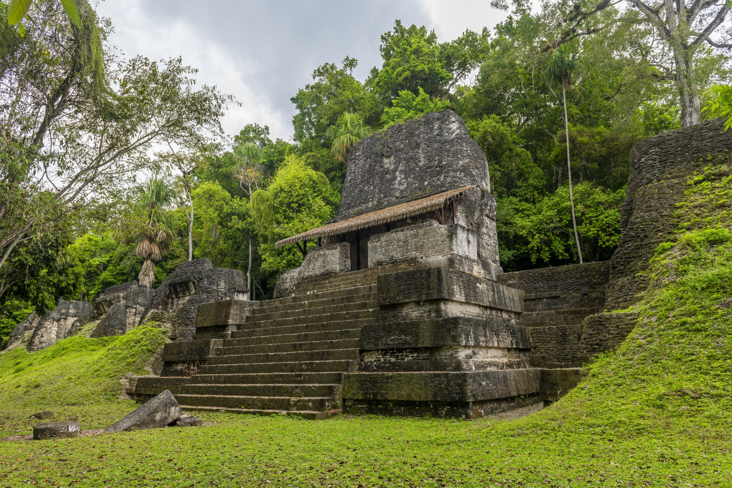
In many ways, the agrarian urbanism model achieved remarkable sustainability. The Maya managed to preserve some of the richest biodiversity in the tropics — a striking contrast to the centralized urbanism of semiarid settings, which relied heavily on a narrow set of domesticated species like wheat, barley, cattle and sheep. Yet their extensive water management systems proved vulnerable to climate instability. As seasonal weather patterns changed, they disrupted agriculture, eventually leading to urban abandonment. Populations dispersed to peripheral regions.
This pattern of dispersed dwelling would find its grandest expression in the jungles of Cambodia, where the Khmer capital city of Angkor was emerging as a radically different kind of metropolis. Recent lidar surveys reveal that at its peak in the twelfth century AD, Angkor sprawled over 350 square miles — dozens of times larger than Rome at its height. While both cities potentially housed nearly a million people, their patterns of dwelling could not have been more different.
The infrastructure of Angkor
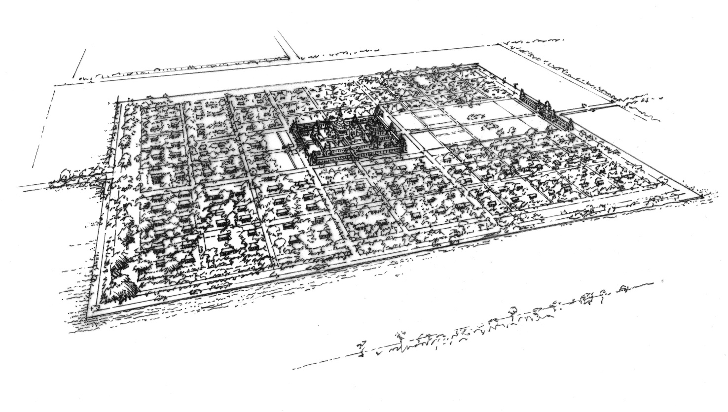
While many Romans lived in dense insulae, Angkor’s commoners lived in scattered homes made of thatch and wood. A Chinese observer noted, “They only use thatch for their roofs, and dare not put up a single tile. Although the sizes of their homes vary according to how wealthy they are, in the end they do not dare emulate the styles of the great houses.” Like Rome, Angkor exhibited social inequality — but because of its predominantly wooden construction, virtually no trace of common dwellings survives. Near the massive Tonle Sap Lake, which fluctuated dramatically with the seasons, houses floated or were built on stilts. Communities arranged themselves around communal ponds, while larger reservoirs collected monsoon waters.
Angkor’s elaborate water management system — a vast network of canals and reservoirs — enabled year-round cultivation. However, around 1350 AD, the transition to the Little Ice Age brought heightened climatic instability. Alternating droughts and intense monsoons overwhelmed Angkor’s finely tuned hydrology. The clearing of vast forestland for rice fields exacerbated the problem. During periods of intense rainfall, coarse river sand washed into the canals, causing siltation. During droughts, new emergency canals diverted water from the hills to the city. But when heavy rains returned, these same canals funneled destructive runoff, damaging their infrastructure.
The very complexity of Angkor’s engineered landscape — once its strength — became its Achilles’ heel. Meanwhile, additional challenges mounted, including political instability. The population fell below the minimum necessary to maintain its complex water management infrastructure. The great city was largely abandoned as people returned to villages, and the jungle reclaimed its domain. The once-mighty Khmer empire was reduced to a regional state.
The consistent fate of ancient low-density cities
Archaeologist Roland Fletcher has shown that Angkor’s fate was not unique. In The Limits of Settlement Growth, he demonstrates how preindustrial low-density cities reached critical thresholds as they expanded, shaping their development — and ultimate fate. Comparing Angkor, Tikal and Anuradhapura, Fletcher writes, “The critical thing is that there was absolutely no connection between these three low-density cities, and they were each on a terminal path.”
His research concluded that low-density agrarian urbanism “can create gigantism and [lead] to severe ecological collapse.” These sprawling civilizations proved less adaptable than compact cities like Rome. While the great low-density agrarian cities endured for perhaps a millennium, Rome’s concentrated form — though battered — survived.
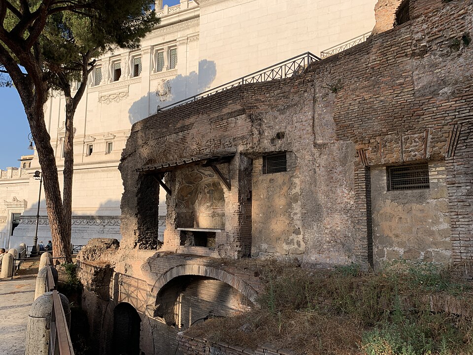
“The form our cities take is not neutral,” Fletcher concludes. It affects “our social capacity to adjust and survive.” Rome’s dense vertical housing posed public health challenges but ultimately proved more resilient than dispersed dwelling patterns. When populations declined, its more concentrated urban infrastructure could still function with fewer people. In contrast, the extensive systems of Angkor and the Maya required large populations to remain viable.
Angkor did not fail because it was spread out. It failed because spreading out had committed it to a quantity of infrastructure that only a large population, in a stable climate, could keep running. Density is not a virtue in and of itself — Rome's insulae were crowded, and their compactness facilitated the spread of disease. But a compact city can shrink and still work. A dispersed one has a floor beneath which its support system stops functioning.
Angkor’s similarities to today's exurbs
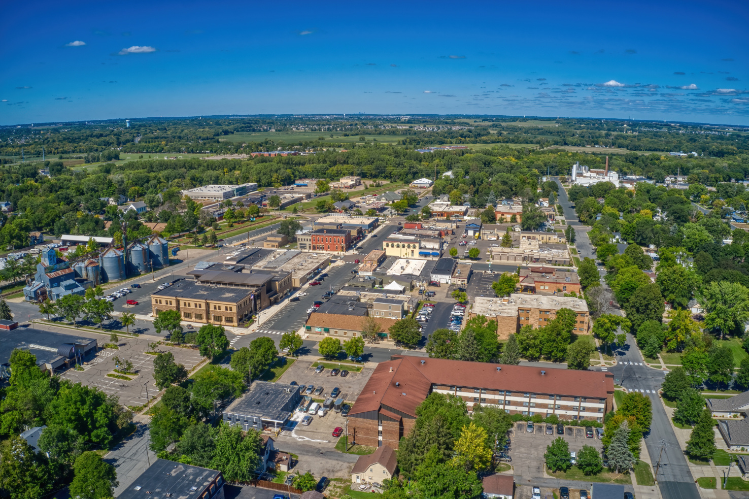
Angkor was not a modern exurb, and its canals were not asphalt highways. Its dispersed urbanism integrated agriculture, water and dwelling in ways that do not map neatly onto contemporary metropolitan regions. But still, there are striking similarities. Today’s sprawling exurbs depend on growing amounts of infrastructure that have to keep functioning across greater distances, regardless of what may happen to the climate or tax base. Every new exurban subdivision extends roads, water and sewer lines, power lines and emergency services further into areas that may be increasingly exposed to extreme heat, droughts, wildfires or flooding. Each extension adds to a maintenance obligation long after the growth that paid for it has moved on. So the question for a region's growth strategy is not simply compact versus dispersed. It is what the chosen form requires to maintain, and whether it can keep working when the climate or the availability of resources change.
The ancient choice between dense and dispersed urban living was not only a matter of lifestyle and exploiting resources. It was a decision that determined a city’s resilience to climate stress. As today’s megalopolises sprawl ever outward amid accelerating climate change, Angkor’s fate offers a sobering warning. How we dwell, and what we build to support that dwelling, will help determine whether our cities endure, or fall.
—
Adapted from Dwelling on Earth: The Past and Future of the Places We Call Home. Copyright © 2026 by Stefan Al. Illustrations © 2025 by David M. Dugas. Used with permission of the publisher, W. W. Norton & Company, Inc. All rights reserved.
Stefan Al, PhD, is an architect, urban planner, professor, and director of the Urban Planning program at Hunter College, CUNY. He is the author or editor of ten books on architecture, cities, and sustainability, and his work has been featured in the New York Times, Wall Street Journal, and NPR. This article is adapted from his latest book, Dwelling on Earth: The Past and Future of the Places We Call Home, winner of a Gold Medal in the Independent Publisher Book Awards and the recipient of a starred review from Library Journal.

First Model Homes Revealed in Disney-Built Community
Disney’s Cotino, in the Southern California desert, is the first of the company’s ‘Storybook Living’ developments.
The Changing Shape of American Suburbs
Housing costs and availability are pushing more American households, including young families, to suburbs and exurbs — and they’re demanding changes.
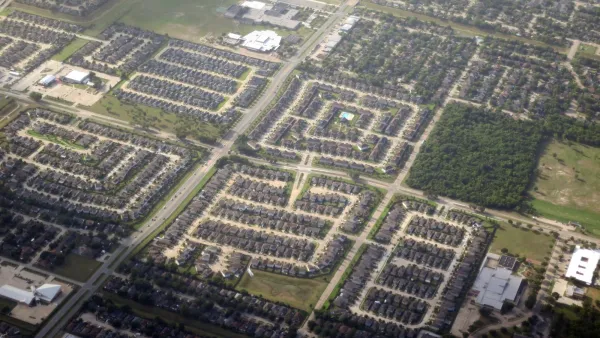
Houston Area's Center of Gravity Shifts Outside the Loop
The population center of Harris County is now outside central Houston, a shift that occurred over the last two decades as the region's suburbs blossomed.

Planetizen Federal Action Tracker
A weekly monitor of how Trump’s orders and actions are impacting planners and planning in America.

The state-sanctioned urbicide of Austin
People don’t kill cities. Freeways do.

Colorado’s Largest Data Center Could Rise Next to Homes — Without a Public Hearing
The proposed campus would consume 11 times the power of Denver International Airport; as it has across the country, opposition mounts.
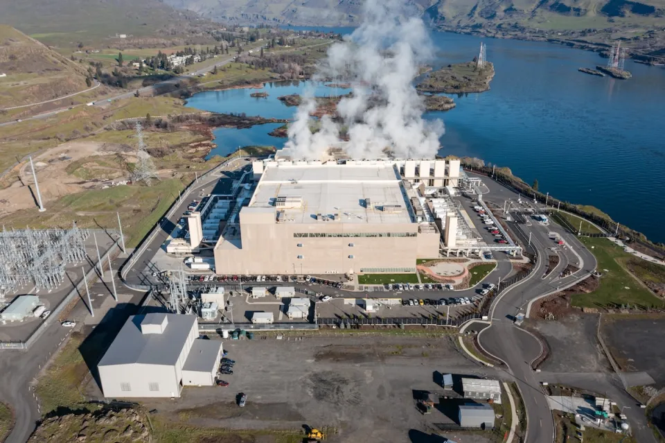
Data centers are consuming nearly 25% of Oregon’s power
The state has 111 data centers, with 32 more either planned or under construction.

A third of Texas cities must update their zoning codes to comply with new housing law
Texas municipalities are now required to allow manufactured housing in at least one residential zoning district.

Nation's most wind-powered state turns to coal as data centers increase energy demand
For the first time in decades, Iowa has increased its generation of coal power.

FREE Course: Walkable City 1: Why Walkability?
After describing his path towards focusing on walkability as the essence of good planning, Jeff Speck marches through his five principal reasons for making more walkable places.
Reinventing Malls: Planning Alchemy—Turning Gray Fields Into Gold
The course focuses on the opportunities and imperatives that shape reinvention of mall sites.

Greater Baltimore Committee
Eagle County Government
Harvard University Graduate School of Design
The Architects Foundation
University of Cincinnati Online
The Pocatello Development Authority
The Urban Renewal Agency of the City of Pocatello
Journal of the American Planning Association


#/media/File:Insula_Ara_Coeli_-_Rome_(IT62)_-_2021-08-27_-_2.jpg)