High-risk flood zones cover roughly 20% of the city’s land.


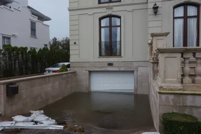
A study published in the Annals of the New York Academy of Sciences maps out New York City’s “Blue Zones,” areas that once held water and that are at risk of more severe flooding as sea levels rise.
As Samantha Maldonado explains in The City, the study reveals that Blue Zones cover about one-fifth of the city’s land in around 500 locations, putting about 1.2 million people at risk. Blue Zones include LaGuardia Airport and JFK Airport. “Lucinda Royte, lead author of the paper and manager of urban conservation, data tools and outreach at the New York Botanical Garden, said the Blue Zones indicate where it’s most pressing to address flood risks and increase resiliency.”
Almost two-thirds of the land area in Blue Zones is owned by government entities. “Many of the initiatives to make neighborhoods more resilient to flooding — including permanently moving people away from risks, adding storm drains and building rain gardens — are in the works, prompted by disastrous flooding after 2012’s Hurricane Sandy and 2021’s Hurricane Ida.”
FULL STORY: A Fifth of NYC Built on Bygone Water Now at Risk: Study Maps City’s ‘Blue Zones’

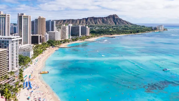
Rising Above: Innovative Solutions for Waikīkī’s Sea-Level Challenges
The University of Hawaiʻi at Mānoa’s award-winning Waikīkī sea-level rise adaptation project combines science, architecture, and community input to create scalable solutions for climate resilience and coastal flood mitigation.
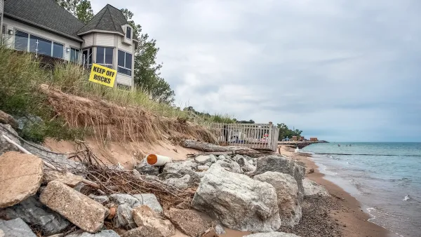
How US Cities Can Prepare for Climate Disasters
Resilience, encompassing infrastructure, governance, economic strength, and social cohesion, is critical for cities to mitigate rising climate risks like flooding, wildfires, and heat, ensuring long-term recovery and adaptability.

Battery Park Resilience Project Breaks Ground
By 2027, the shoreline will be elevated by 5 feet to prevent flooding from future storm surges.

The state-sanctioned urbicide of Austin
People don’t kill cities. Freeways do.

US to reduce Colorado River water deliveries to Mexico
A new Colorado Treaty amendment reduces Mexico’s Colorado River water allocation by 250,000 acre feet.

New Jersey’s second-largest city bans standalone data centers
Jersey City will continue to allow co-location facilities, such as those meant for research institutions that store their own data.

Amtrak not solely to blame for New Jersey commuter rail's unreliability, report finds
A new study from the Garden State Initiative found that NJ Transit’s budget grew 20% across a 4 year period, but reliability declined significantly over the same period.

EPA erases limits on planet-warming pollution from power plants
Under Monday’s plan, power plants would still have some limits on how much mercury, arsenic and other contaminants they can emit.

Phoenix announces new on-demand transit service, more frequent RAPID buses
Both new services will launch in October, and are part of Phoenix's Project Effective Access Solutions for Easing Congestion.

FREE Course: Walkable City 1: Why Walkability?
After describing his path towards focusing on walkability as the essence of good planning, Jeff Speck marches through his five principal reasons for making more walkable places.
Reinventing Malls: Planning Alchemy—Turning Gray Fields Into Gold
The course focuses on the opportunities and imperatives that shape reinvention of mall sites.

Eagle County Government
Harvard University Graduate School of Design
Nashville Planning Department
The Architects Foundation
University of Cincinnati Online
The Pocatello Development Authority
The Urban Renewal Agency of the City of Pocatello
Journal of the American Planning Association