Washington, D.C. officials are evaluating a redesign of Pennsylvania Avenue that would increase public seating and prioritize views of the Capitol.


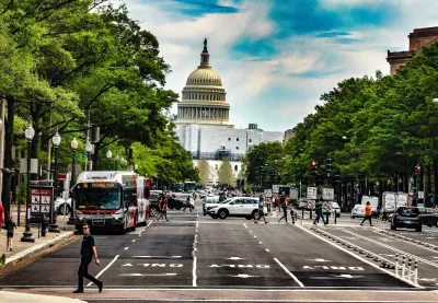
The National Capital Planning Commission is considering plans to redesign key portions of Pennsylvania Avenue near the U.S. Capitol and the White House, reports Winston Rogers for ABC 7 News. "Officials said the plan is an update to one initially created in 1974, which they said is outdated, adding that the original group responsible for oversight of the corridor was disbanded in the 1990s."
In a meeting, planners mentioned other famous boulevards such as the Champs-Élysées in Paris and The Mall in London, sites that are designed to accommodate massive events and parades. "Specifically, the plan targets efforts to redo spaces between the 300 and 500 blocks near the US Capitol and 1200-1400 blocks near the White House, alongside several crossroads in between."
The plan would reduce the number of car lanes and move bike lanes from the middle of the street to the sides on parts of the street, and as add more seating and shade trees along the sidewalks. "For the areas near the White House, proposals include plans to split Freedom Plaza into two parts or keep the plaza intact but lower it to street level so parades could pass through if needed."
Read the full story: America's Main Street' in DC could get a massive overhaul; here's what leaders propose


Planning for Love, Part 2: What happens to dating in a car-centric world?
A survey of over 150 adults about their dating lives reveals stark differences based on their neighborhood's walkability.

Where have all the public benches gone?
Public seating can be an indicator of broader trends in who gets to use public space — and how.
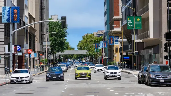
One-Way Streets Have Worse Crashes, Higher Crime and Lower Property Values — Why do we Still Use Them?
How reverting one-way streets to two-way can boost both safety and economic development.

Planetizen Federal Action Tracker
A weekly monitor of how Trump’s orders and actions are impacting planners and planning in America.

California plans to bury El Niño’s downpour
If the state plays its cards right, it may be able to store a billion acre-feet of El Niño’s water in aquifers.

Desperate measures: Advocates weigh draining Lake Powell to fill Colorado River
Draining the reservoir could reduce evaporation losses by a couple hundred thousand acre-feet.

California city breaks ground on transit connector
The project includes three mobility hubs and a pedestrian bridge.

After public outcry, Massachusetts city releases housing development tracker
Cambridge’s tracker currently shows 250 housing projects in various stages of development.

40 years after approval, Chicago breaks ground on new park
The park honors Jean Baptiste Point du Sable, the city’s first permanent non-native settler.

FREE Course: Walkable City 1: Why Walkability?
After describing his path towards focusing on walkability as the essence of good planning, Jeff Speck marches through his five principal reasons for making more walkable places.
Reinventing Malls: Planning Alchemy—Turning Gray Fields Into Gold
The course focuses on the opportunities and imperatives that shape reinvention of mall sites.

City of Rosemead
Rutgers University, Edward J. Bloustein School of Planning and Public Policy
One Hundred Miles
Hunter College, City University of New York (CUNY)
The Architects Foundation
University of Cincinnati Online
City of Cambridge
Montrose County
The Pocatello Development Authority