


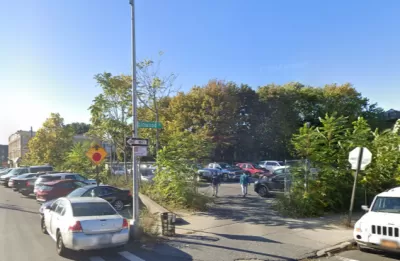
A new map reveals how much land in New York City is being wasted by city police—often sitting vacant, rather than serving the public good.
Land is a treasured asset in New York City; much of it has already been developed, and the few undeveloped lots are highly sought after. But the city’s various agencies also own vacant parcels in various states of use. Constructing housing on these lots would be far cheaper than acquiring land on the private market.
At least 145 of these lots are used by the New York City Police Department to park their vehicles, leading some organizers to ask: is parking more important than housing?
A new interactive map by the East New York Community Land Trust shows where NYPD-owned vacant lots and parking lots are across the city. It’s part of an ongoing campaign to get the NYPD and other city agencies to turn the lots—some empty, some filled with junk and derelict vehicles, and many used for NYPD members’ personal vehicles—over to local community land trusts.
The map, released as part of a new “digital blackpaper,” is intended to be a tool for local communities to find out where the NYPD is sitting on land that could theoretically be turned over for public use. “Part of the purpose of the digital map is to inspire organizing across the issue,” says Brianna Soleyn of East New York Community Land Trust.
The blight of abandoned lots has long been a point of grievance for residents of East New York, who have dealt with vacant lots since at least the 1970s, when the city was facing a fiscal crisis and some officials argued for reducing services in blighted neighborhoods.
Rolling over each NYPD icon on the map presents a pop-up that tells users what city agency currently operates the lot.
FULL STORY: New Yorkers Need Land. The NYPD Is Sitting On Nearly 150 Lots.

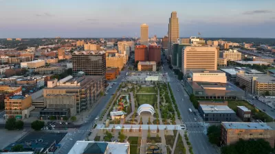
Omaha Program Promotes Infill Development
Budding developers can access funding and low-cost vacant lots for affordable housing construction.

Maryland Passes New Vacancy Tax Law
The law allows local jurisdictions to set tax rates for vacant lots and properties to discourage speculation and stimulate development.
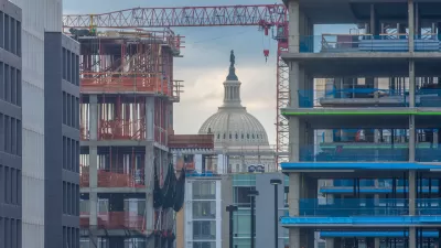
DC ‘Vacant to Vibrant’ Properties Remain Vacant
The city auctioned off 58 lots at low prices to stimulate housing development. Half are still vacant.

Maui's Vacation Rental Debate Turns Ugly
Verbal attacks, misinformation campaigns and fistfights plague a high-stakes debate to convert thousands of vacation rentals into long-term housing.

Planetizen Federal Action Tracker
A weekly monitor of how Trump’s orders and actions are impacting planners and planning in America.

Chicago’s Ghost Rails
Just beneath the surface of the modern city lie the remnants of its expansive early 20th-century streetcar system.

Bend, Oregon Zoning Reforms Prioritize Small-Scale Housing
The city altered its zoning code to allow multi-family housing and eliminated parking mandates citywide.

Amtrak Cutting Jobs, Funding to High-Speed Rail
The agency plans to cut 10 percent of its workforce and has confirmed it will not fund new high-speed rail projects.

LA Denies Basic Services to Unhoused Residents
The city has repeatedly failed to respond to requests for trash pickup at encampment sites, and eliminated a program that provided mobile showers and toilets.
Urban Design for Planners 1: Software Tools
This six-course series explores essential urban design concepts using open source software and equips planners with the tools they need to participate fully in the urban design process.
Planning for Universal Design
Learn the tools for implementing Universal Design in planning regulations.
planning NEXT
Appalachian Highlands Housing Partners
Mpact (founded as Rail~Volution)
City of Camden Redevelopment Agency
City of Astoria
City of Portland
City of Laramie