


The proposed model could be a new tool for preserving historic neighborhoods with more flexibility and with a focus on reducing displacement and addressing community concerns.
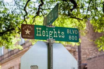
A new proposal to create “conservation districts” in Houston, where use-based zoning is subject to voter approval, could give property owners more flexibility in preserving historic buildings. Mike Snyder, writing in Urban Edge, describes the proposed designation.
According to Roman McAllen, the city’s historic preservation officer, existing historic districts “are located mostly in higher-income neighborhoods as a way of maintaining the status quo. We needed something that was more geared toward keeping at bay what neighbors might see as most egregious to their neighborhoods.”
The proposed conservation districts “could regulate a variety of elements including minimum lot size; lot width and depth; front, side and rear setbacks; building height; and architectural style.” As Snyder notes, “The recommendation also would make it possible to create a conservation district with a lower level of property owner support than the 67% required for a protected historic district,” making it easier to protect important landmarks on a case-by-case basis.
Pointing to an example from Houston’s Freedmen’s Town district, where structures and roads built by freed Black Americans in the 1800s still stand, McAllen says the proposed conservation district model “could protect many of the remaining structures from demolition while enabling appropriate infill development on vacant lots scattered throughout the neighborhood.”
FULL STORY: With conservation districts, Houston could have a new path to preserve neighborhoods


Philly Residents Push Back on New Historic Preservation District
Some residents of Philadelphia’s newly designated Washington Square West Historic District say the community was left out of the decision-making process that could impact housing costs and building requirements.

Houston Leaders Debate Merits of ‘Conservation Districts’ Proposal
A proposal by the city’s mayor would create a new type of preservation district designed to protect historic structures and slow gentrification.

How Cities Are Resisting State Efforts To Increase Density
Cities are attempting to wrest back local control over land use and zoning via some ingenious—and sometimes disingenuous—strategies.

Maui's Vacation Rental Debate Turns Ugly
Verbal attacks, misinformation campaigns and fistfights plague a high-stakes debate to convert thousands of vacation rentals into long-term housing.

Planetizen Federal Action Tracker
A weekly monitor of how Trump’s orders and actions are impacting planners and planning in America.

In Urban Planning, AI Prompting Could be the New Design Thinking
Creativity has long been key to great urban design. What if we see AI as our new creative partner?

King County Supportive Housing Program Offers Hope for Unhoused Residents
The county is taking a ‘Housing First’ approach that prioritizes getting people into housing, then offering wraparound supportive services.

Researchers Use AI to Get Clearer Picture of US Housing
Analysts are using artificial intelligence to supercharge their research by allowing them to comb through data faster. Though these AI tools can be error prone, they save time and housing researchers are optimistic about the future.

Making Shared Micromobility More Inclusive
Cities and shared mobility system operators can do more to include people with disabilities in planning and operations, per a new report.
Urban Design for Planners 1: Software Tools
This six-course series explores essential urban design concepts using open source software and equips planners with the tools they need to participate fully in the urban design process.
Planning for Universal Design
Learn the tools for implementing Universal Design in planning regulations.
planning NEXT
Appalachian Highlands Housing Partners
Mpact (founded as Rail~Volution)
City of Camden Redevelopment Agency
City of Astoria
City of Portland
City of Laramie