


The city of Westminster, Colorado has grown from 10,000 in 1962 to 113,000 in the present day, ensuring water supply for the growing population by considering water efficiency in every zoning decision.
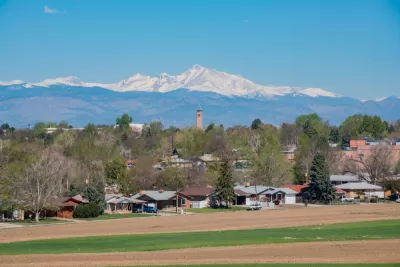
Jason Plautz reports on the sustainable development planning practices of the city of Westminster, Colorado, which weathered the controversies of a drought during the summer of 1962 (a sprinkler ban and poor tap water quality inspired a "Mothers' March" and attracted national news coverage) to become a regional leader in water demand management.
In the years that followed the drought, Westminster settled its supply issues, but "continued to focus on taming demand, most recently with a conservation and planning approach that’s become a regional model for managing growth without straining resources."
The key to this approach is a novel approach to land use planning that relies on water data to inform sustainable decision making.
That meant city planners could identify where it might make more sense to zone for multifamily housing, or see where new pipes might be necessary. Developers could amend their permits to include more low-flow toilets or water recycling. On rare occasions, proposals have been scrapped because they’d need more water than the city could supply. Essentially, Westminster is planning for the worst, making sure that another drought won’t force anyone to turn off the taps.
Stu Feinglas, Westminster’s recently retired senior water-resources analyst, serves as a source for soundbites and explanations of the Westminster water-focused planning approach throughout the article.
FULL STORY: The Town That Extended ‘Smart Growth’ to Its Water

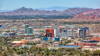
‘Tempe Tomorrow’ Plans for Expected Population Growth
Tempe planners are preparing a General Plan update scheduled for voter approval in March 2024.

Development Streamlining Proposal Dies in San Francisco
The doomed effort was Mayor London Breed's third attempt to streamline development in the city.
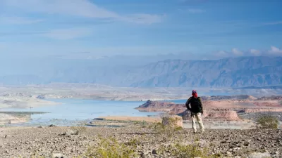
More Need Than Ever for Drought Resilience on the Colorado River
The effects of climate change are already cutting deeply into the lifeblood of the U.S. West—the Colorado River.

Maui's Vacation Rental Debate Turns Ugly
Verbal attacks, misinformation campaigns and fistfights plague a high-stakes debate to convert thousands of vacation rentals into long-term housing.

Planetizen Federal Action Tracker
A weekly monitor of how Trump’s orders and actions are impacting planners and planning in America.

Chicago’s Ghost Rails
Just beneath the surface of the modern city lie the remnants of its expansive early 20th-century streetcar system.

Bend, Oregon Zoning Reforms Prioritize Small-Scale Housing
The city altered its zoning code to allow multi-family housing and eliminated parking mandates citywide.

Amtrak Cutting Jobs, Funding to High-Speed Rail
The agency plans to cut 10 percent of its workforce and has confirmed it will not fund new high-speed rail projects.

LA Denies Basic Services to Unhoused Residents
The city has repeatedly failed to respond to requests for trash pickup at encampment sites, and eliminated a program that provided mobile showers and toilets.
Urban Design for Planners 1: Software Tools
This six-course series explores essential urban design concepts using open source software and equips planners with the tools they need to participate fully in the urban design process.
Planning for Universal Design
Learn the tools for implementing Universal Design in planning regulations.
planning NEXT
Appalachian Highlands Housing Partners
Mpact (founded as Rail~Volution)
City of Camden Redevelopment Agency
City of Astoria
City of Portland
City of Laramie