


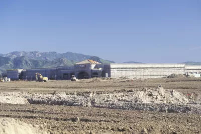
Development continues to encroach on agricultural land around the United States. A new study shows exactly how much agricultural land has been developed.
"American Farmland Trust, which since 1980 has been attempting to save agricultural land in the U.S., has compiled a huge assessment of the movement of farmland between 1992 and 2012," according to an article by Dan Nosowitz.
The "Farms Under Threat" report finds multiple causes for the decline of agricultural land, including the relatively low earnings associated with the agricultural industry and the value of the land, "especially if that farmland is near a city or town." A lack of available land for farmers is also creating an obstacle for new farmers, according to the National Young Farmers Coalition.
The article includes a list of some of the "scary" findings of the report. The headline reads that the United States lost 31 million acres of farmland to development, in total, between 1992 and 2012, which comes out to175 acres per hour, or 3 acres per minute.
FULL STORY: 10 Numbers That Show How Much Farmland We’re Losing to Development

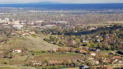
Different Approaches to Fast Growth in Idaho's Treasure Valley
Three cities on the periphery of the fast-growing Treasure Valley showcase different approaches to a sudden influx of newcomers.
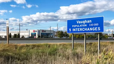
Council Votes to Allow Development on the York Region's Greenbelt
The York Regional Council took a significant step toward allowing development on a large chunk of the area's greenbelt—a move opponents say will set a dangerous precedent.
The Forgotten Treasure in Western Land
Will the arid West’s farms and settlements thrive for another century? Better conservation policy should take a longer view.

Maui's Vacation Rental Debate Turns Ugly
Verbal attacks, misinformation campaigns and fistfights plague a high-stakes debate to convert thousands of vacation rentals into long-term housing.

Planetizen Federal Action Tracker
A weekly monitor of how Trump’s orders and actions are impacting planners and planning in America.

Chicago’s Ghost Rails
Just beneath the surface of the modern city lie the remnants of its expansive early 20th-century streetcar system.

Bend, Oregon Zoning Reforms Prioritize Small-Scale Housing
The city altered its zoning code to allow multi-family housing and eliminated parking mandates citywide.

Amtrak Cutting Jobs, Funding to High-Speed Rail
The agency plans to cut 10 percent of its workforce and has confirmed it will not fund new high-speed rail projects.

LA Denies Basic Services to Unhoused Residents
The city has repeatedly failed to respond to requests for trash pickup at encampment sites, and eliminated a program that provided mobile showers and toilets.
Urban Design for Planners 1: Software Tools
This six-course series explores essential urban design concepts using open source software and equips planners with the tools they need to participate fully in the urban design process.
Planning for Universal Design
Learn the tools for implementing Universal Design in planning regulations.
planning NEXT
Appalachian Highlands Housing Partners
Mpact (founded as Rail~Volution)
City of Camden Redevelopment Agency
City of Astoria
City of Portland
City of Laramie