


The Federal Highway Administration may put an end to rules mandating wide lanes and "clear zones," making it easier to implement complete streets.
A set of "outdated" rules currently guides street construction, taking inspiration from what works on highways. "In what appears to be a major breakthrough, yesterday the Federal Highway Administration [FHWA] proposed rule changes that will allow cities and towns to more easily design streets in a way that's consistent with an urban setting," according to Angie Schmitt.
The existing rules are a source of delay and frustration when it comes to implementing safer complete street designs. "The FHWA may drop 11 of the 13 design requirements that currently apply to streets in the National Highway System designed for speeds below 50 miles per hour. In place of requirements that dictate things like street width and clear zones, FHWA is encouraging engineers to use judgment and consider the surroundings."
"If the proposed changes are approved, local governments would no longer have to deal with a ton of red tape any time their plans deviate from the highway-inspired standards. As it stands, exemptions are often required if planners want to plant street trees, for example, or reduce vehicular lane widths to fit in bike lanes."
FULL STORY: Feds Propose Major Rule Changes to Eliminate Barriers to Safer Streets

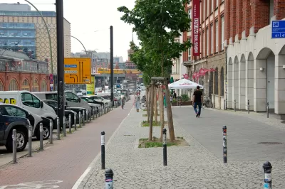
Federal Rule Changes Remove Obstacles to Multi-Modal Streets
The Federal Highway Administration (FHWA) made official a set of rule changes that overthrow an old way of thinking about street design.

Meet NYC’s New Office of Livable Streets
The NYC DOT program will build on pandemic-era initiatives to promote safe and comfortable streets that enhance community and expand uses beyond just moving cars.

Anchorage High-Speed Highway Project Met With Skepticism
The Alaska Department of Transportation and its consultants are working on a Planning and Environmental Linkages study of the Glenn-Seward Highway that bisects the middle of Anchorage, Alaska.

Depopulation Patterns Get Weird
A recent ranking of “declining” cities heavily features some of the most expensive cities in the country — including New York City and a half-dozen in the San Francisco Bay Area.

California Exodus: Population Drops Below 39 Million
Never mind the 40 million that demographers predicted the Golden State would reach by 2018. The state's population dipped below 39 million to 38.965 million last July, according to Census data released in March, the lowest since 2015.

Chicago to Turn High-Rise Offices into Housing
Four commercial buildings in the Chicago Loop have been approved for redevelopment into housing in a bid to revitalize the city’s downtown post-pandemic.

New Park Opens in the Santa Clarita Valley
The City of Santa Clarita just celebrated the grand opening of its 38th park, the 10.5-acre Skyline Ranch Park.

U.S. Supreme Court: California's Impact Fees May Violate Takings Clause
A California property owner took El Dorado County to state court after paying a traffic impact fee he felt was exorbitant. He lost in trial court, appellate court, and the California Supreme Court denied review. Then the U.S. Supreme Court acted.

How Urban Form Impacts Housing Affordability
The way we design cities affects housing costs differently than you might think.
City of Costa Mesa
Licking County
Barrett Planning Group LLC
HUD's Office of Policy Development and Research
Mpact Transit + Community
HUD's Office of Policy Development and Research
City of Universal City TX
ULI Northwest Arkansas
Town of Zionsville
Urban Design for Planners 1: Software Tools
This six-course series explores essential urban design concepts using open source software and equips planners with the tools they need to participate fully in the urban design process.
Planning for Universal Design
Learn the tools for implementing Universal Design in planning regulations.