Community and Regional Planning Associate Professor Zhenghong Tang received an Environmental Protection Agency (EPA) grant to explore the use of drones to monitor wetlands.


What would happen if the wetland wildlife along the Platte River just vanished? No more sandhill cranes, no more geese, no more pheasants, no more ducks, no more hunting, no more bird watching, no more millions of dollars in annual Nebraska tourism.
That is the worst case scenario however Nebraska wetlands have indeed suffered some major habitat losses in the past and wildlife management officials and others are working hard to prevent such occurrences from happening again. Joining that effort is Community and Regional Planning Associate Professor Zhenghong Tang from the College of Architecture at University of Nebraska who has made wildlife conservation one of his career focuses. Most recently the Environmental Protection Agency (EPA) funded a three-year project of Tang’s entitled “Innovative Technology for Playa Wetland Monitoring and Assessment” with Tang serving as principal investigator and Wayne Woldt, Associate Professor of Biological Systems Engineering and Environmental Engineer from the School of Natural Resources as co-principal investigator.
Using an Unmanned Aircraft System (UAS), Tang and Woldt along with a research assistant and an UAS technician plan to develop a methodology for conducting dynamic monitoring and precise assessment of playa wetland habitat conditions. Areas the team plans to focus on include: hydrological conditions, vegetation and energy levels and wildlife usage in the Nebraska Rainwater Basin. Surveying the public waterfowl production and wildlife management areas across the basin will take the team multiple field trips to complete the data collection during each spring and fall migratory seasons.
During the UAS or drone flights, the team will be using multispectral sensors for detection of soil moisture levels and mapping of wetland inundation during spring migration season; thermal imaging cameras and oblique photogrammetry for evaluation of wildlife use and its distribution on playa wetlands; and 3-D imagery for surveys of plant community conditions, estimations of energy availability and assessments of vegetation management effectiveness.
The use of UAS is a huge improvement over the traditional large, plane or ground surveying method’s commonly used. This method will provide improved imaging with greater resolution and detail in a cost-efficient, timely and flexible manner. The new surveying tools and applicable protocols will offer wetland managers a greater understanding of wetland spring inundation conditions. If this method is proven to be effective, the methodology can be replicated elsewhere. Having this information for wildlife managers will have a significant impact on conservation efforts.
“Conducting timely monitoring and accurate assessment is extremely important for wetland managers to implement appropriate conservation programs to increase the quantity and quality of wetlands,” commented Jeff Drahota, U.S. Fish and Wildlife Service Biologist with the Rainwater Basin Wetland Management District. “This Unmanned Aircraft System provides an advanced new tool to conduct more rapid, precise monitoring and assessment for playa wetlands.”
In the past, environmental disruptions such as reduction in water flow because of upstream diversions, sediment, invasive species, and poor water quality have contributed to major losses in playa habitat. By keeping a closer eye on the situation, wildlife managers will be able to identify threats before they negatively influence the wetlands or reach a point that will be very costly and time intensive to restore. With successful adoption of the proposed methodologies, this project has the potential to transform reactive wildlife management to a proactive and efficient system.
The data analyzed during the assessment stage will help close the information gap and help wildlife managers implement proven restoration practices, choose more effective treatments and create a better understanding of this delicate ecosystem throughout its annual cycle.
“It is important to test and verify the innovative UAS methodology in wetland monitoring and assessment,” added Tang. “This project is a great first step to an exciting new way to conserve our wetlands.”
Tang has successfully managed several playa wetlands research projects that integrated data from the field surveys, satellite images and fixed-wing airplanes. Since 2010, he has had wetland research projects funded by the U.S. Fish and Wildlife Service, the Great Plains Landscape Conservation Cooperative, the United States Department of Interior, the United States Department of Agriculture, and four projects funded by the Environmental Protection Agency. The research findings have been published in Wetlands journal, Journal of the American Water Resources Association and International Journal of Geo-Information.
FULL STORY: EPA Awards Grant To Monitor Wetlands Using Unmanned Aircraft System

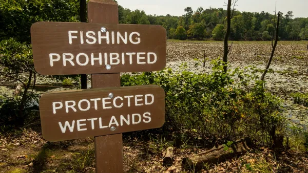
Proposed EPA Rule Change Would Exclude Millions of Acres of Wetlands and Waterways From Federal Protection
A proposed change to the Waters of the United States Rule would narrow the definition of protected waterways.
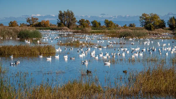
California Lawmakers Move to Protect Waterways
Anticipating that the Trump EPA will reinstate a 2017 policy that excluded seasonal wetlands and waterways from environmental protections.

States Scramble in Wake of Clean Water Act Ruling
The removal of federal oversight of wetlands has left millions of acres unregulated and erected major hurdles for lawmakers seeking to protect them.

Planetizen Federal Action Tracker
A weekly monitor of how Trump’s orders and actions are impacting planners and planning in America.

The state-sanctioned urbicide of Austin
People don’t kill cities. Freeways do.

US to reduce Colorado River water deliveries to Mexico
A new Colorado Treaty amendment reduces Mexico’s Colorado River water allocation by 250,000 acre feet.

Brightline West’s future may rely on $6 billion federal loan
The company has until Nov. 2 to make a $400 million equity investment into its proposed high-speed rail line.

LA Metro’s ultimatum: no extra buses for LA28 if federal funding isn’t imminently secured
If Metro does not provide additional buses, LA28 organizers will have to find a new way to manage Olympic traffic. LA28’s budget does not include a line item for transit.

Colorado’s Largest Data Center Could Rise Next to Homes — Without a Public Hearing
The proposed campus would consume 11 times the power of Denver International Airport; as it has across the country, opposition mounts.

FREE Course: Walkable City 1: Why Walkability?
After describing his path towards focusing on walkability as the essence of good planning, Jeff Speck marches through his five principal reasons for making more walkable places.
Reinventing Malls: Planning Alchemy—Turning Gray Fields Into Gold
The course focuses on the opportunities and imperatives that shape reinvention of mall sites.

Eagle County Government
Harvard University Graduate School of Design
Nashville Planning Department
The Architects Foundation
University of Cincinnati Online
The Pocatello Development Authority
The Urban Renewal Agency of the City of Pocatello
Journal of the American Planning Association