


Dr. William (Billy) Riggs guest blogs about his new research in Journal of Planning Education & Research. Dr. Riggs is Assistant Professor at Cal Poly San Luis Obispo focusing on quantitative community analysis and urban planning policies.


By guest blogger: William Riggs (Cal Poly - San Luis Obisbo).
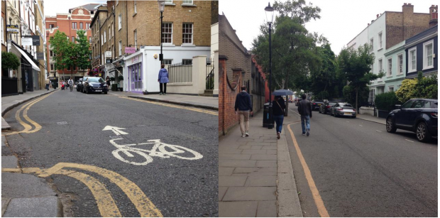
Americans appreciate walkable, bikeable, and transit accessible places enough to travel to see them in large cities like London, Paris, San Francisco, and New York. But for decades, U.S. planners and transportation engineers have been engineering-away these livable spaces and designing streets that do not accommodate walkers and cyclists. Consequently, the streets most Americans see every day are multi-lane, one way streets. However, small changes in this monotonous paradigm can lead to big improvements for pedestrians, which is why in my recent research, I explored the impact of converting one-way streets to two-way streets in the city of Louisville.
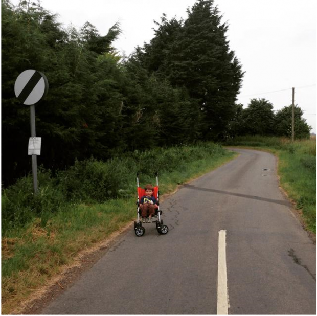
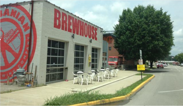
I have always been intrigued by one-way streets as opposed two-way configurations, because they always felt faster and less safe as both a cyclist and a driver. I hypothesized that drivers perceive adjacent travel lanes as a part of their own, encouraging them to drive faster on them as opposed to more narrow two-way streets (for example see my son in his stroller in the photo below on a two-way street that is approximately three meters wide in Lincolnshire, England). This is not to mention that in my hometown of Louisville, KY, multi-lane, one-way streets, which used to run in both directions, now have multiple lanes in one-way—cutting through some of the most diverse and historic neighborhoods in the city and creating unsafe conditions for its most vulnerable residents. But recently these streets have started to be converted back to their original configuration with dramatic improvements in traffic safety and roadway performance.
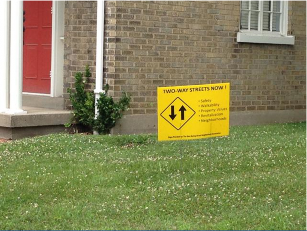
I explore this in my recently published work in the Journal of Planning Education and Research with Dr. John Gilderbloom from the University of Louisville. Just what are the impacts of one-way streets, and what happens when you start converting them back to two-way routes and including bike lanes? We focused on a case of recent street conversions in Louisville, KY, hypothesizing that these changes improve livability along these corridors. Evidence from streets that the city converted from multi-lane one way to two way streets seems to confirm this. On the converted streets, we observed reduced collisions (as much as 60 percent despite an increase in traffic volume), increased property values, decreased crime, and show improved business sentiment and neighborhood cohesion among residents. Pedestrians generally felt feel more comfortable and protected since cars traveled more slowly on two-way vs. one-way corridors.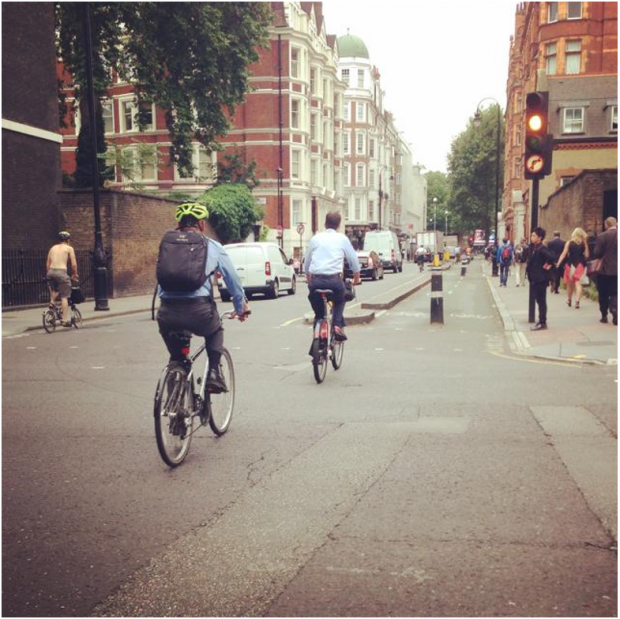
Both my co-author and I recognize that converting one-way streets to two-way is not a panacea, but this strategy should be an important part of the urban dialogue, both in the academy and in professional planning circles.
For many years the late Donald Appleyard and Allan Jacobs debated the virtue of one vs. two-way streets and their appropriate application. They drew on cases from Europe that were bold yet experimental. Both saw a role for each, and would have agreed that the physical of the street and how it related to livability should be an important part of our dialogue—not just traffic volume nor bicycle and pedestrian improvements. Narrow streets, naked streets, and bicycle super-highways would have never been possible without this.
Despite the resurgence of interest in complete streets, Appleyard and Jacobs are no longer given much attention. This is despite evidence that multifunctional two-way streets add economic value, reduce crime, increase property values, and foster social cohesion. American cities still use vehicular level of service standards that make multimodal accommodations difficult, and still have parking standards that are unreasonably high. Both of these standards discourage two way streets and pedestrian activity. If the planning community really wants bicycles and pedestrians on the street, then perhaps the street should be designed to accommodate, or even prioritize space for them.
And therein lies the key lesson—street design and configuration should be more of a central part of the urban regeneration and livability dialogue in the United States. It needs to be a greater part of the academic dialogue like it was in the debates of Appleyard and Jacobs. Street design needs to be a part of professional master planning, economic development, and regeneration efforts. And with these dialogues we can take the bold steps necessary to reshape the arteries feeding the heart of American cities, injecting life into them and creating more vibrant corridors for all travelers.
Follow JPER on Twitter (@JPER7) and Facebook (www.facebook.com/JPERPlanning).

How Streets and Social Justice Intersect
A look at how streets affect health, social interaction, and economic development by Marissa Reilly, a Berkeley-based urban planner and Lillian Jacobson, a master’s candidate at MIT.

What Street Grids Reveal About a City
Author and blogger David Prowler takes a lighthearted and pictorial look at what the layout of a town's streets unveils about a city's history and aspirations.
Louisville Wrestles With Freeway Dilemma
Critic Michael Kimmelman, fresh back from Louisville's Idea Festival, questions why that quickly emerging city wants to double down on a new freeway expansion through its downtown while other progressive cities are tearing theirs down.

Planetizen Federal Action Tracker
A weekly monitor of how Trump’s orders and actions are impacting planners and planning in America.

Chicago’s Ghost Rails
Just beneath the surface of the modern city lie the remnants of its expansive early 20th-century streetcar system.

Amtrak Cutting Jobs, Funding to High-Speed Rail
The agency plans to cut 10 percent of its workforce and has confirmed it will not fund new high-speed rail projects.

Ohio Forces Data Centers to Prepay for Power
Utilities are calling on states to hold data center operators responsible for new energy demands to prevent leaving consumers on the hook for their bills.

MARTA CEO Steps Down Amid Citizenship Concerns
MARTA’s board announced Thursday that its chief, who is from Canada, is resigning due to questions about his immigration status.

Silicon Valley ‘Bike Superhighway’ Awarded $14M State Grant
A Caltrans grant brings the 10-mile Central Bikeway project connecting Santa Clara and East San Jose closer to fruition.
Urban Design for Planners 1: Software Tools
This six-course series explores essential urban design concepts using open source software and equips planners with the tools they need to participate fully in the urban design process.
Planning for Universal Design
Learn the tools for implementing Universal Design in planning regulations.
Caltrans
City of Fort Worth
Mpact (founded as Rail~Volution)
City of Camden Redevelopment Agency
City of Astoria
City of Portland
City of Laramie