


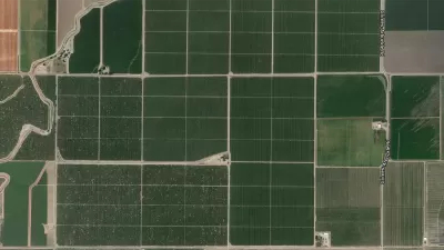
Did you know that sweet potatoes are only produced in a small area of North Carolina? Or that flaxseed is only grown in the country's remote northern reaches? Crop maps published by the USDA paint an interesting picture of American agriculture.

"After being astonished by the relatively high cost of corn in Kansas City (for the region is known more for its winter wheat), I began to explore the geography of different crops. And I stumbled across this amazing set of county-by-county crop maps put out by the United States Department of Agriculture," writes Samuel Arbesman.
The maps offer a revealing look into the geography of American agriculture. "For example, while cotton is associated with the South, it’s grown as far away as Arizona and California as well," he notes. "And guess where rice is produced? Pretty much just Arkansas, California, and Louisiana."
FULL STORY: The Geography of American Agriculture


Land Use the Subject of Latest IPCC Report
Not urban land use, but in the literal sense: land used to produce food, graze livestock, supply drinking water, grow trees, and sequester carbon. As the climate warms and the population grows, crop yields will decrease and land will be degraded.
Study: Agriculture's Carbon Output Higher Than Previously Thought
Over the span of history, agricultural uses have released nearly as much carbon into the atmosphere as actual deforestation. New problem areas are still appearing in places like Brazil.
Mapping the U.S. 'Turkey Belt'
Don't worry; we're not mentioning belts to make you feel too guilty to enjoy today's meal.

Maui's Vacation Rental Debate Turns Ugly
Verbal attacks, misinformation campaigns and fistfights plague a high-stakes debate to convert thousands of vacation rentals into long-term housing.

Planetizen Federal Action Tracker
A weekly monitor of how Trump’s orders and actions are impacting planners and planning in America.

Chicago’s Ghost Rails
Just beneath the surface of the modern city lie the remnants of its expansive early 20th-century streetcar system.

Bend, Oregon Zoning Reforms Prioritize Small-Scale Housing
The city altered its zoning code to allow multi-family housing and eliminated parking mandates citywide.

Amtrak Cutting Jobs, Funding to High-Speed Rail
The agency plans to cut 10 percent of its workforce and has confirmed it will not fund new high-speed rail projects.

LA Denies Basic Services to Unhoused Residents
The city has repeatedly failed to respond to requests for trash pickup at encampment sites, and eliminated a program that provided mobile showers and toilets.
Urban Design for Planners 1: Software Tools
This six-course series explores essential urban design concepts using open source software and equips planners with the tools they need to participate fully in the urban design process.
Planning for Universal Design
Learn the tools for implementing Universal Design in planning regulations.
planning NEXT
Appalachian Highlands Housing Partners
Mpact (founded as Rail~Volution)
City of Camden Redevelopment Agency
City of Astoria
City of Portland
City of Laramie