


This post from Richard Florida looks at the geography of obesity in America, and relates state obesity rates to the rates of death from various diseases.
"Obesity has reached epidemic proportions in America. More than 72 million American adults are obese, according to estimates from the National Center for Health Statistics. But obesity varies greatly by state.
...As usual, we point out that correlation does not imply causality, but simply points to associations between variables. Still, a number of interesting things stand out.
It should come as little surprise that states with higher levels of obesity have significantly higher rates of death from cancer, heart disease, and cerebrovascular diseases like hypertension. There is a significant correlation between obesity and death rates from cancer (.7), heart disease (.7), and cerebrovascular disease (.7)."
FULL STORY: The Geography of Obesity

The Shifting Demographics of Covid-19
For most of the Covid-19 pandemic, Black Americans died at much higher rates than White Americans. That trend has reversed at times during the past year.

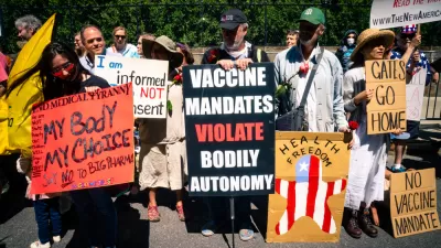
COVID-19, AIDS, and CDC Guidance
Music critic Joel Rozen pens a unique perspective for Slate's "Coronavirus Diaries" on the Provincetown, Massachusetts cluster that prompted the CDC on July 27 to reverse its masking guidance for the fully vaccinated issued a month earlier.

Coronavirus Declared a Pandemic. What Does That Mean?
The director-general of the World Health Organization announced on Wednesday that the COVID-19 viral disease that has killed more than 4,000 people, infected nearly 120,00 people and is present in 114 nations is a pandemic.

Maui's Vacation Rental Debate Turns Ugly
Verbal attacks, misinformation campaigns and fistfights plague a high-stakes debate to convert thousands of vacation rentals into long-term housing.

Planetizen Federal Action Tracker
A weekly monitor of how Trump’s orders and actions are impacting planners and planning in America.

Chicago’s Ghost Rails
Just beneath the surface of the modern city lie the remnants of its expansive early 20th-century streetcar system.

Bend, Oregon Zoning Reforms Prioritize Small-Scale Housing
The city altered its zoning code to allow multi-family housing and eliminated parking mandates citywide.

Amtrak Cutting Jobs, Funding to High-Speed Rail
The agency plans to cut 10 percent of its workforce and has confirmed it will not fund new high-speed rail projects.

LA Denies Basic Services to Unhoused Residents
The city has repeatedly failed to respond to requests for trash pickup at encampment sites, and eliminated a program that provided mobile showers and toilets.
Urban Design for Planners 1: Software Tools
This six-course series explores essential urban design concepts using open source software and equips planners with the tools they need to participate fully in the urban design process.
Planning for Universal Design
Learn the tools for implementing Universal Design in planning regulations.
planning NEXT
Appalachian Highlands Housing Partners
Mpact (founded as Rail~Volution)
City of Camden Redevelopment Agency
City of Astoria
City of Portland
City of Laramie