


San Francisco planners unveiled a rezoning proposal that would permit new skyscrapers around the new Transbay terminal, shifting downtown southward around a planned 1,000 foot tower -- which would be the tallest on the West Coast.
"A cluster of skyscrapers rivaling the Transamerica Pyramid would rise around the West Coast's tallest tower under an ambitious proposal that would shift the heart of San Francisco's downtown south of Market Street.
The city's zoning plan, unveiled Wednesday at a packed public meeting, would allow as many as seven new skyscrapers to surpass the current 550-foot height limits in an area surrounding the planned Transbay tower - a high-rise of roughly 1,000 feet adjacent to a new Transbay Terminal at First and Mission streets.
The Board of Supervisors and Planning Commission would have to approve the zoning proposal, which is likely to be revised in response to public comments. A thorough environmental report is also required.
But planners argue that the taller skyscrapers would create a more dynamic skyline and are needed to meet the city's projected demand for office space. A bonus, they say, is that tax revenue from the new buildings would help pay for part of the multibillion-dollar transit hub intended to serve bus passengers from around the Bay Area and rail commuters from the Peninsula and farther south.
"There is a renewed interest in heights given the constraints on the environment and a move toward transit-oriented development," said Dean Macris, a development adviser to Mayor Gavin Newsom and former city planning director who oversaw much of the proposed rezoning. "But these changes are fully justified even if there was no transit center, given the growth projections for San Francisco over the next 25 years." "
FULL STORY: Transbay plan would sprout new S.F. skyline


Tallest Building in US Proposed for OKC
The building would stand 1,907 feet high, twice as tall as any other building in the Oklahoma City skyline.
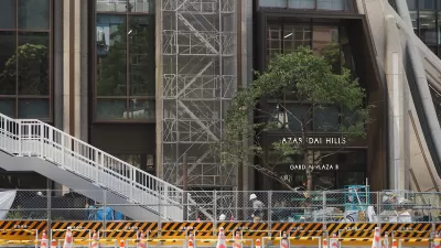
A New Tallest Skyscraper for Japan
The Toranomon-Azabudai reaches 330 meters into the sky, far lower than international standards but taller by 30 meters than the previous tallest building in Japan.

Paris Reinstates Historic Height Limits as Part of its New Bioclimatic Local Urban Plan
Paris’ reinstated height limits, lowering height limits allowed in 2010, are part of Mayor Anne Hidalgo’s recently released Bioclimatic Local Urban Plan.

Maui's Vacation Rental Debate Turns Ugly
Verbal attacks, misinformation campaigns and fistfights plague a high-stakes debate to convert thousands of vacation rentals into long-term housing.

Planetizen Federal Action Tracker
A weekly monitor of how Trump’s orders and actions are impacting planners and planning in America.

Chicago’s Ghost Rails
Just beneath the surface of the modern city lie the remnants of its expansive early 20th-century streetcar system.

Bend, Oregon Zoning Reforms Prioritize Small-Scale Housing
The city altered its zoning code to allow multi-family housing and eliminated parking mandates citywide.

Amtrak Cutting Jobs, Funding to High-Speed Rail
The agency plans to cut 10 percent of its workforce and has confirmed it will not fund new high-speed rail projects.

LA Denies Basic Services to Unhoused Residents
The city has repeatedly failed to respond to requests for trash pickup at encampment sites, and eliminated a program that provided mobile showers and toilets.
Urban Design for Planners 1: Software Tools
This six-course series explores essential urban design concepts using open source software and equips planners with the tools they need to participate fully in the urban design process.
Planning for Universal Design
Learn the tools for implementing Universal Design in planning regulations.
planning NEXT
Appalachian Highlands Housing Partners
Mpact (founded as Rail~Volution)
City of Camden Redevelopment Agency
City of Astoria
City of Portland
City of Laramie