It is now about 22 months since hurricanes Katrina and Rita devastated New Orleans and the Gulf Coast region. I was recently in New Orleans for the first time and had plenty to see. The city is still very much in a state of devastation. But there has also been a lot of progress.In this post, I'd like to share some pictures I took when I was there and some facts and figures I've come across that help illustrate the current situation in the city.
It is now about 22 months since hurricanes Katrina and Rita devastated New Orleans and the Gulf Coast region. I was recently in New Orleans for the first time and had plenty to see. The city is still very much in a state of devastation. But there has also been a lot of progress.
In this post, I'd like to share some pictures I took when I was there and some facts and figures I've come across that help illustrate the current situation in the city.
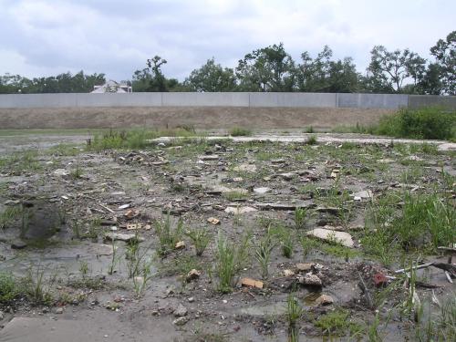
Many of the people who left New Orleans after the storm still haven't returned. According to the U.S. Census Bureau, the pre-Katrina (Census 2000) population of Orleans Parish was 484,674. The Census bureau estimates that the population was 452,170 in July 2005, and by July 2006 was less than half at 223,388.
No more current data exists, but residential postal delivery totals have been used as a substitute data point. Using the US Postal Service's records, the amount of people receiving mail can be compared back against data from July 2005. In March 2007, residential delivery was at 81.9% of pre-Katrina levels. In August 2006, delivery levels were only 49.5% of the levels one year earlier.
This population data was published in a report from the Greater New Orleans Community Data Center. Released on May 17, 2007, "The Katrina Index" was produced in association with the Brookings Institution Metropolitan Policy Program and compiles various data about the city's recovery including general demographics, housing, economic development and more. Much of the data in this post is from this report.
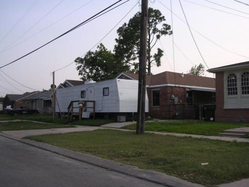
As of April 3, 2007, 4.525 mobile homes and 51,173 travel trailers are occupied in Louisiana, according to the Federal Emergency Management Agency.
FEMA also reports that of the $4.6 billion available to the state of Louisiana, it has paid out more than $3 billion as of June 1, 2007. Of that amount, $1.21 billion was paid out to Orleans Parish.
More than $5.52 billion in benefits have been calculated as part of the US Department of Housing and Urban Development's Road Home Program. As of June 6, 2007, the program has received 142,925 applications for benefits. Benefits for 85,495 of those applications have been calculated, at an average of $74,744 per beneficiary.
FEMA is also a provider of financial assistance to those affected by the storm. As of April 3, 2007, FEMA reports 948,992 households have been approved for assistance since the storm. An additional 682,413 have been approved for rental assistance. I didn't find the amount of those households that have actually received their assistance.
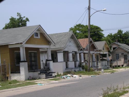
A row of flooded houses that have now been abandoned.
Regarding rebuilding in the city, the amount of building permits granted in the city has shown a sharp rise over the past year-and-a-half, according to the Katrina Index. In October 2005, 300 building permits were issued by New Orleans City Hall. There were 1,840 the next month. By December, that number had risen to 4,800. In January 2006 more than 12,000 building permits were issued. In April 2007, the last month reported, the city granted 58,270 building permits. The city had issued more than 50,000 permits per month since October 2006.
And as rebuilding continues, the amount of home sales has shown signs of recovery. The Katrina Index reports that the amount of single-family homes sold in the New Orleans Metropolitan Statistical Area has rebounded to pre-Katrina levels, with 941 sold in March 2007. This compares closely with 963 in September 2004, and 925 in August 2005.
Currently there are more than 14,000 residential properties for sale in the New Orleans MSA, according to the Katrina Index. This number has mainly risen since collection of this data began in October 2005, when 8,914 properties were on the market.
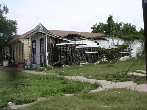
The common sight of a devastated house.
The Louisiana Recovery Authority's February 2007 quarterly report says that more than 30,000 buildings still need to be demolished.
The New Orleans Department of Public Works reports that so far in 2007:
- 32,278 potholes have been repaired
- 4,773 storm drains have been cleaned
- 7,195 street lights have been repaired
- and more than 1 million feet of drain lines have been cleaned
The Louisiana Recovery Authority's report says that more than 50 million cubic yards of debris have been removed from curbs, yards and roads. The report estimates that debris cleanup is about 78 percent done.
According to the Katrina Index report, the labor force in Orleans Parish was 157,826 people in march 2007, a little less than the August 2005 total of 204,476.
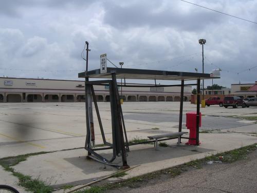
The skeleton of a bus stop near an abandoned shopping center.
The Katrina Index also published figures on the city's public transit, which has seen s sharp decline since before the storm. Pre-Katrina, there were 62 bus routes, 368 buses in the fleet, and a daily average of 124,000 riders. During the week of May 6, 2007, the city had 29 bus routes in operation, 61 buses in the fleet, and a daily average of 18,147 riders. This is operational equivalent of 47% of pre-Katrina service levels.
Another indicator of population is school operation and enrollment. Of the 128 public or charter schools open in Orleans Parish before the storm, only 58 were open in May 2007, according to the Greater New Orleans Community Data Center. School enrollment is still less than half of what it was pre-Katrina. Enrollment in February 2007 was 26,165, compared to 66,372 in October 2004. Only 6,242 students were enrolled in January 2006.
The data go on and on. And though numbers like these could never accurately portray the complete recovery situation in New Orleans, they do provide points of reference that help build a more faceted image of the city.
And for those interested in following the trends in the city, the next monthly edition of the Katrina Index is scheduled for release sometime in the middle of June.

Planetizen Federal Action Tracker
A weekly monitor of how Trump’s orders and actions are impacting planners and planning in America.

Chicago’s Ghost Rails
Just beneath the surface of the modern city lie the remnants of its expansive early 20th-century streetcar system.

Amtrak Cutting Jobs, Funding to High-Speed Rail
The agency plans to cut 10 percent of its workforce and has confirmed it will not fund new high-speed rail projects.

Ohio Forces Data Centers to Prepay for Power
Utilities are calling on states to hold data center operators responsible for new energy demands to prevent leaving consumers on the hook for their bills.

MARTA CEO Steps Down Amid Citizenship Concerns
MARTA’s board announced Thursday that its chief, who is from Canada, is resigning due to questions about his immigration status.

Silicon Valley ‘Bike Superhighway’ Awarded $14M State Grant
A Caltrans grant brings the 10-mile Central Bikeway project connecting Santa Clara and East San Jose closer to fruition.
Urban Design for Planners 1: Software Tools
This six-course series explores essential urban design concepts using open source software and equips planners with the tools they need to participate fully in the urban design process.
Planning for Universal Design
Learn the tools for implementing Universal Design in planning regulations.
Caltrans
City of Fort Worth
Mpact (founded as Rail~Volution)
City of Camden Redevelopment Agency
City of Astoria
City of Portland
City of Laramie


