Georgia Tech’s latest urban canopy assessment for Atlanta uses high-resolution mapping and a Potential Planting Index to guide data-driven tree preservation.


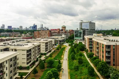
Georgia Tech’s Center for Urban Resilience and Analytics (CURA) has released a high-resolution canopy assessment for the City of Atlanta, continuing more than 15 years of work to track and understand the city’s urban forest. Led by Anthony Giarrusso and funded by the city’s Tree Recompense Fund, the study uses advanced tools such as WorldView-2 satellite imagery, field validation, and a random forest classification model to categorize land into tree canopy, non-tree vegetation, and non-vegetation. The research aims to provide neutral, science-based data that equips policymakers, planners, and community leaders to make informed decisions about urban growth, conservation, and climate resilience.
Beyond mapping existing canopy, the Georgia Tech team developed a Potential Planting Index (PPI) to identify locations where tree planting is physically possible. The study also warns of misleading “loss-gain-loss” canopy cycles, in which temporary regrowth occurs on cleared land—often stalled development sites—only for the vegetation to be cleared again later. Giarrusso stresses that without understanding land use patterns, short-term canopy gains can create a false sense of progress, especially when the regrowth is low-quality and lacks permanence.
The city is incorporating these tools into zoning reform and updates to its tree ordinance, including recommendations to limit full lot clearing in certain zones and adjust setback and lot coverage requirements to protect existing trees. Giarrusso emphasizes the importance of prioritizing intact, high-quality forest tracts, warning that once they are cleared, they are rarely restored to their original ecological value. “If you can see it from space and it’s still forest — save it,” he said.
FULL STORY: Mapping Georgia’s Urban Forest: Georgia Tech Tools Help Planners Prioritize Tree Canopy


How Data is Helping Protect Campus Trees
The University of Alabama at Birmingham is using GIS technology, student engagement, and sustainability-driven planning to manage and protect its nationally recognized urban forest.

LA County Releases Draft Community Forest Management Plan
LA County's Chief Sustainability Office just released the discussion draft of Room to Grow, the first Community Forest Management Plan for the county.

The Problem with Tree Planting Programs
Ambitious campaigns to plant trees in urban areas often don't take into account the complexities of growing and maintaining effective urban forests.

The state-sanctioned urbicide of Austin
People don’t kill cities. Freeways do.

US to reduce Colorado River water deliveries to Mexico
A new Colorado Treaty amendment reduces Mexico’s Colorado River water allocation by 250,000 acre feet.

New Jersey’s second-largest city bans standalone data centers
Jersey City will continue to allow co-location facilities, such as those meant for research institutions that store their own data.

Amtrak not solely to blame for New Jersey commuter rail's unreliability, report finds
A new study from the Garden State Initiative found that NJ Transit’s budget grew 20% across a 4 year period, but reliability declined significantly over the same period.

EPA erases limits on planet-warming pollution from power plants
Under Monday’s plan, power plants would still have some limits on how much mercury, arsenic and other contaminants they can emit.

Phoenix announces new on-demand transit service, more frequent RAPID buses
Both new services will launch in October, and are part of Phoenix's Project Effective Access Solutions for Easing Congestion.

FREE Course: Walkable City 1: Why Walkability?
After describing his path towards focusing on walkability as the essence of good planning, Jeff Speck marches through his five principal reasons for making more walkable places.
Reinventing Malls: Planning Alchemy—Turning Gray Fields Into Gold
The course focuses on the opportunities and imperatives that shape reinvention of mall sites.

Eagle County Government
Harvard University Graduate School of Design
Nashville Planning Department
The Architects Foundation
University of Cincinnati Online
The Pocatello Development Authority
The Urban Renewal Agency of the City of Pocatello
Journal of the American Planning Association