Planners often focus on walkability and bicycle-friendly cities, which is great to promote active transport. But how do we design a "runnable" city as well?


This article is republished from The Conversation under a Creative Commons license. Read the original article.
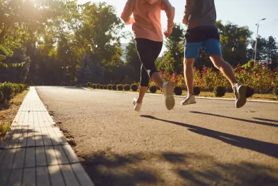
If you’ve ever run a big marathon in your city, you’ll know the feeling can be electric. Blocked off streets, cars temporarily banished from the road and a sense of enormous freedom as you run.
For most runners, however, running through cities on an ordinary day is not always pleasant. Planners often focus on walkability and bicycle-friendly cities, which is great to promote active transport. But we don’t generally plan cities to be good for runners.
Yet, millions of us are runners; it’s one of the world’s most practiced sports and more of us are joining run clubs.
Making our cities “runnable” could inspire even more people to take up running. So, what makes a city runnable?
Urban design and ‘runnability’
It was at conference of the International Society of City Planners in Jakarta in 2019 that a group of us — all planners who love running — began to seriously consider city planning with a focus on runnability. We even held a “run-shop” (instead of a workshop) where we ran together to explore the city.
For the past five years our group has been reflecting the runnability of cities. We realized factors such as safety, air quality, accessibility, and infrastructure play a significant role.
Our recent paper published in the Journal of Urban Design and Planning explored the key urban design elements that make a city runnable.
Among other things, runnable cities prioritize:
- accessibility
- uninterrupted movement for runners (avoiding stops, crossroads and railways)
- safety
- aesthetic appeal and
- well-maintained green infrastructure, such as parks, urban forests, and trees (which also improve air quality and reduce urban heat).
So, how can planners build these elements into urban design?
Urban design principles that promote runnability
Several urban design principles can enhance the runnability of a city:
Connectivity and accessibility: This means developing a network of interconnected running paths and trails that are easily accessed from various parts of the city (especially neighborhoods). Even better if can be green corridors that connect to other parks and open spaces, and support continuous movement.
Safety and security: Ensuring running paths are well-lit and separated from vehicle traffic is crucial. Traffic calming measures such as vehicle lane narrowing, wider footpaths, and appropriate landscaping enhance runner safety. Street trees also help reduce car speeds, as they alter our perception of how wide the road is and provide a psychological cue that we’re in a residential area. Redesigning urban infrastructure to include dedicated running paths alongside walking paths and bicycle lanes, is a great idea.
Inclusive design: City design should encourage active mobility, which means including benches, water fountains, and restrooms along running routes. It means building footpaths that enables running, and avoiding uneven, slippery or unfavorable surfaces such as cobblestones. It also means making it easy to find your way around — even in unfamiliar environments.
What makes a city unpleasant for running?
Narrow pavements, sharp corners, noise (including traffic noise) and areas with many traffic lights are some of the big concerns for city runners.
Other factors that make a city less “runnable” include:
- high pollution levels
- inadequate infrastructure, such as potholes and broken or non-existent paths
- poor lighting
- unsafe traffic environments
- unleashed dogs
- encounters with cars and cyclists
- urban heat (which is exacerbated by too much concrete and not enough greenery).
Around 75 percent of athletes on the exercise app Strava indicated extreme heat affected their exercise plans in 2023. Given the pace at which the climate is changing, factoring urban heat into city design will grow ever more crucial.
We don’t want our cities to become so hot that going for a run feels impossible.
Does it matter what trees are planted alongside the paths?
Street trees offer benefits to pedestrians and runners.
However, they also bring challenges. Tree roots can buckle sidewalks, fallen leaves or fruits can make paths slippery, and trees can sometimes block the view of nearby traffic.
The type of trees planted along running paths are therefore crucial. Native trees are often the best choice, as they are well adapted to the local climate and require less maintenance. They provide shade, improve air quality, and support local biodiversity.
Trees with high canopies and low root invasiveness offer shade without obstructing the paths or damaging the pavement.
Where are the great runnable cities of the world?
Several cities around the world have been recognized for their runnability. For instance, Copenhagen has an extensive network of running paths and green spaces, along with a strong emphasis on safety and inclusivity.
Cities such as Portland, Vancouver and Amsterdam have also made significant strides in promoting runnability.
And according to the app, Runkeeper, Sydney is a top contender due to its harbor, gardens, coastal paths and parks. Auckland in New Zealand also made the list, celebrated for its harbors, great paths, and runs you can take “just outside the city for trails through seemingly enchanted forests”.
The challenge for urban planners and governments is to extend this urban running experience to cities, and neighborhoods, all over the world. If we want to create healthier and more inclusive environments, runnable cities might be the answer.
Jua Cilliers, Head of School of Built Environment, Professor of Urban Planning, University of Technology Sydney

Children in 55 countries are redesigning their cities in Minecraft
A U.N.-backed program lets students and community members reimagine sites in their neighborhoods in the game — and translate them into real-life buildings.
Move over, zoning. Housing’s unsung hero is better street design.
The physical layout of infrastructure is the quiet force that shapes housing supply.
Planning for Love, Part 3: Enhancing human connection through walkability
In the third and final installment of this series, author Hannah Kosoff examines what her research findings say about modern dating and urban form.

Planetizen Federal Action Tracker
A weekly monitor of how Trump’s orders and actions are impacting planners and planning in America.
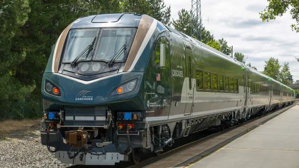
Northwest rail fans eager for Sept. 30 debut of Amtrak’s Airo fleet
Get ready for that new train smell and more seats. But they won’t go faster or run more frequently on the Cascades route in Washington and Oregon.
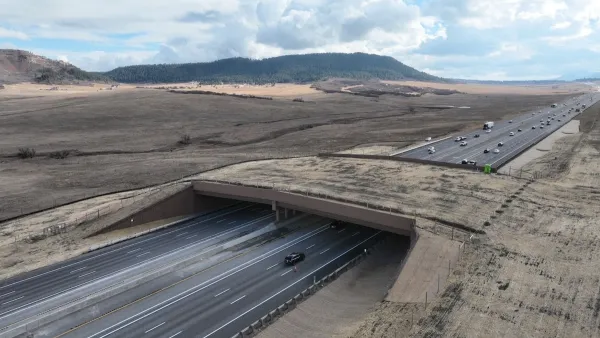
Record-breaking wildlife overpass in Colorado brings 91% reduction in animal collisions
Prior to the overpass, vehicles were hitting one deer per day on Colorado’s Interstate 25.

See the 12 communities on New York City’s affordable housing naughty list
The Upper East and West Sides, Elmhurst, and Bayside are among the communities that have built little affordable housing over the past five years, and now will see certain projects fast-tracked under new city rules.

Downtown Chicago opens the doors of first office-to-housing project
Chicago aims to eventually turn empty office space into 1,765 mixed-income housing units.

Novel study finds extreme state-by-state disparity in housing construction timelines
The first comprehensive working paper on U.S. construction timelines also found that the permitting process for multi-family projects has slowed nationwide.

FREE Course: Walkable City 1: Why Walkability?
After describing his path towards focusing on walkability as the essence of good planning, Jeff Speck marches through his five principal reasons for making more walkable places.
Reinventing Malls: Planning Alchemy—Turning Gray Fields Into Gold
The course focuses on the opportunities and imperatives that shape reinvention of mall sites.

City of Thousand Oaks
City of Wisconsin Rapids
Harvard University Graduate School of Design
The Architects Foundation
University of Cincinnati Online
Northern Illinois Transit Authority (NITA)
The Pocatello Development Authority
The Urban Renewal Agency of the City of Pocatello

