When talking to people about Los Angeles, one comment I often here is that L.A. was the first city to be built around the automobile. This statement certainly makes sense when you look at the current landscape of Los Angeles – with its freeways and strip malls and crowded parking lots – and lack of a widespread rail transit infrastructure when compared to other dense American cities. The problem with this statement is that it’s not really true. While the car has definitely left its impression on the region, Los Angeles could actually be considered a textbook example of a city built around transit – albeit one that no longer exists.
When talking to people about Los Angeles, one comment I often here is that L.A. was the first city to be built around the automobile. This statement certainly makes sense when you look at the current landscape of Los Angeles – with its freeways and strip malls and crowded parking lots – and lack of a widespread rail transit infrastructure when compared to other dense American cities.
The problem with this statement is that it's not really true. While the car has definitely left its impression on the region, Los Angeles could actually be considered a textbook example of a city built around transit – albeit one that no longer exists.
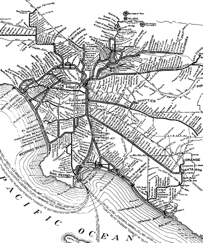
Like in most cities at the turn of the last century, Los Angeles had an extensive street car network that linked L.A.'s central business district with the surrounding residential neighborhoods and suburban towns. The most famous of these street car systems – the Pacific Electric Railway – was created by tycoon Henry Huntington in large part to fuel real estate development in the outlying areas.

A glance back at a map of the Pacific Electric Railway network, and one can see the modern skeleton of the Los Angeles region – before the freeway network had even been conceived. The PE ‘Red Cars' linked Santa Monica, Long Beach, Pasadena, Santa Ana, Van Nuys – enabling all of these ‘suburban' communities to grow and prosper.
So what happened? Once Huntington's vast holdings were developed, the business case for maintaining the rail system ceased to exist. Service was cut and maintenance deferred. With trains sharing the right of way with the growing numbers of cars, service became slow and unpredictable (much as bus service is today).
With the growing popularity of the automobile, local officials decided the future was in freeways, not rail transit. The rest, as they say, is history.
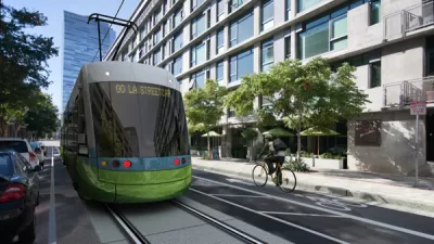
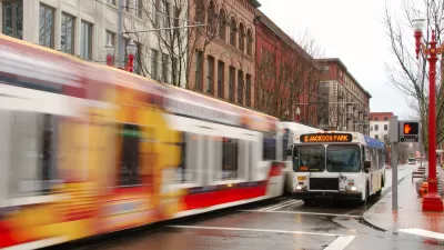
However, all is not lost. Urban scholar and Interchange blogger Gordon Price talks about the inherited urban form of the streetcar city in Los Angeles and elsewhere (including his native Vancouver). The boulevards and accompanying neighborhoods that grew off streetcar lines often retain a walkable character, and could easily serve as launching points for new rail or bus rapid transit lines.
As for an example of a city truly built around the car, I'd probably point to my hometown of Orlando, Florida (though in its defense, the brutal summers of Central Florida are not particularly conducive to walking and transit).

Planetizen Federal Action Tracker
A weekly monitor of how Trump’s orders and actions are impacting planners and planning in America.

Canada vs. Kamala: Whose Liberal Housing Platform Comes Out on Top?
As Canada votes for a new Prime Minister, what can America learn from the leading liberal candidate of its neighbor to the north?

The Five Most-Changed American Cities
A ranking of population change, home values, and jobs highlights the nation’s most dynamic and most stagnant regions.

New York MTA Says No More Borrowing, Will Cut Costs Instead
The agency says it won’t take out any new loans to finance its planned improvements and is finding other ways to cut costs.

Research: More Complex Streets Are Safer
Streets that offer more perceived obstacles and distractions can force drivers to slow down and drive more carefully.

San Diego Adopts First Mobility Master Plan
The plan provides a comprehensive framework for making San Diego’s transportation network more multimodal, accessible, and sustainable.
Urban Design for Planners 1: Software Tools
This six-course series explores essential urban design concepts using open source software and equips planners with the tools they need to participate fully in the urban design process.
Planning for Universal Design
Learn the tools for implementing Universal Design in planning regulations.
New York City School Construction Authority
Village of Glen Ellyn
Central Transportation Planning Staff/Boston Region MPO
Institute for Housing and Urban Development Studies (IHS)
City of Grandview
Harvard GSD Executive Education
Regional Transportation Commission of Southern Nevada
Toledo-Lucas County Plan Commissions


