


Stormwater mitigation rules are supposed to help protect the environment, but the current regulations also end up encouraging sprawl over urban redevelopment.
 Quick -- what has been the most influential planning phenomenon over the past decade? While many planners would speak to the Kelo decision, or the planning efforts underway in the Gulf Coast, they don't even come close to this one: the Post Construction Minimum Measure under the 1999 National Pollutant Discharge Elimination System second phase for Municipal Separate Storm Sewer System.
Okay, so it doesn't exactly roll off the tongue or make for a memorable title slide, but by now, planners in over 6000 cities and counties around the country have encountered these new rules, which address the impacts of stormwater runoff from new development and redevelopment projects.
As a short review -- the impacts of urban runoff typically fall into three categories. First, there is quantity, which has traditionally been called 'flooding'. The second, runoff quality, affects water resources when stormwater flows over polluted surfaces, carrying excess nutrients, pesticides, oil, trash, and whatever else can be dislodged and carried into local streams, lakes and estuaries through pipes, curbs and gutters. The third category is somewhat new: flow rate. Fast-flowing water scours streambanks and causes erosion, further degrading habitat and drinking water resources.
To understand why these regulations are so powerful, it is instructive to look back at a study conducted by the Center for Watershed Protection from the mid-1990s. The study looked at why watershed plans fail, and concluded that one big reason is that most protective practices rarely made it into the language of local codes and ordinances.
It seems somebody at EPA read the study, because in 1999, the aforementioned stormwater regulations came out, and in a nutshell, require states to develop runoff management rules for development and redevelopment projects. Under these rules, localities are required to enact management practices at the local level "by ordinance or other regulatory mechanism." The EPA regulations listed many possible strategies, from site level infiltration to infill to regional land conservation. These regulatory and code changes are occurring now both at the state level and in cities that meet the population and density thresholds for regulation.
In the push to "green up" local codes, stakeholder groups have a wealth of new techniques, from conservation design to green building techniques. As the new regulations take shape, the folks delivering open space zoning, swales and cluster subdivisions could also bring us something else: a new wave of sprawl.
Sprawling patterns are often blamed, in large part, on the fact that new development is almost universally easier to undertake than redevelopment. Unfortunately, the new rules are being written in a manner that tilt the playing field even more by making infill and redevelopment harder while making new subdivisions easier and cheaper.
How? A combination of circumstances is forming the policy environment:
- The new regulations were an unfunded mandate. Cash-strapped states and local governments are seeking stormwater plans and ordinances that are easy to implement, cheap to maintain and legally bulletproof. Blanket policies that apply everywhere fit these needs nicely.
- The stormwater rules essentially transferred to the engineering department a large and complex chunk of what planners have traditionally been responsible for related to site design, setbacks, parking, landscaping and circulation.
- The new regulations carry on a long national trend: delegating the design and construction of public infrastructure to developers. The new rules essentially ask developers to not only control drainage, but fix our watersheds at the same time.
- Although EPA listed district-wide stormwater solutions and coordinated smart growth techniques, the American system of designing and approving development projects is still carried out one site (or one subdivision or office park) at a time.
- The trend towards green design is making its way into the stormwater rules. Many States are requiring some variation of environmental site design. Because the practices focus on the site, these BMPs are more easily integrated into existing codes and handed off to developers than stormwater solutions that operate on a larger, publicy-funded development scale.
- Finally, because the stormwater rules are so strong, there is a push to get the strictest controls in place.
While every state and locality is different, the swirl of circumstances listed above is forming a regulatory punch line that's delivered in the form of two equations: (1) the post-development hydrology profile equals the pre-development hydrology profile of a development site and (2) pre-development hydrology equalshydrology of a meadow. That is, any new development or redevelopment project must be designed with infiltration and runoff characteristics of an open field.
It sounds good, but does it protect the environment? That answer is less clear. Perhaps the most important aspect of modern watershed health would be a seventh addition to the list above. Most impacts from urban runoff are generated from existing development that is not poised for redevelopment activity anytime soon. While there is a lot of environmental hope placed on the new regulations, truth is, better stormwater practices don't kick in unless a construction permit is pulled.
It is also important to understand, from an impaired watershed's point of view, any improvement from the construction permit system will only occur when impervious surface is converted to pervious parkland or landscaping. For new development, the engineering equation only gets you a natural version of status quo.
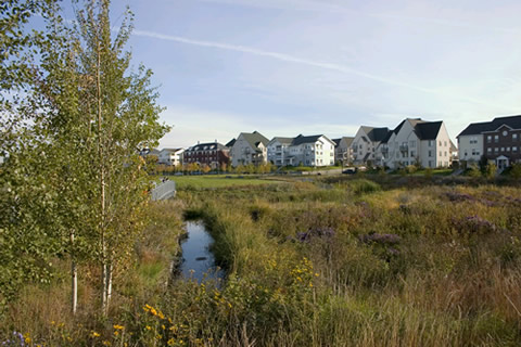
But, it's a questionable status quo. Remember that the engineering equation only looks at the developers' site plans and what happens on individual private sites. In undeveloped areas, one of the easier ways to meet the "meadow" requirements is to simply buy more land for soaking in runoff. But this expands the public imperviousness of roads, transportation access and other infrastructure to meet bigger lots. This infrastructure also extends to the new subdivisions, which are now more attractive to builders since the trend in local rulemaking eliminates costly sidewalks and much of the roadway through lot clustering. Envisioning the natural benefits of a couple of conservation subdivisions is rather uncomplicated, but can we really house millions more people, jobs and services under engineering specs that swear the landscape won't notice the bulldozers?
The new stormwater regulations have not, unfortunately, spurred a more in-depth look at what drives vast expanses of dispersed development in the first place. Instead, the 250,000 square foot retail store and its 800 parking spaces are given an equation to meet with the use of bioswales, green roofs and porous pavers. Because we are allowing the sum total of environmental protection to be reduced to a "post versus pre" hydrology equation, the official low impact or sustainable seal of approval may be giving a false sense that all the other environmental and community impacts are low as well.
If the environmental evaluation for new development were not complicated enough, looking at redevelopment under the new regulations is even tougher. As noted above, under the stormwater permit rules, converting imperviousness is really the only path to improvement, and the redevelopment permit counter is the gate.
But the clean-up relies on one important assumption: that the redevelopment even takes place. While it's easy to visualize platinum LEED glamour buildings in downtowns and along waterfronts, the more important reuse will occur on the vast slabs of certifiably unglamorous "grayfields" that cover urban and suburban landscapes alike with vacant storefronts and empty parking spaces.
This raises a couple of questions. First, if local governments are having a hard time attracting development to these vacant sites now, how are strict rules that make redevelopment even more expensive and difficult going to help? The new rules, if anything, may tip the decision towards building rehabilitation, which does not trigger stormwater improvements. For redevelopment, there is a regulatory sweet spot: pushing for as much on-site stormwater management as possible without tripping decisions that result in no improvement at all.
Looking at it from the watershed's point of view, can any new development claim to be green if there is already developed land available to absorb development demand? When it rains, the watershed pays twice -- once for what flows off the vacant property and again from the new development and its newly-poured public infrastructure (not to mention the chain reaction of imperviousness that occurs once new rural residents begin to demand familiar urban services). In this case, shouldn't new development actually be required to do more than meet the "meadow" standard?
At this point, stakeholders with an environmental angle are likely to be thinking -- "but we do support redevelopment." To be sure, most environmental groups have text on web sites that sing the praises of redevelopment for the environment. But, it seems like the hymnals at "Our Lady of What's Good for the Environment" don't always have the same pages.
For example, here in Sarasota, the Sierra Club recently backed a candidate for his stance against development that encroaches into residential neighborhoods. While the successful candidacy was spurred by reaction to several garish buildings, voters are likely to read the election results as a repudiation of the city's infill plans to bring in a better use and transportation mix. The green candidate in Arlington, Virginia assails the "overdevelopment" of the Rosslyn-Ballston corridor, even though the five-station metro corridor is hailed worldwide for its environmental performance. By one account, the development on this 3 square mile stretch would cover 12 square miles if built under modern, suburban standards.
The Rosslyn-Ballston example brings up perhaps the greatest disconnect exposed by the new water rules. Each property in the corridor is designed with an eye towards intensity. Thus, each tall building covers almost the entire site. So under the site level footprint model, the building looks "bad," even as thousands of square feet worth of demand for office or living space has been absorbed on a very small footprint under one roof on a site that was already impervious.
Conversely, Maryland has five categories for stormwater credits, the most impressive-sounding being "Environmentally Sensitive Development." But the qualifications are limited to houses that only cover 15% of the site on at least two acres or clustered housing in subdivisions. The signals here are astounding. Sprawling McMansions can easily rate as "environmentally sensitive" while mixed-use, compact designs, touted by the Department of Planning as best for the environment, don't even make the cut.
So what is the planning community to do?
- We must all recognize that many of our problems (and by extension, those of the environment) are related to the measurement problem. The current system is myopically focused on impervious coverage for individual projects, which needs to change right away. There must be a rigorous effort to develop models that measure (and report for compliance) the benefits of redevelopment, density, a compact development footprint and other aspects of shrinking the impacts of the development system writ large.
- Secondly, regulations at the state and local levels must match stormwater management with the development and environmental contexts. A proper combination of BMP selection, performance standards, and district-wide solutions cannot be pulled together under a one-size-fits-all scheme. Given the work load that the new requirements place on public works and engineering, it will be up to the planning community to help develop rules and procedures for finding that environmental "sweet spot."
- That being said, the post-development = pre-development = meadow equation will work beautifully in many areas of the country. The best rural applications will occur where the county has gone through a comprehensive planning effort to decide the location and sequencing of new development. For urban redevelopment, projects that sit on land valuable for water resource must be required to carry the highest degree runoff treatment, prevention and clean-up, whether it is funded by the developer, the locality, or both.
- The biggest environmental bang is likely to occur, at least in the immediate term, by funding the worst runoff problems through an "in lieu of" fee system. Planners need to be part of the conversation in locating and prioritizing retrofit projects.
None of these can take place unless those of us who understand the complexities of zoning get together with those who understand the complexities of cleaning up the environment. A national discussion needs to take place, and soon, on not only the components of stormwater management, but a frank conversation on what sustainable development looks like -- from the watershed's point of view.
Lisa Nisenson has over 15 years experience in smart growth, with a unique combination of experience as citizen planner, federal policy analyst, researcher and writer. Her current work focuses on integrating new stormwater requirements with land development ordinances, in particular for redevelopment and smart growth plans.


Planetizen Federal Action Tracker
A weekly monitor of how Trump’s orders and actions are impacting planners and planning in America.

Chicago’s Ghost Rails
Just beneath the surface of the modern city lie the remnants of its expansive early 20th-century streetcar system.

Amtrak Cutting Jobs, Funding to High-Speed Rail
The agency plans to cut 10 percent of its workforce and has confirmed it will not fund new high-speed rail projects.

Ohio Forces Data Centers to Prepay for Power
Utilities are calling on states to hold data center operators responsible for new energy demands to prevent leaving consumers on the hook for their bills.

MARTA CEO Steps Down Amid Citizenship Concerns
MARTA’s board announced Thursday that its chief, who is from Canada, is resigning due to questions about his immigration status.

Silicon Valley ‘Bike Superhighway’ Awarded $14M State Grant
A Caltrans grant brings the 10-mile Central Bikeway project connecting Santa Clara and East San Jose closer to fruition.
Urban Design for Planners 1: Software Tools
This six-course series explores essential urban design concepts using open source software and equips planners with the tools they need to participate fully in the urban design process.
Planning for Universal Design
Learn the tools for implementing Universal Design in planning regulations.
Caltrans
City of Fort Worth
Mpact (founded as Rail~Volution)
City of Camden Redevelopment Agency
City of Astoria
City of Portland
City of Laramie