Some of the first cities emerged without rulers or blueprints. Planners are now trying to recover what that process does well.


This article is the first installment in a multi-part series by Stefan Al on the history of planning.
In 1937, mystery writer Agatha Christie accompanied her archaeologist husband Max Mallowan on various digs in Syria. She had first met him seven years earlier at an excavation site and subsequently joined him on expeditions across the region, cleaning and cataloging artifacts and even developing film. As she described later in a poem, “A-Sitting on a Tell,” she met an archaeologist amid the trenches of a dig. While he passionately extolled the nuances of measuring prehistoric pots, her mind wandered to plotting murders — imagining ways to “kill a millionaire,” and stash the body in a “Frigidaire.”
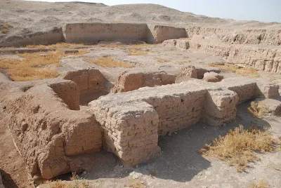
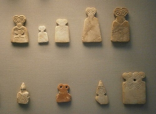
Little did Christie know that she was witnessing the excavation of a different kind of mystery — one that would eventually alter the origin story of urbanism. During this time, Mallowan made what would prove to be one of his most fortunate discoveries. He was the first to excavate a Syrian site known as Tell Brak, where he found an ancient temple filled with thousands of enigmatic figurines dominated by oversized, owl-like eyes — the so-called eye idols, dating back nearly six thousand years. Tell Brak, together with the nearby settlement of Khirbat al-Fakhar, would challenge long-standing assumptions about how the first cities began.
Breaking ancient conventions
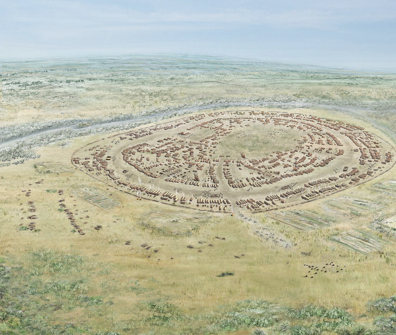
For millennia, village life in Mesopotamia followed a recurring pattern. When a settlement grew too large, tensions arose between families or resources became scarce, it would split like a cell dividing. One group would inevitably move away to establish a new settlement. But around 4,000 BC, Tell Brak and Khirbat al-Fakhar departed from this pattern. Instead of splitting apart, they continued to grow. Households gathered together in several neighborhood clusters separated by open spaces. Each cluster functioned almost like a traditional village, but now these communities were part of something larger.
Their scale was immense. Khirbat al-Fakhar sprawled across 750 acres, larger than modern- day Monaco. Tell Brak was about 130 acres, still larger than other settlements. These settlements were remarkable for their structure as well. Instead of a dense, cohesive urban core, they resembled a patchwork of household clusters interspersed with open spaces.
All of this defied conventional ideas of urbanism. The settlements were too expansive to be called villages. At the same time, they could not be called cities, since they showed no signs of central authority. They had no grand palaces, no soaring temples rising above the skyline. Scholars would come to refer to them as “proto-cities.”
The discoveries upended the traditional story of urbanization. Scholars long believed that cities began from the minds of powerful rulers or the necessities of complex irrigation systems. Uruk, in southern Mesopotamia, has long held the title of the world's first city — defined by its monumental temples and centralized administration.
The evidence from Tell Brak and Khirbat al-Fakhar offers a fascinating alternative: Some cities could have emerged organically, shaped by the collective actions of countless households rather than the decrees of a central authority. Complexity here was not imposed from above but grew from below.
A global pattern of bottom-up growth
This was no isolated phenomenon. Around the same time, ancient Trypillia settlements in present-day Ukraine exhibited similar traits. These settlements spanned up to 300 hectares, yet they lacked monumental buildings and evidence of centralized power structures. The parallel emergence of such settlements suggests a shared pattern of urban development across different regions, pointing to a broader decentralized model of early urbanization.
What drove people to create these unprecedented communities in Mesopotamia? One clue lies in a piece of volcanic glass. Obsidian, prized for its sharpness, was likely the economic engine. Imported from hundreds of miles away, this precious resource attracted people from far and wide. Each household became a workshop, which contributed to a network of decentralized production and trade. Organizing such exchanges required communication, coordination, and trust — which put these communities on a path toward growing complexity, a path toward urbanism.
This evidence points to a new tentative conclusion. Some cities may have formed from a self-organizing process, emerging from the interactions of many independent agents rather than the directions of political elites. The pattern bears a resemblance to what biologists call “emergence” — as with termite mounds. These structures form without a leader directing the process, driven instead by individuals following simple rules — like following trails laid down by others, exchanging information and building according to instinct.
The successes and failures of self-organization
Households likely didn’t set out to form large settlements from the beginning. Instead, the settlement was the organic result of their collective motivations — which may have included feeding dependents, expanding households and preserving autonomy. As archaeologist Jason Ur, who has studied these proto-cities in Mesopotamia, noted in his paper “Households and the emergence of cities in ancient Mesopotamia”: “Urbanism does not appear to have originated with a single, powerful ruler or political entity. Instead, it was the organic outgrowth of many groups coming together.”
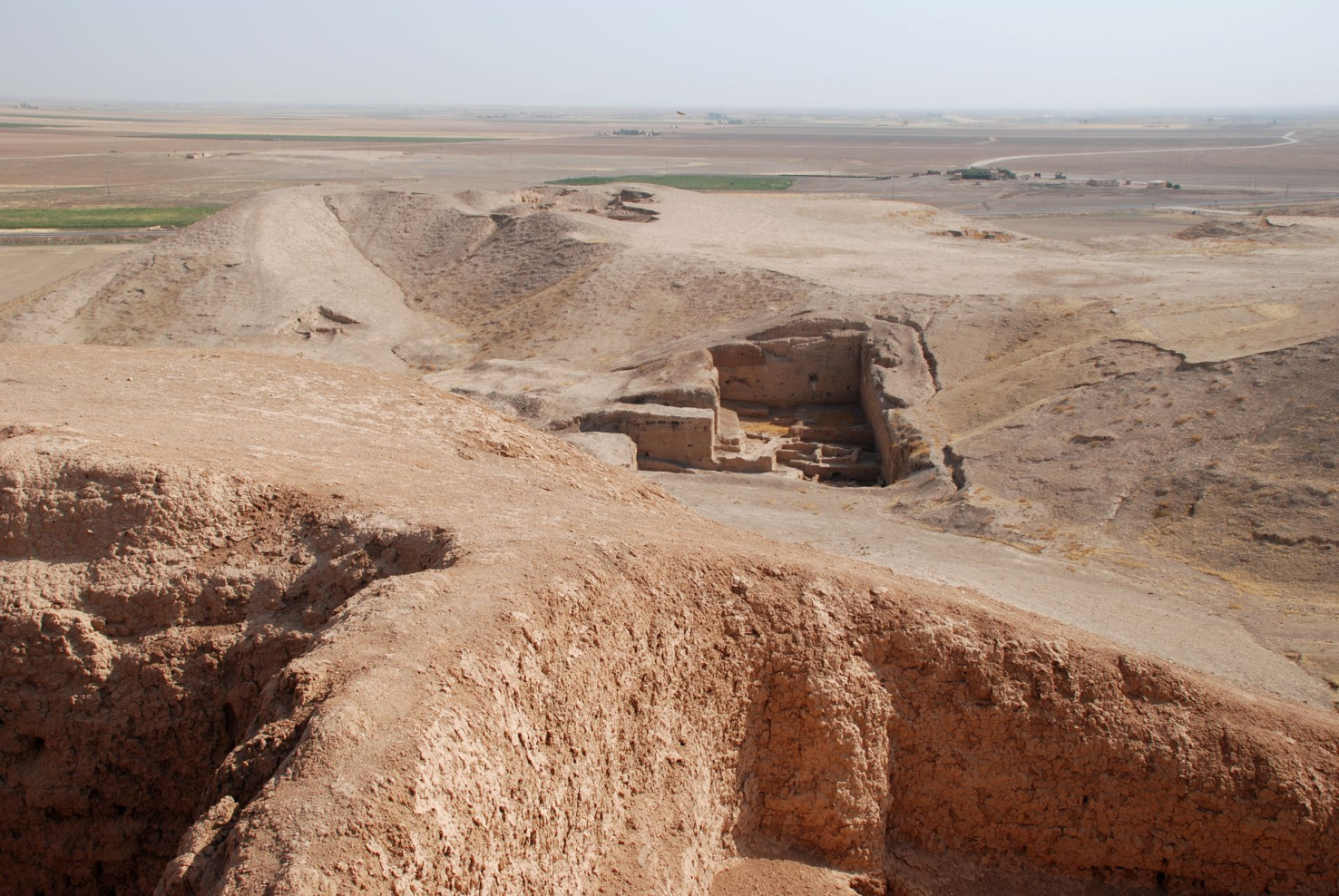
Tell Brak was not a timeless utopia of self-organization. As it grew, residents faced the mounting costs of urban complexity: longer journeys to distant fields, trash mounds as large as five football fields and pollution and fire risks from bread ovens and pottery kilns.The outskirts became specialized zones for these various functions, suggesting that the inhabitants deliberately pushed less-desirable activities to the periphery, as happens in modern cities.
Inequality also appears to have deepened as time progressed. Pig remains — a cheaper source of meat — were also found at the periphery, suggesting that poorer migrants lived in the outer clusters, much like the informal settlements that ring many megacities in the developing world today. Mass graves point to episodes of violent conflict. Eventually, more centralized institutions emerged. The lesson is not that planning was unnecessary. It is that early urbanism preceded the plan — and that institutions likely arose partly to manage the complexity that bottom-up growth had created.
Modern echos of bottom-up growth
That tension — between what households can build for themselves and what only institutions can secure — persists today, most visibly in informal settlements. During the years I lived in Hong Kong, frequent visits to Shenzhen had accustomed me to its skyscrapers, superblocks and sweeping geometry of master-planned megaprojects. But on a visit in 2010, what caught my eye were the urban villages — former rural settlements engulfed by Shenzhen’s explosive growth. Outside conventional zoning, they had expanded vertically and incrementally. Many of them are known for their “handshake houses,” buildings sometimes just feet apart, so close together that neighbors could literally reach across and shake hands from their windows.
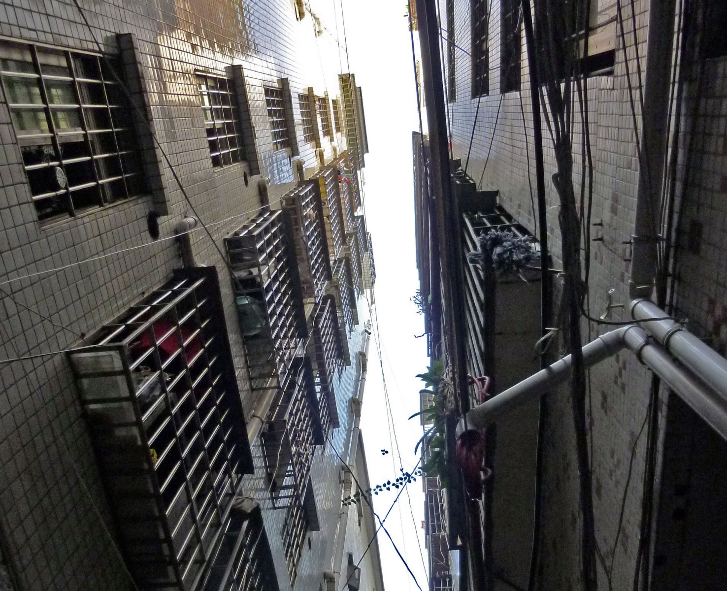
Wandering through these villages, I often saw dilapidated buildings. But there was also everyday ingenuity: rooftop additions, shipping containers turned into workshops, and old factories transformed into storefronts. And from an urban design perspective, there was a clear urban logic amid the apparent disorder: walkable streets, affordable rents, small stores, and human-scaled public life — qualities often missing from Shenzhen’s oversized modernist megablocks. These informal villages offered what many planned communities could not. They provided many migrants, as well as students, with an affordable foothold in the city and room for small-scale enterprise.
Of course, urban villages also expose the limits of unregulated growth. They are often characterized by apartments with poor ventilation, unsafe construction and overcrowding. But the deficiencies of individual buildings do not erase the mixed uses, adaptability, affordability and street life that urban villages produce. The question is not whether bottom-up urbanism is inherently better, but how planning can preserve those benefits while addressing risks that individual households cannot solve alone.
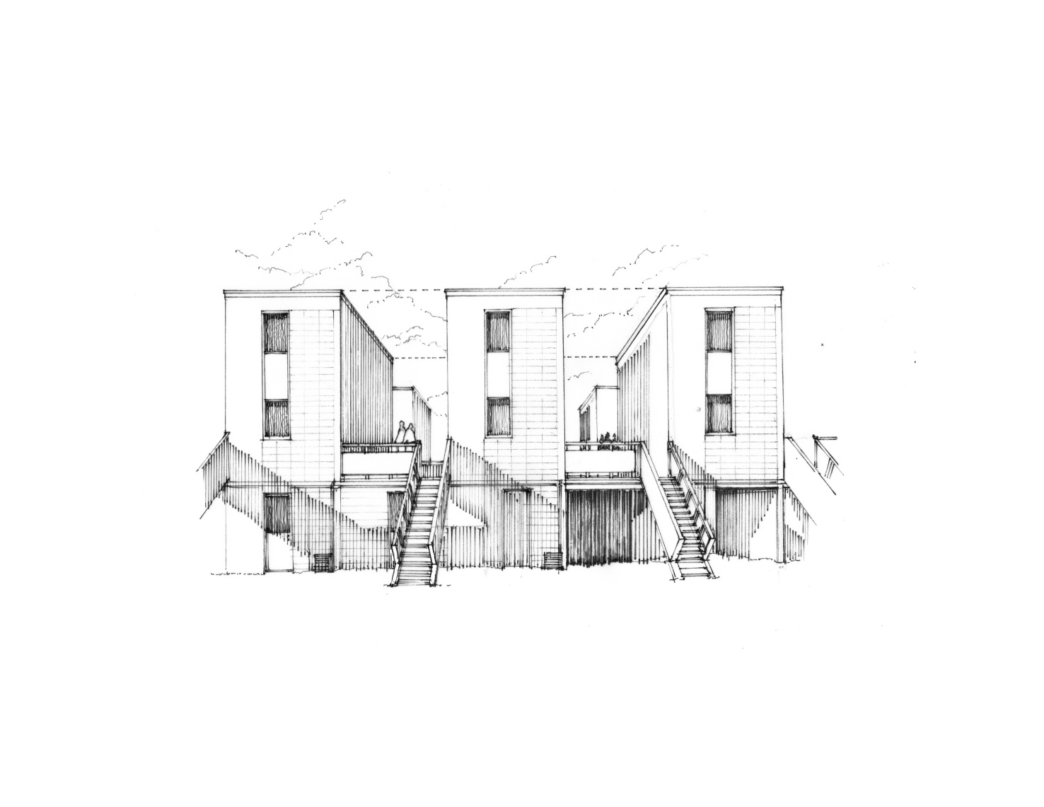
Some designers have deliberately exploited incremental growth. At Quinta Monroy in Iquique, Chile, Alejandro Aravena’s Elemental built what became known as “Half a House.” Using limited housing funds, the homes provided only the essential structure and services while leaving residents to build out and expand their living space over time. Building less upfront allowed scarce resources to house more families while preserving room for adaptation. The large-scale planning version of this is Villa El Salvador in Lima, Peru, where the government in 1971 laid out a grid of streets with basic infrastructure and left arriving families to build the rest themselves.
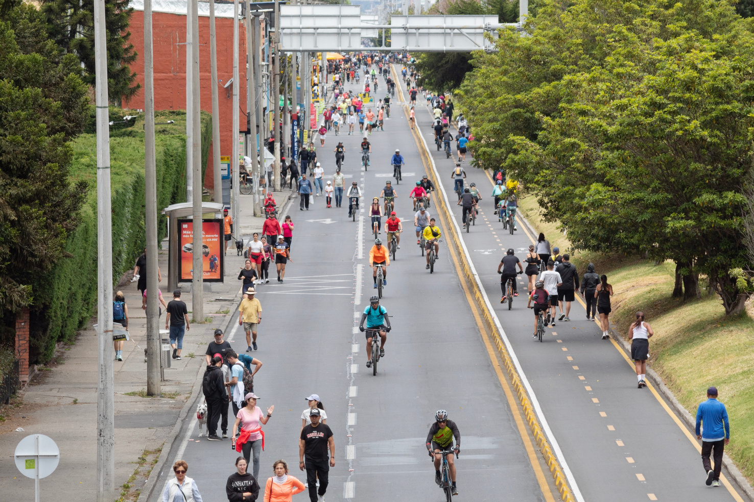
Even in formally planned cities, planners and activists have sought to harness bottom-up processes at the scale of streets and public spaces. Bogotá’s Ciclovía grew from a citizen-organized bicycle demonstration into a recurring opening of major streets to walking and cycling. San Francisco’s PARK(ing) Day began with the temporary conversion of one metered parking space into a miniature park and helped inspire permanent parklets. And in Dallas, the Better Block movement showed how residents could test pop-up shops, café seating, bike lanes and landscaping before committing to permanent construction. Such experiments helped popularize tactical urbanism: short-term, low-cost interventions that allow citizens and planners to test ideas in real space, observe how people use them, and adjust over time.
These experiments point back to the larger lesson of Tell Brak. If some of the earliest cities began not with rulers, monuments or master plans but with households gathering and building incrementally, then bottom-up action may have been one of urbanism’s generative forces. As more people settled in proximity, their exchanges, dependencies, conflicts and opportunities multiplied. That complexity, in turn, created demands for coordination — for shared rules, infrastructure, governance and eventually planning. Bottom-up urbanism and formal planning are therefore not necessarily opposites; historically, one may even have helped produce the need for the other.
Informal settlements, from Shenzhen's urban villages to Latin America's self-built neighborhoods, show both the possibilities and limits of incremental growth. Quinta Monroy, Villa El Salvador and tactical urbanism show how planners can deliberately make room for it. The challenge is to determine what must be secured collectively — safety, infrastructure, access, and public protections — and what can remain open to adaptation. Planning at its best does not replace the urban intelligence that may have helped cities emerge in the first place. It gives that intelligence a safer, fairer and more durable framework.
—
Adapted from “Dwelling on Earth: The Past and Future of the Places We Call Home.” Copyright © 2026 by Stefan Al. Illustrations © 2025 by David M. Dugas. Used with permission of the publisher, W. W. Norton & Company, Inc. All rights reserved.
Stefan Al, PhD, is an architect, urban planner, professor, and director of the Urban Planning program at Hunter College, CUNY. He is the author or editor of ten books on architecture, cities, and sustainability, and his work has been featured in the New York Times, Wall Street Journal, and NPR. This article is adapted from his latest book, Dwelling on Earth: The Past and Future of the Places We Call Home, winner of a Gold Medal in the Independent Publisher Book Awards and the recipient of a starred review from Library Journal.


What the fall of earth's largest pre-industrial city can teach us about urban sprawl
Angkor was a low-density metropolis. It lasted six centuries, until it could no longer maintain its infrastructure in a changing climate. Today, it offers planners a sobering warning about the risks of dispersed urban living.
The Case for Bottom-Up Urban Planning and Design
The wisdom of a broad cross section of residents and stakeholders is an essential part of planning and designing livable, efficient, and authentic communities.
Toward Inclusive Redevelopment: When in Doubt, Bring People Together
It's hard to get urban redevelopment right. Headlines are dominated by rising costs, gentrification concerns, and not-in-my-backyard blockading. Let's talk about a way to work toward more inclusive redevelopment.

Planetizen Federal Action Tracker
A weekly monitor of how Trump’s orders and actions are impacting planners and planning in America.

California plans to bury El Niño’s downpour
If the state plays its cards right, it may be able to store a billion acre-feet of El Niño’s water in aquifers.

Chicago breaks ground on $3 billion megadevelopment
The new neighborhood, titled Foundry Park, will one day host 3,700 residences.

California High-Speed Rail Authority CEO resigns after $600,000 scandal
Under Ian Choudri, the authority used taxpayer dollars to fund first class flights and trips to nightclubs.

Want to study the Missouri River? Soon, you may need unanimous approval from 10 states
Legislation would require 10 governors’ permission to study or build projects moving water outside the basin.

Desperate measures: Advocates weigh draining Lake Powell to fill Colorado River
Draining the reservoir could reduce evaporation losses by a couple hundred thousand acre-feet.

FREE Course: Walkable City 1: Why Walkability?
After describing his path towards focusing on walkability as the essence of good planning, Jeff Speck marches through his five principal reasons for making more walkable places.
Reinventing Malls: Planning Alchemy—Turning Gray Fields Into Gold
The course focuses on the opportunities and imperatives that shape reinvention of mall sites.

City of Rosemead
Rutgers University, Edward J. Bloustein School of Planning and Public Policy
One Hundred Miles
Hunter College, City University of New York (CUNY)
The Architects Foundation
University of Cincinnati Online
City of Cambridge
Montrose County
The Pocatello Development Authority


