Creating new land from the sea gets a bad rap. Done responsibly, it can be a climate adaptation strategy, not a real estate play.


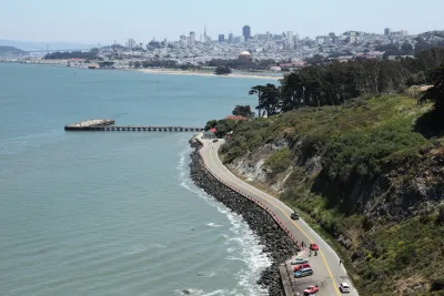
The San Francisco Bay is a hub of innovation, balancing natural habitats with one of the most densely developed regions in the country. But it’s also at the frontline of two converging crises: sea level rise and a chronic housing shortage. Sea levels are projected to rise more than three feet by 2100 in a moderate scenario, threatening airports, freeways, and thousands of homes. Meanwhile, the region must add over 440,000 housing units by 2031 just to meet state mandates.
So far, our response has not matched the magnitude of the crises. Our fragmented approach cannot keep pace with the scale of change. About 56 percent of the Bay Area’s renter households paid at least 30 percent of their income toward housing costs in 2024, compared with only 28 percent in 2000. A regional study from the Bay Area’s own planning agencies — BCDC, ABAG, and MTC — estimated that protecting our shoreline by 2050 could cost around $110 billion, yet less than $5 billion is currently anticipated through federal, state, and local programs.
To protect the Bay Area’s future, we must start thinking bigger, bolder, and more strategically.
It’s time to reconsider an idea long deemed off-limits in the Bay area: strategic land reclamation.

From crisis management to visionary planning
The Bay Area’s geography leaves little room to grow. Infill housing faces political resistance, restrictive zoning, and high land costs. At the same time, climate adaptation plans are constrained by fragmented local authority and slow-moving bureaucracy.
What if one intervention could tackle both problems — protecting shorelines while providing new, resilient, affordable housing close to jobs and transit?
Land reclamation — creating new land from the sea — isn’t about building another Foster City or Dubai’s Palm Islands. Done responsibly, it can be a climate adaptation strategy, not a real estate play. By strategically reinforcing shoreline areas with existing infrastructure capacity and limited biodiversity, we can transform them into resilient barriers against flooding and sea-level rise — while improving the Bay Area’s job-housing balance.
A balanced, bay-appropriate approach
Globally, cities from Rotterdam to Singapore have used reclamation to adapt to rising seas while expanding urban opportunity. The Dutch Maasvlakte II project added thousands of acres to the Port of Rotterdam using environmentally sensitive engineering. Singapore’s Marina Bay transformed from tidal flats into one of the world’s most livable urban districts.
The Bay Area could take a hybrid approach — combining green infrastructure (wetlands, tidal pools, restored marshes) with smart engineering (geotextiles, adaptive levees, modular construction). Reclaimed land could be used for housing and public amenities, while adjacent wetlands absorb storm energy and provide ecological habitat. This is not science fiction. The technology exists. What’s missing is the political will and regional coordination needed to invest in shared infrastructure that can support additional housing.
Through spatial analysis of demographic, environmental, and economic data, we identified shoreline areas both most at risk and most suitable for climate-resilient growth. The findings highlight overlapping vulnerabilities that aren’t visible from elevation maps alone: unstable soils, biodiversity hotspots, and pollution-burdened lowlands. The data also revealed where people are most exposed. Communities in West Oakland, Richmond, and Hayward face the highest social vulnerability, with limited resources to recover from climate impacts. Many critical services — fire stations, hospitals, transit hubs — sit in flood zones, meaning that one bad storm could ripple through the entire region.
In the end, 12 districts emerged as both the most vulnerable and the most promising for adaptive development, eight of them in the South Bay (see Figure 2).

Hunters Point: A pilot for the future
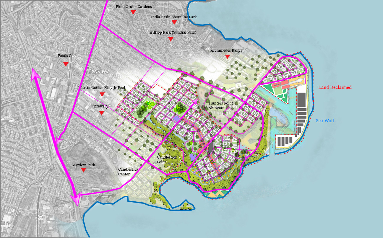
One of the promising sites lies at Hunters Point in southeast San Francisco. Imagine transforming its shoreline into a new neighborhood, not in flood-prone lowlands, but on elevated, newly reclaimed land designed to withstand rising seas.
Our concept proposes extending the existing shoreline by about 700 acres, with 60 percent developed for housing and 40 percent reserved for parks, wetlands, and tidal buffers. With most buildings 5 to 6 stories, the site could provide up to 20,000 housing units — nearly a third affordable — connected to the city by Muni Metro, Highway 101, and potential ferry service. The district would feature a gentle mid-rise character with perimeter townhomes. Through sea walls, elevated streets, permeable open spaces, and the avoidance of residential uses on the ground floor, the plan promotes an adaptive and resilient urban design.
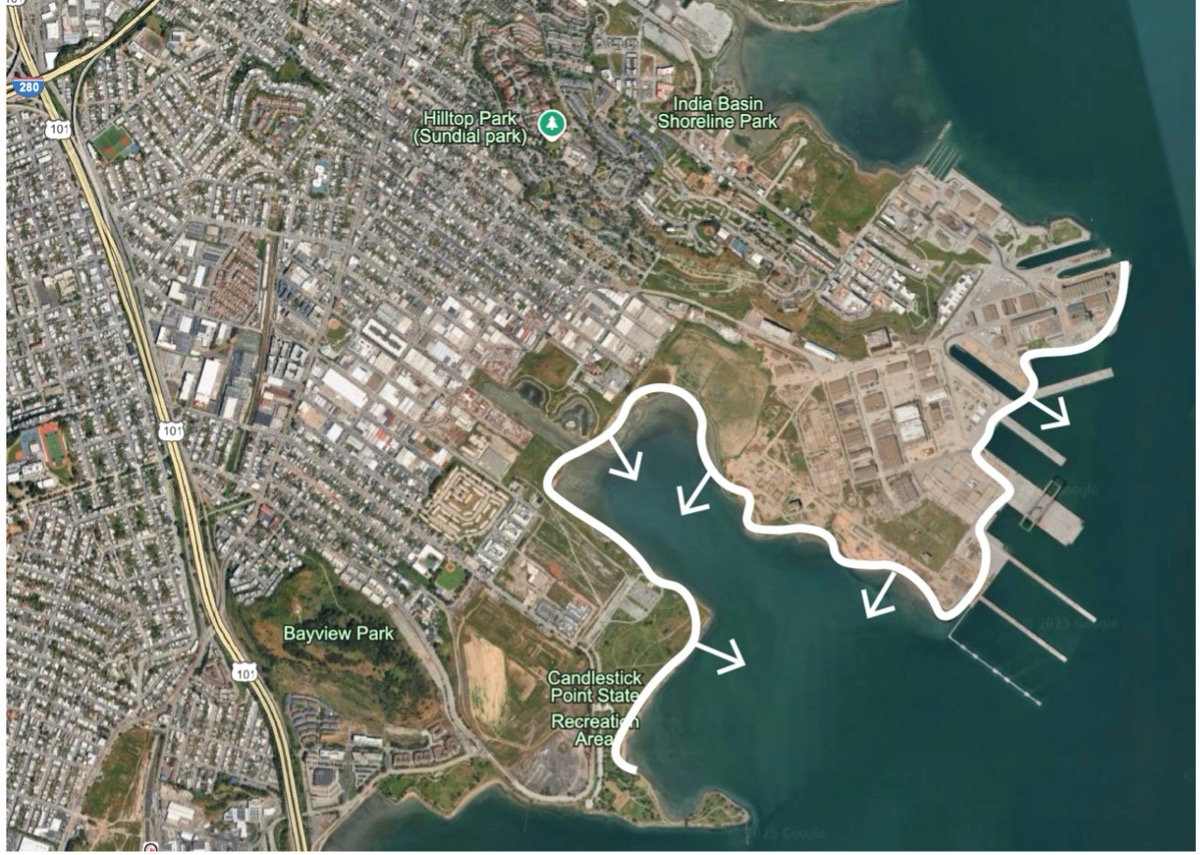
Hunters Point’s industrial legacy makes it a logical pilot: already designated for redevelopment, less ecologically sensitive than wetlands, and within reach of existing infrastructure. If successful, it could serve as a template for other sites across the South and East Bay, where a dozen or more strategically planned reclamation zones could provide the majority of 360,000 new homes, meeting the region’s entire housing allocation while enhancing coastal protection. Building a network of mid-rise neighborhoods around the Bay Area — especially in the South Bay — would open the door to smarter transit investments that link these communities and ease the strain on our overcrowded highways and transit lines.
The economics add up
Land reclamation is expensive — but so is inaction. Protecting the entire Bay shoreline through conventional defenses could cost $110 billion by mid-century. Meanwhile, the economic damages from flooding could exceed $230 billion.
Creating new, elevated land is estimated to cost between $1.5 million and $3 million per acre — equivalent to roughly $90,000 per housing unit in land cost, or about double the cost of land in much of the South Bay. However, when factoring in the avoided costs of flood damage and the efficiencies gained in future infrastructure and transit investments from improved job–housing balance, land reclamation could represent a cost-effective resilience investment rather than a luxury project. State or regional financing could focus not on land creation itself, but on supporting infrastructure — such as transit, energy, and ecological restoration — and on streamlining the permitting process to make such projects more attractive to developers
Regulation can’t be an excuse
The Bay Area’s biggest obstacle for regional scale development isn’t technology or money — it’s governance. Fragmented decision-making, overlapping jurisdictions, and endless environmental reviews have paralyzed regional planning for decades.
We already have the science — through tools like the San Francisco Estuary Institute’s Adaptation Atlas, which identifies shoreline “Operational Landscape Units” for coordinated planning. What we lack is a unified regional framework or vision that links housing, climate resilience, and infrastructure into a single investment strategy.
The state can play a catalytic rol e— just as it has with housing laws like SB 9 and SB 79 — by authorizing a regional authority empowered to coordinate large-scale adaptation and housing projects across jurisdictional boundaries.
A choice between retreat and reinvention
If we continue our current path, thousands of households and vital infrastructure — airports, highways, data centers — will be underwater within decades. By 2050, more than 75,000 homes and 20,000 acres of wetlands could be at risk.
Land reclamation isn’t a panacea, but it represents a third path between denial and retreat: one that allows the Bay Area to grow safely, equitably, and sustainably while preparing for a transformed coastline.
We can focus on protecting the shoreline of the past — or step forward to shape what comes next.
Amir Hajrasouliha is a Professor and Head of City and Regional Planning at Cal Poly, College of Architecture and Environmental Design, San Luis Obispo.
Hamed Ghoddusi is an Associate Professor of Finance at Cal Poly, Orfalea College of Business, San Luis Obispo.

The Great Highway Should Be Better, Not Bigger
San Francisco's Great Highway is losing great chunks of asphalt to the ocean. A new plan intends to change that.
Road Diet Plans Shelved for San Francisco's Ocean Beach
After two years of work, SPUR's proposals for the Ocean Beach Master Plan are still taking shape. A road diet for vehicle lanes on the Great Highway, for instance, was recently shelved for the good of other pressing priorities.
San Francisco's Battle With Mother Nature
As climate change accelerates coastal erosion across the continent, officials everywhere look to San Francisco to see how it will stem the tide, Felicity Barringer reports.

Planetizen Federal Action Tracker
A weekly monitor of how Trump’s orders and actions are impacting planners and planning in America.

The state-sanctioned urbicide of Austin
People don’t kill cities. Freeways do.

US to reduce Colorado River water deliveries to Mexico
A new Colorado Treaty amendment reduces Mexico’s Colorado River water allocation by 250,000 acre feet.

5 New England states march closer to 800 megawatt wind energy project
Securing federal approval for the project may be complicated under the Trump administration, which has historically been hostile towards domestic wind power.

Baltimore to break ground on $50 million Transit Priority Project
The project will bring faster bus trips, safer streets and better bike connections to Baltimore.

Airbnb launches $250 million 'last-dollar financing' housing accelerator, makes first investment in Austin
The company will put $6.4 million towards affordable housing development in Texas’ capital.

FREE Course: Walkable City 1: Why Walkability?
After describing his path towards focusing on walkability as the essence of good planning, Jeff Speck marches through his five principal reasons for making more walkable places.
Reinventing Malls: Planning Alchemy—Turning Gray Fields Into Gold
The course focuses on the opportunities and imperatives that shape reinvention of mall sites.

Eagle County Government
Harvard University Graduate School of Design
Nashville Planning Department
The Architects Foundation
University of Cincinnati Online
The Pocatello Development Authority
The Urban Renewal Agency of the City of Pocatello
Journal of the American Planning Association

