Heading to the CNU conference next month? A Northwest Arkansas urban planner has custom designed a roadtrip just for you.


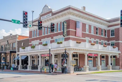
In just a few months, planners, designers, and urbanists from across the country will arrive in Northwest Arkansas for the Congress for the New Urbanism’s annual gathering. For longtime observers of the region, the decision to host the conference feels almost inevitable. Walkable downtowns, reinvestment in historic districts, a rapidly expanding regional trail network and a collaborative planning culture have steadily reshaped how people move through — and experience — the region.
For visitors unfamiliar with Northwest Arkansas, however, the selection may come as a surprise. Unlike traditional urban centers that often host planning conferences, the region is composed of several mid-sized cities scattered across the Ozark hills. Yet that very geography is what makes the area such a compelling case study.
Northwest Arkansas is growing quickly — and the choices being made today will shape how the region evolves for decades.
According to the Northwest Arkansas Council, the region added nearly 100,000 residents between 2010 and 2021, growing from roughly 450,000 residents to well over half a million during that period (Northwest Arkansas Council, 2023). That pace of growth has created significant pressure on infrastructure, housing, transportation networks and utilities.
At the same time, rapid growth has created space for innovation. Cities across the region have updated development codes, invested in active transportation infrastructure and collaborated on regional mobility strategies. Rather than defaulting entirely to conventional suburban expansion, Northwest Arkansas has increasingly experimented with approaches that echo many of the principles of New Urbanism: walkable centers, mixed-use districts, reinvestment in historic downtowns, and stronger regional connectivity.
For visitors attending the conference, the best way to experience Northwest Arkansas may be to treat the region as an urbanist road trip — moving north through the metropolitan corridor while exploring how each city contributes to the broader planning story.
Stop one: Fayetteville — a walkable college town with planning momentum
The southern gateway to the region is Fayetteville, home to the University of Arkansas and the largest population in Northwest Arkansas. According to the U.S. Census Bureau, nearly 94,000 residents live in Fayetteville, making it the region’s largest city (U.S. Census Bureau, 2023).
Like many successful college towns, Fayetteville combines historic urban form with youthful energy. The downtown square remains a civic anchor surrounded by local businesses, restaurants, and cultural institutions. Nearby Dickson Street provides one of the region’s most vibrant entertainment districts, particularly during Razorback game weekends.
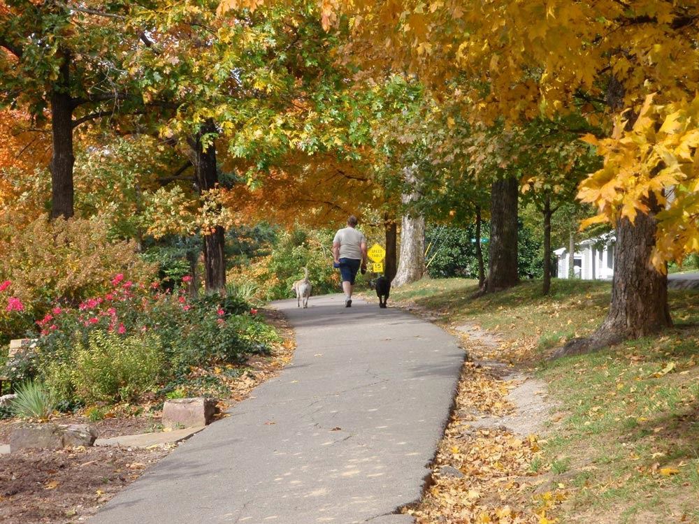
Beyond nightlife, Fayetteville has also become a regional leader in active transportation planning. The city’s trail network connects neighborhoods, parks, and major destinations across town, including the scenic loop around Lake Fayetteville.
These local trails feed directly into one of Northwest Arkansas’s most significant planning achievements: the Razorback Regional Greenway, a 40‑mile multi‑use trail stretching north through the metropolitan area. The Greenway connects multiple cities and provides a continuous corridor for cycling, walking, and recreation, illustrating how trail infrastructure can function as both transportation and placemaking.
Stop two: Springdale — industrial heritage meets downtown revival
Heading north along the Greenway brings travelers into Springdale, a city whose identity is deeply tied to Northwest Arkansas’s agricultural and food-production economy.
Springdale is home to the headquarters of Tyson Foods, along with major operations from companies such as George’s Inc. and Cargill. These industries helped shape the city’s growth throughout the twentieth century and remain central to the region’s economy today.
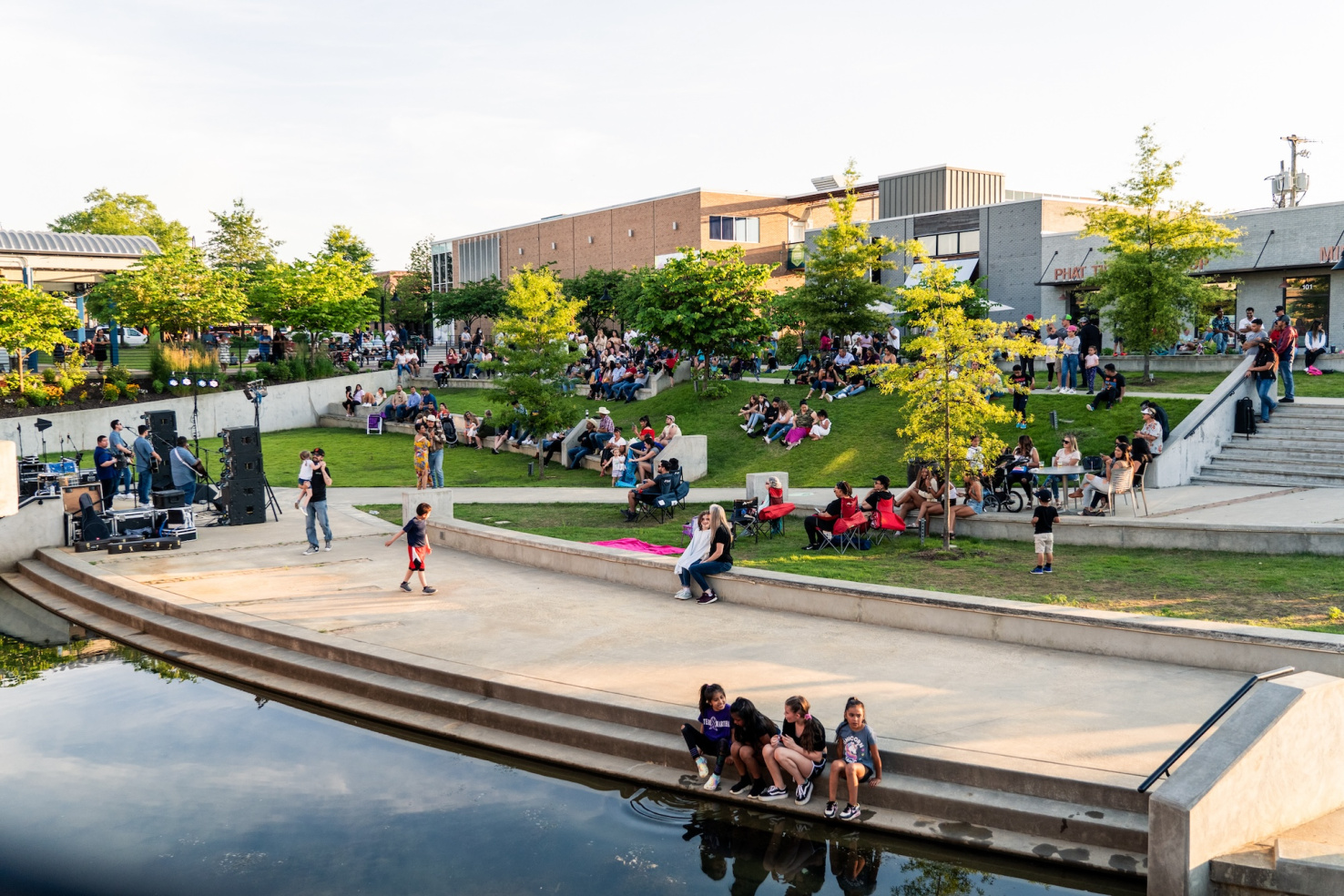
In recent years, however, Springdale has begun redefining its downtown identity. Investments around Shiloh Square, Walter Turnbow Park, and the Shiloh Museum of Ozark History have helped create a growing civic district centered on public gathering spaces and cultural amenities.
The expansive Shaw Family Park and other recreational investments demonstrate how rapidly growing communities can incorporate accessible recreational infrastructure while maintaining neighborhood connectivity and livability.
Stop three: Rogers — bridging historic downtown and new growth
Further north lies Rogers, a city that offers a compelling contrast between historic urban form and modern development patterns.
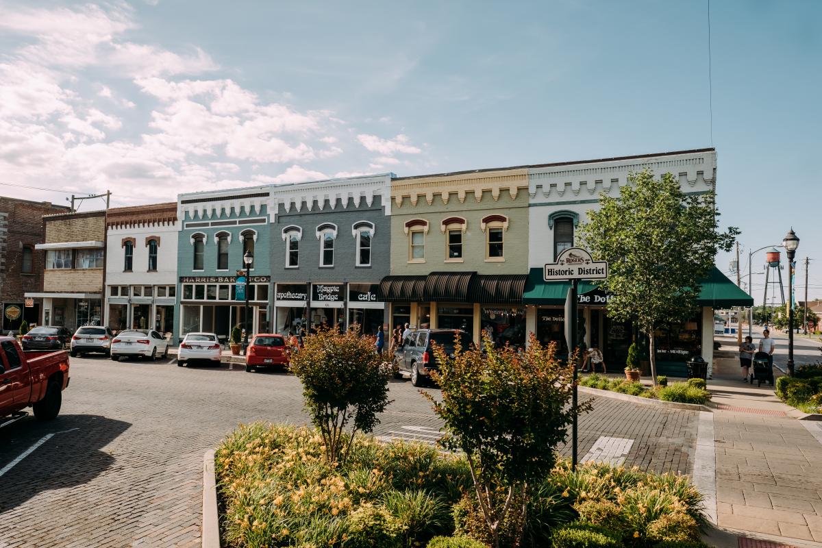
Downtown Rogers remains one of the region’s most intact historic districts. Brick streets, restored storefronts and a vibrant public square create a pedestrian-friendly environment reminiscent of classic American small towns.
The district surrounding Railyard Park has become a focal point for community events, concerts, and public gatherings. Nearby attractions — including the Daisy Airgun Museum and Rogers Historical Museum — celebrate the city’s heritage while anchoring a revitalized downtown economy.
At the same time, Rogers has experienced rapid growth in its Uptown district, an area that was largely pastureland less than two decades ago. Today the district includes major entertainment venues such as the Walmart AMP, along with restaurants, breweries, and retail destinations.
Stop four: Bentonville — corporate capital and urban innovation
At the northern end of the metropolitan corridor sits Bentonville, widely known as the global headquarters of Walmart.
Yet the city has increasingly built an identity that extends far beyond corporate offices. Bentonville’s historic square remains the civic heart of the city, hosting farmers markets, festivals, and community gatherings throughout the year.
Cultural investments such as Crystal Bridges Museum of American Art have transformed Bentonville into a national arts destination. The city has also embraced a bold planning identity centered on cycling and active transportation.
One of the most visible symbols of this commitment is The Ledger, widely recognized as the world’s first bikeable office building, allowing cyclists to ride directly to upper floors via a spiral ramp. Many of these investments have been supported by regional philanthropy, including initiatives from the Walton Family Foundation to expand cycling infrastructure and public spaces across Northwest Arkansas.
Connecting the region: trails, transit and regional collaboration
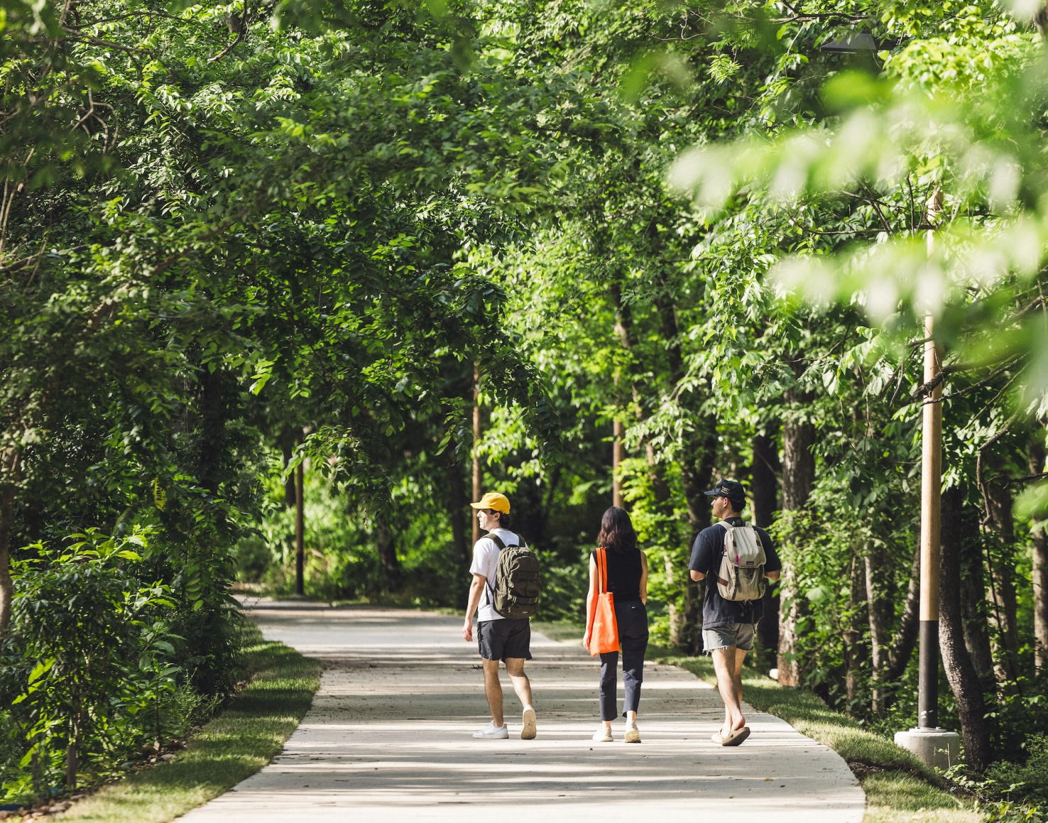
Perhaps the most remarkable feature of Northwest Arkansas is not any single city but the connections between them.
The Razorback Regional Greenway provides a continuous trail corridor linking Fayetteville, Springdale, Rogers, and Bentonville, enabling residents and visitors to travel between cities by bike or on foot.
Public transportation also plays a growing role. Ozark Regional Transit operates bus routes and on-demand mobility services throughout the region, helping connect communities and employment centers.
Meanwhile, organizations such as the Northwest Arkansas Regional Planning Commission coordinate regional transportation strategies with the Arkansas Department of Transportation and local governments.
Why Northwest Arkansas is perfect for the CNU
Northwest Arkansas represents a uniquely American urban story.
It is neither a dense legacy city nor a master-planned community built from scratch. Instead, it is a rapidly growing region where multiple cities are simultaneously experimenting with how to grow more thoughtfully.
Walkable downtowns, regional trail systems, cultural investments, and coordinated planning efforts have helped create a metropolitan area that increasingly reflects the principles of New Urbanism.
For the Congress for the New Urbanism, Northwest Arkansas offers something especially valuable: a chance to see those principles unfolding in real time.
References
AllNWAHomes. (2024). Overview of communities in Northwest Arkansas. https://allnwahomes.com
Arkansas Department of Transportation. (2024). State transportation planning and infrastructure investment. https://www.ardot.gov
Congress for the New Urbanism. (2000). Charter of the New Urbanism. https://www.cnu.org
National Park Service. (2024). Pea Ridge National Military Park. https://www.nps.gov/peri
Northwest Arkansas Council. (2023). Regional growth and demographic trends in Northwest Arkansas. https://nwacouncil.org
Northwest Arkansas Regional Planning Commission. (2024). Regional transportation planning initiatives. https://www.nwarpc.org
Ozark Regional Transit. (2024). Public transit services in Northwest Arkansas. https://ozark.org
Rails-to-Trails Conservancy. (2023). Economic and community benefits of trail systems. https://www.railstotrails.org
U.S. Census Bureau. (2023). QuickFacts: Fayetteville city, Arkansas. https://www.census.gov
Walton Family Foundation. (2023). Northwest Arkansas trail and placemaking initiatives. https://www.waltonfamilyfoundation.org
Rick Barry, MPA, AICP, works in operations at Northwest Arkansas Community College. He is an AICP-certified urban planner with a background in planning, education and public administration. Molly Barry is a strategic communications professional specializing in journalism across public sector marketing and enterprise communications. Together, they explore the evolving landscape of Northwest Arkansas from their home in Springdale.

Northwest Arkansas grapples with growth as it prepares to host New Urbanism gathering
A compelling story of a fast-growing, polycentric region grappling with identity and affordability, Susan Henderson reframes CNU 34 as a hands-on workshop, inviting planners to explore Northwest Arkansas as it decides what it will become.
Houston Awarded $18.5M for Trail Linking Uptown and Memorial Park
The grant will make the freeway-bounded park more accessible to pedestrians and cyclists.

Bold Plans Unveiled for Converting Durham's Historic Downtown Loop
The city of Durham hosted a public workshop this week to discuss urban design plans for converting a circuitous couplet to a two-way street grid.

The state-sanctioned urbicide of Austin
People don’t kill cities. Freeways do.

US to reduce Colorado River water deliveries to Mexico
A new Colorado Treaty amendment reduces Mexico’s Colorado River water allocation by 250,000 acre feet.

New Jersey’s second-largest city bans standalone data centers
Jersey City will continue to allow co-location facilities, such as those meant for research institutions that store their own data.

Amtrak not solely to blame for New Jersey commuter rail's unreliability, report finds
A new study from the Garden State Initiative found that NJ Transit’s budget grew 20% across a 4 year period, but reliability declined significantly over the same period.

EPA erases limits on planet-warming pollution from power plants
Under Monday’s plan, power plants would still have some limits on how much mercury, arsenic and other contaminants they can emit.

Phoenix announces new on-demand transit service, more frequent RAPID buses
Both new services will launch in October, and are part of Phoenix's Project Effective Access Solutions for Easing Congestion.

FREE Course: Walkable City 1: Why Walkability?
After describing his path towards focusing on walkability as the essence of good planning, Jeff Speck marches through his five principal reasons for making more walkable places.
Reinventing Malls: Planning Alchemy—Turning Gray Fields Into Gold
The course focuses on the opportunities and imperatives that shape reinvention of mall sites.

Eagle County Government
Harvard University Graduate School of Design
Nashville Planning Department
The Architects Foundation
University of Cincinnati Online
The Pocatello Development Authority
The Urban Renewal Agency of the City of Pocatello
Journal of the American Planning Association

