


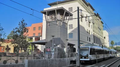
The idea that proximity to transit equals higher land values doesn't tell the full story. According to this study, a variety of other factors must be in place to achieve the desired effect.
Boosters of transit-oriented development often operate by the assumption that land values will rise, inevitably, next to transit. Laura Bliss writes, "Cities can 'capture' this 'land value uplift' to pay for transportation infrastructure projects (for example, by creating a special tax on certain developments that are projected to benefit most from the expanded transit access)."
The results of a recent study throw some doubt on that simple equation. While transit does stimulate land values in some locations, in others it has little effect. "[...] the results of some [heavy rail transit] studies are insignificant, negligible, or even negative, and there are sometimes stark differences between studies in the same city."
Two factors complicate the picture. First, badly-sited new transit may not provide real benefits on the ground. "If a neighborhood is already well served by convenient access to a highway system, or by cycling and pedestrian options, a wonderful new transit line might not result in more 'accessibility.'"
Second, looking at proximity by itself ignores how well—or how poorly—other factors are complementing the transit. "For example, mixed-use zoning, open and public spaces, amenity-rich neighborhoods, and pedestrian-oriented street design all carry positive effects on land value. When models overlook these factors, they paint an incomplete picture of projected land values in an area—and even worse, the authors write, researchers can mistakenly claim them as empirical evidence of the benefits of accessibility."
FULL STORY: Does Transit Always Increase Land Value?


DARTSpace Platform Streamlines Dallas TOD Application Process
The Dallas transit agency hopes a shorter permitting timeline will boost transit-oriented development around rail stations.

Opinion: California’s SB 79 Would Improve Housing Affordability and Transit Access
A proposed bill would legalize transit-oriented development statewide.

Report: Zoning Reforms Should Complement Nashville’s Ambitious Transit Plan
Without reform, restrictive zoning codes will limit the impact of the city’s planned transit expansion and could exclude some of the residents who depend on transit the most.

Planetizen Federal Action Tracker
A weekly monitor of how Trump’s orders and actions are impacting planners and planning in America.

Congressman Proposes Bill to Rename DC Metro “Trump Train”
The Make Autorail Great Again Act would withhold federal funding to the system until the Washington Metropolitan Area Transit Authority (WMATA), rebrands as the Washington Metropolitan Authority for Greater Access (WMAGA).

The Simple Legislative Tool Transforming Vacant Downtowns
In California, Michigan and Georgia, an easy win is bringing dollars — and delight — back to city centers.

The States Losing Rural Delivery Rooms at an Alarming Pace
In some states, as few as 9% of rural hospitals still deliver babies. As a result, rising pre-term births, no adequate pre-term care and "harrowing" close calls are a growing reality.

The Small South Asian Republic Going all in on EVs
Thanks to one simple policy change less than five years ago, 65% of new cars in this Himalayan country are now electric.

DC Backpedals on Bike Lane Protection, Swaps Barriers for Paint
Citing aesthetic concerns, the city is removing the concrete barriers and flexposts that once separated Arizona Avenue cyclists from motor vehicles.
Urban Design for Planners 1: Software Tools
This six-course series explores essential urban design concepts using open source software and equips planners with the tools they need to participate fully in the urban design process.
Planning for Universal Design
Learn the tools for implementing Universal Design in planning regulations.
Smith Gee Studio
City of Charlotte
City of Camden Redevelopment Agency
City of Astoria
Transportation Research & Education Center (TREC) at Portland State University
US High Speed Rail Association
City of Camden Redevelopment Agency
Municipality of Princeton (NJ)