


A new study indicates that the safest urban streets have lanes that measure 10-10.5 feet wide. Narrower and wider lanes have higher crash frequencies, and wider lanes have higher crash severity.
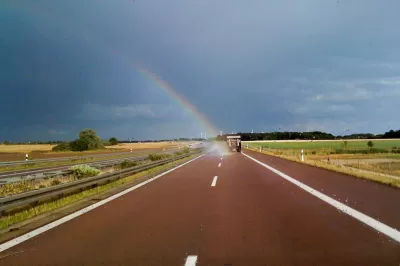
The "forgiving highway" approach to traffic engineering holds that wider is safer when it comes to street design. After decades of adherence to these standards, American cities are now criss-crossed by streets with 12-foot wide lanes. As Walkable City author Jeff Speck argued in a column last year, this is actually terrible for public safety and the pedestrian environment.
A new study reinforces the argument that cities need to reconsider lane widths and redesign streets accordingly. In a paper to be presented at the Canadian Institute of Traffic Engineers annual conference, author Dewan Masud Karim presents hard evidence that wider lanes increase risk on city streets.
Karim conducted a wide-ranging review of existing research as well as an examination of crash databases in two cities, taking into consideration 190 randomly selected intersections in Tokyo and 70 in Toronto. Looking at the crash databases, Karim found that collision rates escalate as lane widths exceed about 10.5 feet. Roads with the widest lanes—12 feet or wider—were associated with greater crash rates and higher impact speeds. Karim also found that crash rates rise as lanes become narrower than about 10 feet, though this does not take impact speeds and crash severity into account. He concluded that there is a sweet spot for lane widths on city streets, between about 10 and 10.5 feet.

The rate of side impact crashes is lowest on urban streets with lanes about 10.5 feet wide — much narrower than the standard 12 feet. Graph: Dewan Karim
In Toronto, where traffic lanes are typically wider than in Tokyo, the average crash impact speed is also 34 percent higher, Karim found, suggesting that wider lanes not only result in more crashes but in more severe crashes.
The "inevitable statistical outcome" of the "wider-is-safer approach is loss of precious life, particularly by vulnerable citizens," Karim concluded.
FULL STORY: Compelling Evidence That Wider Lanes Make City Streets More Dangerous
Rethinking Streets: New Report Illustrates Complete Streets Projects
"Rethinking Streets," a new report by the University of Oregon's Sustainable Cities Initiative, provides detailed information on 25 complete streets and streetscaping projects. It is available free in PDF and hard copy format.

Balancing Road Diets With Emergency Access
Examples from the Netherlands show how bike lanes and traffic calming can coexist with effective emergency response.
Vision Zero at Work: Hoboken Celebrates Seven Years of Zero Traffic Deaths
The New Jersey city implemented simple yet impactful changes to eliminate traffic fatalities.

Pennsylvania Mall Conversion Bill Passes House
If passed, the bill would promote the adaptive reuse of defunct commercial buildings.

World's Largest Wildlife Overpass In the Works in Los Angeles County
Caltrans will soon close half of the 101 Freeway in order to continue construction of the Wallis Annenberg Wildlife Crossing near Agoura Hills in Los Angeles County.

U.S. Supreme Court: California's Impact Fees May Violate Takings Clause
A California property owner took El Dorado County to state court after paying a traffic impact fee he felt was exorbitant. He lost in trial court, appellate court, and the California Supreme Court denied review. Then the U.S. Supreme Court acted.

California Grid Runs on 100% Renewable Energy for Over 9 Hours
The state’s energy grid was entirely powered by clean energy for some portion of the day on 37 out of the last 45 days.

New Forecasting Tool Aims to Reduce Heat-Related Deaths
Two federal agencies launched a new, easy-to-use, color-coded heat warning system that combines meteorological and medical risk factors.

AI Traffic Management Comes to Dallas-Fort Worth
Several Texas cities are using an AI-powered platform called NoTraffic to help manage traffic signals to increase safety and improve traffic flow.
City of Costa Mesa
Licking County
Barrett Planning Group LLC
HUD's Office of Policy Development and Research
Mpact Transit + Community
HUD's Office of Policy Development and Research
Tufts University, Department of Urban and Environmental Policy & Planning
City of Universal City TX
ULI Northwest Arkansas
Urban Design for Planners 1: Software Tools
This six-course series explores essential urban design concepts using open source software and equips planners with the tools they need to participate fully in the urban design process.
Planning for Universal Design
Learn the tools for implementing Universal Design in planning regulations.