


A new mapping project allows new access to information about Chicago's controversial tax increment financing mechanism. Now at least the debate will include visuals.
Benjamin van Loon shares news of the TIF Projects map from Chicago Cityscape, which offers new and helpful access to information and visualization of the impact of tax increment financing.
According to van Loon, "Chicago Cityscape's data-rich map provides an interactive overview of all 375 TIF projects in Chicago currently or soon-to-be underway. Data can be sorted by project name, approval date, TIF assistance amount, total project cost, ward, and community area, so you can always see how that magic money is being spent."
The article also includes a series of screengrabs from neighborhoods around Chicago. TIF districts have come under fire in Chicago recently, with a debate over how TIFs get spent (i.e., "mayor's slush fund for wealthy Downtown interests" or "neighborhood infrastructure investment necessity") leading up the recent Chicago mayoral election.
FULL STORY: Now You Can Easily See Where TIF Dollars Are Being Spent

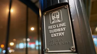
Update: Chicago Red Line Extension TIF Approved
The long-anticipated project that will bring the Chicago Transit Authority rail system into transit deserts on the Southside of Chicago is making substantial progress.

Chicago’s Red Line Extension Environmental Review Complete
The Red Line Extension on Chicago’s South Side could be a game changer, if the city can figure out the local funding.
Chicago Seeks Public Input on Clark Street Improvements
The city is creating a strategy for improvements in the Clark Street corridor to improve the area's walkability and stimulate the local economy.

Trump Administration Could Effectively End Housing Voucher Program
Federal officials are eyeing major cuts to the Section 8 program that helps millions of low-income households pay rent.

Planetizen Federal Action Tracker
A weekly monitor of how Trump’s orders and actions are impacting planners and planning in America.

Canada vs. Kamala: Whose Liberal Housing Platform Comes Out on Top?
As Canada votes for a new Prime Minister, what can America learn from the leading liberal candidate of its neighbor to the north?

Paris Voters Approve More Car-Free Streets
Paris Mayor Anne Hidalgo says the city will develop a plan to close 500 streets to car traffic and add new bike and pedestrian infrastructure after a referendum on the proposal passed with 66 percent of the vote.

Making Mobility More Inclusive
A new study highlights the challenges people with disabilities continue to face in navigating urban spaces.

Texas Bills Could Push More People Into Homelessness
A proposal to speed up the eviction process and a bill that would accelerate enforcement of an existing camping ban could make the state’s homelessness crisis worse, advocates say.
Urban Design for Planners 1: Software Tools
This six-course series explores essential urban design concepts using open source software and equips planners with the tools they need to participate fully in the urban design process.
Planning for Universal Design
Learn the tools for implementing Universal Design in planning regulations.
Heyer Gruel & Associates PA
Ada County Highway District
Institute for Housing and Urban Development Studies (IHS)
City of Grandview
Harvard GSD Executive Education
Toledo-Lucas County Plan Commissions
Salt Lake City
NYU Wagner Graduate School of Public Service