


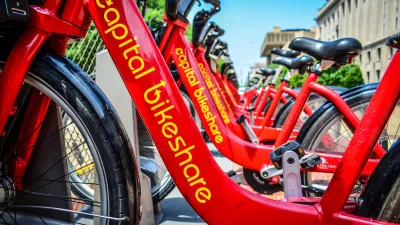
Few transportation projects have transformed D.C. as thoroughly as Capital Bikeshare. From humble beginnings in 2010 with fewer than 50 stations, there are now over three hundred stations and 2500 bikes spread across the city.
For most of us, the bikesharing program is a fun way to get some exercise, a commute-shortener, or an excuse to get rid of our cars. And most of us don't give much more thought to it than that. Sure, we lobby for a new dock near our house or office, we wave at the hardworking bike rebalancers.
Delve a little deeper, though, and you realize that Capital Bikeshare is an incredibly complex system. Users take hundreds of thousands of trips per month (many more in the spring and summer--the system set new ridership records during the Cherry Blossom Festival). Bike docks empty out of neighborhoods like Columbia Heights in the mornings and fill downtown, and the pattern reverses in the evening. Placing new stations is more of an art than a science.
As the system heads toward its four-year anniversary, we thought we'd compile our favorite facts, thoughts and stories about the cheery red ubiquitous bikes. Don't call it a complete guide to bikeshare. Call it Elevation DC's take on answering the bikeshare questions you (should) think hardest about.
The post includes more information on how they place new stations, where the busiest are, the most hidden, secret Bikeshare station, and the most creative use of two CaBis ever.
FULL STORY: Everything you've always wanted to know about bikeshare (but were afraid to ask)

CaBi Breaks Ridership Record — Again
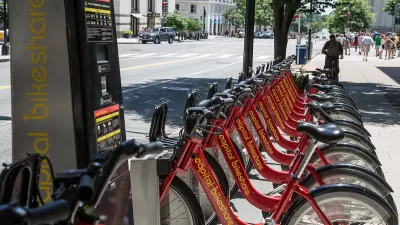
Washington D.C.’s bike share system is extremely popular with both residents and visitors.

DC Bike Share Growing Fast, But Regional Gaps Remain
The wildly popular system ‘frays at its geographic edges,’ making its use less effective outside the central District.
DC Micromobility Use Keeps Growing
Capital Bikeshare saw its fourth straight month of record ridership.

Planetizen Federal Action Tracker
A weekly monitor of how Trump’s orders and actions are impacting planners and planning in America.

Map: Where Senate Republicans Want to Sell Your Public Lands
For public land advocates, the Senate Republicans’ proposal to sell millions of acres of public land in the West is “the biggest fight of their careers.”

Restaurant Patios Were a Pandemic Win — Why Were They so Hard to Keep?
Social distancing requirements and changes in travel patterns prompted cities to pilot new uses for street and sidewalk space. Then it got complicated.

Platform Pilsner: Vancouver Transit Agency Releases... a Beer?
TransLink will receive a portion of every sale of the four-pack.

Toronto Weighs Cheaper Transit, Parking Hikes for Major Events
Special event rates would take effect during large festivals, sports games and concerts to ‘discourage driving, manage congestion and free up space for transit.”

Berlin to Consider Car-Free Zone Larger Than Manhattan
The area bound by the 22-mile Ringbahn would still allow 12 uses of a private automobile per year per person, and several other exemptions.
Urban Design for Planners 1: Software Tools
This six-course series explores essential urban design concepts using open source software and equips planners with the tools they need to participate fully in the urban design process.
Planning for Universal Design
Learn the tools for implementing Universal Design in planning regulations.
Heyer Gruel & Associates PA
JM Goldson LLC
Custer County Colorado
City of Camden Redevelopment Agency
City of Astoria
Transportation Research & Education Center (TREC) at Portland State University
Camden Redevelopment Agency
City of Claremont
Municipality of Princeton (NJ)