Following a Waterfront Small Area Plan adopted in January 2012, Alexandria, Virginia got its first look at proposed designs for the redevelopment of its Old Town waterfront this week.


The City Council of Alexandria, Virginia this week reviewed landscape designs for the proposed redevelopment of the city’s Old Town waterfront, according to Washington Business Journal reporter Michael Neibauer. The designs are the work of Philadelphia-based Olin Studio, which also designed Washington D.C.’s Canal Park and New York City’s Bryant Park.
The designs by Olin Studio follow the Waterfront Small Area Plan, adopted in January 2012. According to Neibauer, “the 20- to 30-year waterfront small area plan calls for an expanded network of public spaces, parks and piers that will ultimately total slightly more than 30 acres, a net gain of 5 acres from the existing layout. It separates the Old Town waterfront into six areas, from south to north: Gateway South, The Strand, Torpedo Factory, Founders Park, Oronoco Bay and Gateway North.”
“Among the goals — to install a continuous waterfront path, create a gathering place at the foot of King Street, provide a variety of experiences, reinforce cultural areas and mitigate Alexandria’s nuisance flooding.”
Neibauer’s article also includes a slideshow of the renderings produced by Olin Studio so far.
Read the full story: Alexandria's waterfront overhaul: The vision from The Olin Studio

Former power plant in Alexandria to become walkable waterfront neighborhood with 800 homes
The Potomac River Generating Station was once the biggest source of air pollution in northern Virginia.
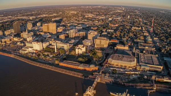
Baton Rouge master plan aims to triple downtown population
The Louisiana capital wants to entice developers to its riverfront district.

Cincinnati upzoning plan paves way for revitalized waterfront district
The city hopes to kickstart new development on five vacant lots in the riverfront entertainment district.

Planetizen Federal Action Tracker
A weekly monitor of how Trump’s orders and actions are impacting planners and planning in America.

Eastern Nebraska is running out of electricity
Data centers and electrification are straining eastern Nebraska’s grid, throttling economic development.

Study reveals best places in the U.S. for cycling, walking
New research from Streetlight Data examines bicycle and pedestrian miles per capita in the 100 largest U.S. cities by population.

Federal government nominates new FTA administrator
Mark Aesch is currently the founder and CEO of a transportation management consulting firm.

Developers reveal $10 billion stadium plan as ‘Hail Mary’ to keep Bears in Chicago
The plan would also boast a public park, high- and mid-rise buildings and a youth sports complex.

As Texas embraces carbon storage, a Black community questions the risks
Texas now issues permits for companies to store carbon dioxide underground. East Texas residents fear safety risks, and skeptics doubt the climate benefits.

FREE Course: Walkable City 1: Why Walkability?
After describing his path towards focusing on walkability as the essence of good planning, Jeff Speck marches through his five principal reasons for making more walkable places.
Reinventing Malls: Planning Alchemy—Turning Gray Fields Into Gold
The course focuses on the opportunities and imperatives that shape reinvention of mall sites.

City of Charlotte
City of Rosemead
Rutgers University, Edward J. Bloustein School of Planning and Public Policy
University of Michigan School for Environment and Sustainability (SEAS)
Hunter College, City University of New York (CUNY)
The Architects Foundation
City of Cambridge
The Pocatello Development Authority
The Urban Renewal Agency of the City of Pocatello