


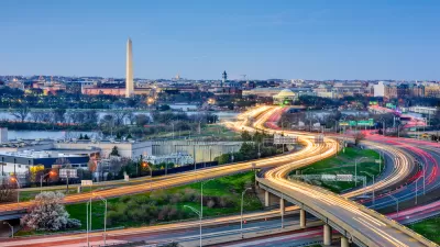
Adding 1,100 people every month, Washington D.C. is in the midst of one of the nation’s most powerful examples of population growth. A recently developed heat map shows where supply is being built to meet the new demand.
Pulling data from the District of Columbia Data Catalogue, blog Map Attacks has created a map showing every active building permit in the city, as of January 10, 2014. The visualization is useful in projecting the future of the nation's capital, which is drawing a large influx of new residents.
Dan Reed provides some local insight about the patterns visible on the map: “there's a lot of construction occurring in downtown DC, though there's also a significant amount of building taking place near U Street. H Street and Columbia Heights are no slouch, as well as Fort Totten, where a new Walmart is under construction.” Reed describes the orientation of construction permits by referencing some of the political dynamics at play in the development climate of the capital: “[the bulk of new construction occurring east of Rock Creek Park is] a good thing after decades of disinvestment, but it also illustrates how resistance to new development west of the park has pushed demand further east.”
One caveat about the heat map and its dataset from Map Attacks: “This dataset captures large construction projects like the O Street Market development in Shaw, as well as someone renovating their bathroom in Georgetown.”
FULL STORY: See where building construction is happening in DC

Transit-Oriented Development Central to D.C. Region's Growth Plan
Transit-oriented development will play a key role in mitigating the congestion effects of growing population in the region around the nation's capital, and regional planners say the region is already achieving its goals.

A Relentless D.C. Zoning Activist
Chris Otten says change doesn't come from "being nice to decision makers," so he's comfortable being confrontational with developers and City Council members he sees as taking advantage of the poor.

Explained: D.C. Gains '1,000 New Residents Every Month'
Officials and residents in Washington, D.C. are often heard saying that the District is gaining 1,000 new residents every month. But what does it mean?

Planetizen Federal Action Tracker
A weekly monitor of how Trump’s orders and actions are impacting planners and planning in America.

Map: Where Senate Republicans Want to Sell Your Public Lands
For public land advocates, the Senate Republicans’ proposal to sell millions of acres of public land in the West is “the biggest fight of their careers.”

Restaurant Patios Were a Pandemic Win — Why Were They so Hard to Keep?
Social distancing requirements and changes in travel patterns prompted cities to pilot new uses for street and sidewalk space. Then it got complicated.

Platform Pilsner: Vancouver Transit Agency Releases... a Beer?
TransLink will receive a portion of every sale of the four-pack.

Toronto Weighs Cheaper Transit, Parking Hikes for Major Events
Special event rates would take effect during large festivals, sports games and concerts to ‘discourage driving, manage congestion and free up space for transit.”

Berlin to Consider Car-Free Zone Larger Than Manhattan
The area bound by the 22-mile Ringbahn would still allow 12 uses of a private automobile per year per person, and several other exemptions.
Urban Design for Planners 1: Software Tools
This six-course series explores essential urban design concepts using open source software and equips planners with the tools they need to participate fully in the urban design process.
Planning for Universal Design
Learn the tools for implementing Universal Design in planning regulations.
Heyer Gruel & Associates PA
JM Goldson LLC
Custer County Colorado
City of Camden Redevelopment Agency
City of Astoria
Transportation Research & Education Center (TREC) at Portland State University
Camden Redevelopment Agency
City of Claremont
Municipality of Princeton (NJ)