


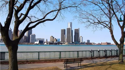
After two years of work, hundreds of meetings, and 70,000 survey responses and comments from participants, Detroit will today release the strategic framework plan that will guide the city's long-term recovery, reports Leonard N. Fleming.
The plan, which began in 2010 under the auspices of the Detroit Works project, and is now being called Detroit Future City, is oriented around five key elements - economic growth, land use, city systems, neighborhoods and land and building assets. According to Fleming, it "involves everything from creatively reusing large swaths of empty land and expanded public transportation to supporting local businesses and finding ways to help foster economic growth."
One of the primary challenges for the authors of the plan was how to reconcile a shrinking population of about 700,000 with an infrastructure and environment built to support a population that reached nearly 2 million in 1950.
"Organizers said parts of the plan could take up to 50 years to implement, but other changes intended to stabilize neighborhoods could happen sooner. Residents living in less densely populated areas, for example, would not be required to leave but could expect natural areas and hiking trails built around them in years to come. And in some areas where services are more prevalent, rezoning efforts could lead to business growth in areas that are now considered residential." As Fleming notes, the city would also provide incentives to encourage residents to move into more populated areas.
"Organizers said they wanted to build a "framework for decision-making" with specific goals in the first five years to stabilize the city through more reliable services, improve the city through 2020 with economic growth, sustain Detroit through 2030 with a more stabilized population and an increase in jobs, and by 2050, transform it into a premier city."
FULL STORY: Long-term Detroit neighborhood stabilization plan to be unveiled


A Plan To Shrink Detroit (Well)
Justin Hollander, PhD, AICP, looks closely at Detroit’s new Strategic Framework Plan and finds a compelling plan to manage depopulation. The plan takes a realistic view of what it would take to make Detroit a great city without growing.

Detroit, 'Comeback City'
Despite the massive improvements Detroit has made both in public perception, it still has a long way to go to in overcoming misperceptions associated with its decades of struggles.
'Detroit Future City' Enters a New Stage
The Detroit Future City Implementation Office has completed a new strategic plan that will redirect the organizations revitalization efforts, four years after the city adopted the largely successful Detroit Future City framework.

Planetizen Federal Action Tracker
A weekly monitor of how Trump’s orders and actions are impacting planners and planning in America.

Congressman Proposes Bill to Rename DC Metro “Trump Train”
The Make Autorail Great Again Act would withhold federal funding to the system until the Washington Metropolitan Area Transit Authority (WMATA), rebrands as the Washington Metropolitan Authority for Greater Access (WMAGA).

DARTSpace Platform Streamlines Dallas TOD Application Process
The Dallas transit agency hopes a shorter permitting timeline will boost transit-oriented development around rail stations.

Parks: Essential Community Infrastructure — and a Smart Investment
Even during times of budget constraint, continued investment in parks is critical, as they provide proven benefits to public health, safety, climate resilience, and community well-being — particularly for under-resourced communities.

Porches, Pets, and the People We Grow Old With
Neighborhood connections and animal companions matter to aging with dignity, and how we build can support them. Here’s a human-scale proposal for aging in place.

Single-Stair Design Contest Envisions Human-Scale Buildings
Single-stair building construction is having a resurgence in the United States, where, for the last several decades, zoning codes have required more than one staircase in multi-story housing developments.
Urban Design for Planners 1: Software Tools
This six-course series explores essential urban design concepts using open source software and equips planners with the tools they need to participate fully in the urban design process.
Planning for Universal Design
Learn the tools for implementing Universal Design in planning regulations.
City of Charlotte
Municipality of Princeton
City of Camden Redevelopment Agency
City of Astoria
Transportation Research & Education Center (TREC) at Portland State University
US High Speed Rail Association
City of Camden Redevelopment Agency
Municipality of Princeton (NJ)