


Peter Hermann describes the police force's efforts in D.C.'s up-and-coming areas to put a stop to crime and congestion before it even occurs.
The revitalization of an area or community is often seen as an effective means to reduce crime, but could this process actually draw in the very thing it is meant to discourage? D.C. Police Chief Cathy L. Lanier has begun using real estate trends to predict and prevent crime in redeveloping areas of the city, which can be vulnerable to crowding, traffic and criminal activities. Says Hermann, "Economic development data can be as important in shaping police staffing decisions as armed-robbery statistics."
Lanier has recently targeted H Street in Northeast, and Columbia Heights and the U Street corridor in Northwest, due to increases in robberies and nuisance crimes as the areas redevelop, displacing the drug-dealing and prostitution that was taking place.
Why doesn't redevelopment make policing easier? "One reason redevelopment challenges police is that it doesn't happen all at once," writes Hermann. "Along H Street NE, for instance, the bars, dance studio, restaurants and clubs are still next to boarded-up buildings."
Lanier intends to resolve these shortcomings by utilizing the data at hand to project future outcomes. "Ultimately, it's a complete shift in standards, regulations, transportation, policing and public safety. If we know where the development is, we can predict a little better and put things in place to prevent crimes from popping up in those places."
FULL STORY: D.C. police measure up-and-coming neighborhoods

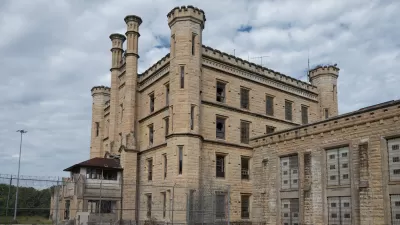
‘Shawshank Redemption’: 5 Adaptive Reuse Strategies for Shuttered Jails
Redeveloping closed correctional facilities in ways that foster just and thriving communities is a growing trend across the United States.
Preservation and Redevelopment Can Work Hand in Hand
While historic preservation is often perceived to be a hinderance to development efforts, preserving buildings actually helps economic development, say advocates.
What do Californians Want From Government?
CA Speaker of the Assembly John Pérez discusses the current challenges faced by government in California, drawing particular attention to the struggle for consensus on how the State should support economic development at the local level. (VIDEO)

Planetizen Federal Action Tracker
A weekly monitor of how Trump’s orders and actions are impacting planners and planning in America.

Map: Where Senate Republicans Want to Sell Your Public Lands
For public land advocates, the Senate Republicans’ proposal to sell millions of acres of public land in the West is “the biggest fight of their careers.”

Restaurant Patios Were a Pandemic Win — Why Were They so Hard to Keep?
Social distancing requirements and changes in travel patterns prompted cities to pilot new uses for street and sidewalk space. Then it got complicated.

Platform Pilsner: Vancouver Transit Agency Releases... a Beer?
TransLink will receive a portion of every sale of the four-pack.

Toronto Weighs Cheaper Transit, Parking Hikes for Major Events
Special event rates would take effect during large festivals, sports games and concerts to ‘discourage driving, manage congestion and free up space for transit.”

Berlin to Consider Car-Free Zone Larger Than Manhattan
The area bound by the 22-mile Ringbahn would still allow 12 uses of a private automobile per year per person, and several other exemptions.
Urban Design for Planners 1: Software Tools
This six-course series explores essential urban design concepts using open source software and equips planners with the tools they need to participate fully in the urban design process.
Planning for Universal Design
Learn the tools for implementing Universal Design in planning regulations.
Heyer Gruel & Associates PA
JM Goldson LLC
Custer County Colorado
City of Camden Redevelopment Agency
City of Astoria
Transportation Research & Education Center (TREC) at Portland State University
Camden Redevelopment Agency
City of Claremont
Municipality of Princeton (NJ)